Snapping pictures for science
Waterloo researcher says citizen scientists advance research on climate change by documenting changes in Far North.

Waterloo researcher says citizen scientists advance research on climate change by documenting changes in Far North.
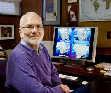
By Christian Aagaard Communications and Public AffairsEllsworth LeDrew has a scene on his mind.
A party of Inuit hunters sets out from a settlement. One of them stops, pulls out a smart phone and snaps a picture of a crack in the shore ice that affects his route.
The hunter instantly uploads the photo to a public database, which shares the image with anybody who has an interest in ice conditions in the area.
"It’s like a traffic alert on your Magellan,’’ LeDrew says, referring to a popular digital navigator.

LeDrew, a professor in the Department of Geography and Environmental Management at the University of Waterloo, champions the notion that science benefits from the participation of laypersons.
The cellphone laboratory
Too often, he says, cost and professional barriers shut people out of reams of online information. Ordinary, cellphone-toting citizens could be especially useful in tracking the extent and effect of climate change.
Some obstacles are starting to fall.
The Polar Data Catalogue, an online repository of detailed research about the Arctic and Antarctic, is a less forbidding place for visitors without lengthy academic credentials. The website of the Canadian Cyrospheric Information Network, an agency that keeps an eye on snow and ice conditions, features a kids’ page.
As communication networks improve in the Far North, LeDrew sees citizen scientists adding photos of landscapes and weather events to the store of images captured by satellite.
His own first- and third-year students practise with the model. They photograph scenes and events that affect their lives, uploading images to a Google platform set up for their classes.
“What we are trying to do is to transform data into information that people can use,” LeDrew says. “This is where the gap between scientist and citizen is trying to be bridged.”
For researchers, the work of eyes in the sky and eyes on the ground could provide a richer understanding of how climate change affects the land.
For the people of the north, LeDrew says, using and stocking a vast store of Arctic research affords something even greater: Strong information by which they can determine their own social course through a warming environment.

Read more
An ambitious research collaboration with Habitat for Humanity is reimagining home ownership across Waterloo Region and Canada

Read more
Here are the people and events behind some of this year’s most compelling Waterloo stories

Read more
Researchers awarded funding to investigate ecology, climate change, repatriation, health and well-being through cultural and historical lens
The University of Waterloo acknowledges that much of our work takes place on the traditional territory of the Neutral, Anishinaabeg, and Haudenosaunee peoples. Our main campus is situated on the Haldimand Tract, the land granted to the Six Nations that includes six miles on each side of the Grand River. Our active work toward reconciliation takes place across our campuses through research, learning, teaching, and community building, and is co-ordinated within the Office of Indigenous Relations.