Snow-covered tweets
Waterloo scientist invites ordinary citizens to measure snow depth and tweet the results for a more detailed climate change picture.

Waterloo scientist invites ordinary citizens to measure snow depth and tweet the results for a more detailed climate change picture.
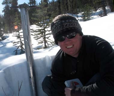
By Mark Witten Communications and Public AffairsAnyone with a smart phone and a ruler can help Richard Kelly gather data about all things snow – from the severity of a storm system to the shrinking of the snow season.
 “The satellite observations from space are very coarse readings of snow depth. We use Snowtweets to help test the accuracy of the satellite estimates and this on-the-ground data gives us a more detailed and complete snowfall picture,” says Kelly, a professor in the Department of Geography and Environmental Management and founding member of the Interdisciplinary Centre on Climate Change (IC³ or “ice cube”).
His Snowtweets project invites citizen scientists to broadcast snow depth measurements from their backyards during a blizzard or during the spring snow melt. Contributors use their postal code when tweeting and these measurements are displayed in real time on a global map. Citizen scientist can then compare tweet data with satellite observations of snow cover.
Winter storm Nemo
When “Winter Storm Nemo” struck southern Ontario and the U.S. eastern seaboard last February, Snowtweeters took advantage of business and school closures to report in real time the rapid accumulation of snow from hour to hour.
“The Nemo storm was a good test case because it showed many people in southern Ontario, Quebec, the Maritimes and New England were receptive to the novelty of social media and citizen science,” says Kelly.
Nemo also illustrated the power of citizen science. Snowtweets complemented rather than duplicated the existing ground networks of data. Also, Twitter reports were better able to capture variations in the amount of snow within local areas and at different times, compared with satellite observations. That’s because satellite data is typically averaged over large areas up to 25 kilometres wide and reported only a couple of times a day.
Climate change
Crowdsourcing of vital ground data can also help scientists like Kelly track changes in seasonal snow cover related to climate change.
“The number of snow recording stations in Canada has gone from about 2,500 in the early 1990s to less than 700 today. Since 2008 there haven’t been enough in situ stations to evaluate in local detail Canadian Arctic changes in snow cover duration. An accurate monitoring system is essential to help policy makers make sound decisions to protect our planet,” says Kelly, who spent five years as a satellite research scientist with NASA.
“Snowtweets can get people engaged in climate change issues, which is always a good thing,” says Kelly.

Read more
An ambitious research collaboration with Habitat for Humanity is reimagining home ownership across Waterloo Region and Canada

Read more
Here are the people and events behind some of this year’s most compelling Waterloo stories

Read more
Researchers awarded funding to investigate ecology, climate change, repatriation, health and well-being through cultural and historical lens
The University of Waterloo acknowledges that much of our work takes place on the traditional territory of the Neutral, Anishinaabeg, and Haudenosaunee peoples. Our main campus is situated on the Haldimand Tract, the land granted to the Six Nations that includes six miles on each side of the Grand River. Our active work toward reconciliation takes place across our campuses through research, learning, teaching, and community building, and is co-ordinated within the Office of Indigenous Relations.