Artificial intelligence (AI) technology may soon make it easier and cheaper to detect problems with roads, bridges, buildings and other infrastructure.
Systems design engineering professor John Zelek has developed artificial intelligence (AI) technology to automatically detect potholes and other road defects using photographs.
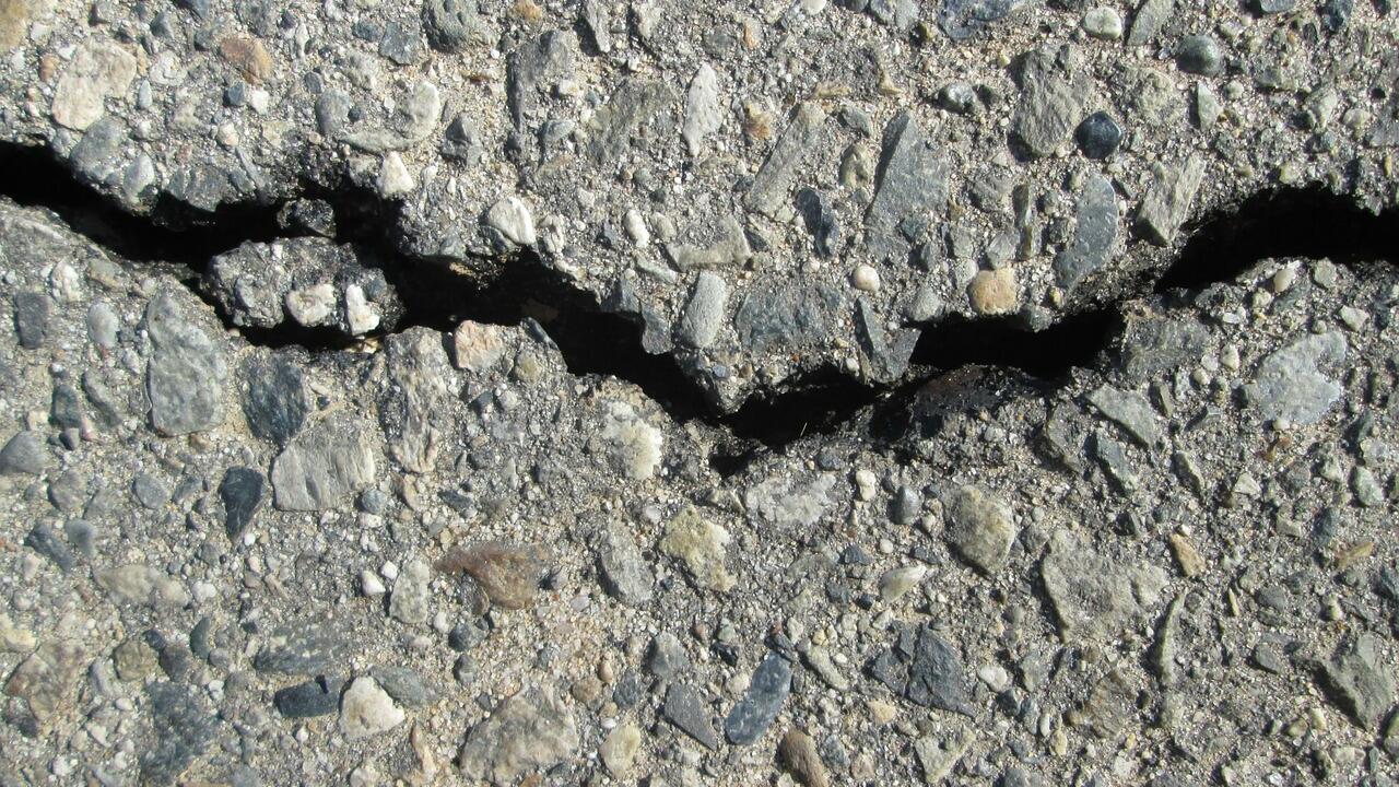
A new AI software system developed by researchers at Waterloo Engineering automatically analyzes photographs taken by vehicle-mounted cameras to flag potholes, cracks and other defects.
“If governments have that information, they can better plan when to repair a particular road and do it at a lower cost,” says John Zelek, a systems design engineering professor. “Essentially, it could mean lower taxes for residents.”
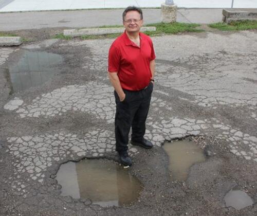
Systems design engineering professor John Zelek has developed artificial intelligence (AI) technology to automatically detect potholes and other road defects using photographs.
Governments around the world currently take two basic approaches to monitoring the condition of roads, the initial focus of the research at Waterloo.
In many small jurisdictions, workers simply drive around, do visual inspections and take notes. Others use trucks fitted with expensive cameras to record images of pavement for manual assessment by teams of analysts.
According to Zelek, the automated AI system now being refined at Waterloo would cut assessment costs, achieve at least comparable accuracy, lead to more timely repairs because of more frequent monitoring and produce uniform results.
“It is more consistent analysis because you’re not introducing the biases of different human beings who look at the data differently,” he says.
The project began with analysis of free online images of roads from Google Street View. Researchers have since also applied the AI software to images from other sources, including a company with a partially automated system to detect pavement defects.
Data would enable repair planning
Zelek, who is collaborating with PhD student David Chacra, says small jurisdictions could use the AI system to analyze video taken by cellphone cameras mounted in vehicles as workers go about their usual business.
Data from the automated assessments could then be superimposed on street maps to create a tool enabling officials to plan and prioritize repairs.
In addition to roads, researchers are exploring use of the AI software on images recorded by drones of bridges, buildings and other infrastructure. Another potential application would involve monitoring progress on construction projects.
“If the parts of a new building aren’t coming together properly, it would obviously be very beneficial to flag problems before the next 30 storeys have been put up,” Zelek says.
The latest in a series of papers on the research, Municipal Infrastructure Anomaly and Defect Detection, was scheduled to be presented this month at the 26th European Signal Processing Conference in Rome, Italy.