A Classification System for Public Space Design in Wide Seasonal Range (WiSR) Cities

In cold climates, prolonged winter weather and poor planning limit the use of public spaces for a major part of the year. While effective strategies exist to extend outdoor activity, their scope of application remains unknown and designers continue to rely on approaches that are incompatible with the local context. As a result, public spaces bear a high cost with low return, and city dwellers and businesses lose out on the important social and economic benefits of attractive public spaces.
In cold- and winter-related planning literature, few studies exist, and several issues persist. Despite the metrics, definitions, and approaches developed to assist design professionals, there are few examples of successful public spaces. Overall, Winter City studies present a narrow perspective on all-year planning needs, as they focus too heavily on the winter season and do not account for human behaviour over time. In turn, public space designers continue to rely on metrics developed solely for one time of year. There is also no distinction between (a) high-latitude cities that have moderate winters and cool summers, and (b) mid- to high-latitude cities that experience both severe cold winters and hot summers. This leaves a significant design challenge unattended for (b), as planning solely for one season often conflicts with all- year objectives.
This thesis investigates the key elements for successful public spaces in cold climate cities and aims to provide a metric to assist planners and designers toward effective design outcomes.
A review of literature on urban bioclimatology reveals that an understanding of macro scale processes is key to design at the microclimate level. Urban design studies show that public space design principles exist for ideal weather, but there is poor guidance for cities with wide climate variability. A review of human responses to thermal environments shows that heat budget models are effective for addressing physiological needs, but ineffective for factoring behavioural adaptation—a critical component of human activity in cold climates.
An analysis of public spaces in Canada, Northern Italy, Russia, and Japan reveals five principal approaches categorized by permanent, convertible, and ephemeral interventions. Convertible and ephemeral interventions can provide a wider range of activities, and this is shown to be most effective for all-year use and enjoyment when properly implemented. It is concluded that a classification of local climate needs for mid- to high-latitude cities could assist designers in relating microclimate design strategies to local scale planning needs.
An analysis of average monthly climate data for 13 mid- to high-latitude cities reveals important differences in local winter challenges. Comparison of the data to current metrics shows that common terms, classifications, and indices are misleading and offer limited information for planning purposes.
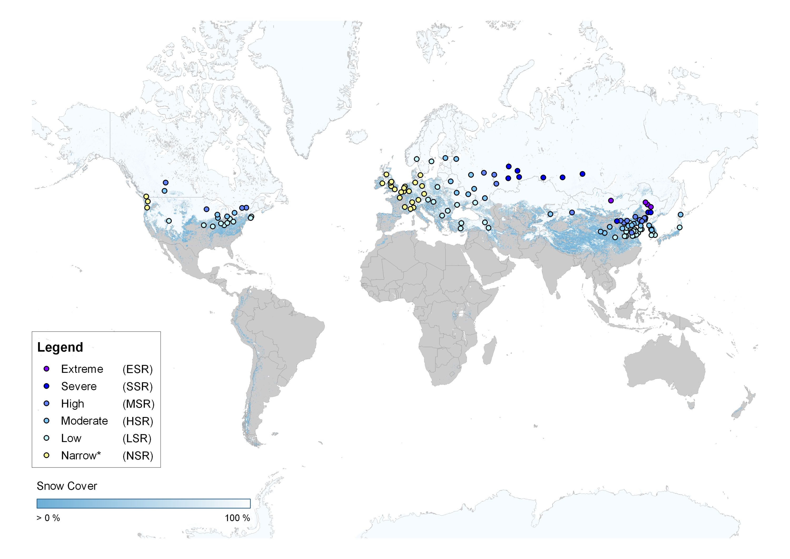
These findings confirm that public space designers lack a tangible metric for identifying all-year local climate needs. Since no term exists for environments exposed to wide seasonal variation between winter and summer, the term Wide Seasonal Range (WiSR) is proposed. WiSR cities include, e.g., Edmonton, Minneapolis, Ottawa, Kazan, Ulaanbaatar, or Shenyang, and these are mostly in continental and steppe climates. A classification system is proposed for WiSR cities based on 30-year average monthly temperature data for 128 cities meeting a specified criterion. Since winter climate severity depends primarily on temperature or seasonal variation, six classes of Seasonal Range (SR) are proposed for defined thresholds of average temperature of the coldest month (Tmin) and annual temperature range (Trange), i.e., the difference between average temperature of coldest month (Tmin) and hottest month (Tmax).
The classification is then used to analyze the relationship between Tmin, Tmax, Trange, snow cover, and latitude. Results show a strong relationship between Trange and Tmin. On the other hand, latitude weakly correlates with Tmin, Trange, and snow cover, proving that latitude is not a suitable indicator of winter climate severity.
The WiSR classification system provides measurable local climate data on winter, summer, and seasonal range that can be viewed from a global perspective. It is proposed as a simple metric that can serve as a starting point for identifying, comparing, and analyzing all-year local climate needs of mid- to high-latitude cities. In turn, planners and designers may better interpret the relevance of public space design strategies for specific local challenges.
The examining committee is as follows:
Supervisor:
John Straube, University of Waterloo
Committee Member:
Jonathan Enns, University of Waterloo
Internal Reader:
Alstan Jakubiec
The
committee
has
been
approved
as
authorized
by
the
Graduate
Studies
Committee.
The
Defence
Examination
will
take
place:
December
4,
2020,
2:30pm
EST,
open
defense.
Teams
link
available
via
the graduate
student
Learn
page
or
by request.
A
copy
of
the
thesis
is
available
for
perusal
in
ARC
2106A.