Description
Available from the Scholars Geoportal, this image resource covers the City of Guelph, captured by First Base Solution Inc on May 1st and 3rd 2020 at a ground resolution of 10cm
Spatial reference and data type
These mosaics are available in Universal Transverse Mercator (UTM) co-ordinates; horizontal datum is North American Datum (NAD) 83, and are stored in MrSID image format with accompanying Sid World (SDW) files. Other data formats can be accommodated, as the Geospatial Centre has access to a number of conversion utilities.
Data access
In order to access these images, please visit the Geospatial Centre reference desk during reference hours when Library reference staff are available to provide further information about these data sets and to deliver data upon request. Access is also available via the Scholars Geoportal.
Data output
These images may be exported from ArcMap as images such as jpeg, or bmp. Additionally, ArcMap is able to export images as georeferenced TIFF extensions. Users may also choose to export images from MrSID Viewer as a TIFF or GeoTIFF image.
Use restrictions/licensing/copyright
This material is provided for academic, research, teaching, and personal use only. A data release agreement must be agreed to before the data is delivered. First Base Solutions should be acknowledged on any derivative product, such as a map or an image.
Citation
The City of Guelph digital orthophotos [computer file]. Markham, Ontario: First Base Solutions [2020].
Sample view of the data
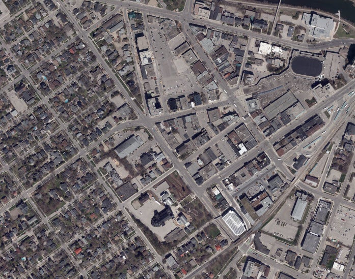
Sample image of Guelph, Ontario, 2020