Description
The ACRES Landsat 7 Mosaic of Australia is derived from the ACRES Landsat 7 Y2K satellite and was produced by the Australian Greenhouse Office (AGO) in 2000 as part of the National Carbon Accounting System. The ACRES Landsat 7 Mosaic of Australia is comprised of 369 individual Landsat satellite scenes acquired between July 1999 and September 2000. Imagery has a pixel size of 25 metres.
The Geospatial Centre has two distinct mosaics, each produced using different spectral bands. One mosaic has a file size of 1.8 GB and is produced from a combination of blue, near infrared, and middle infrared spectral bands resulting in a pseudo natural colour image. The other mosaic has a file size of 2.5 GB and uses blue, green and red spectral bands giving a natural colour image.
Spatial reference and data type
The mosaics are stored in Enhanced Compression Wavelet (ECW) format. Projection for both mosaics is Lambert Conformal Conic.
Data access
In order to access these image files, please visit the Geospatial Centre Reference Desk during reference hours. Library reference staff are available to deliver data upon request. Under the terms of the Library's license agreement, this imagery is for use by students, faculty, and staff at the University of Waterloo only.
Data manipulation and storage
There are public workstations in the Geospatial Centre that provide access to ArcGIS software programs, program extensions and data manipulation utilities. Patrons may use the Geographic Information System (GIS) and image processing software in the library to view and manipulate the data. UWaterloo faculty, students and staff may copy these data to other media (for example: CD, DVD or Zip disc) for use elsewhere.
Data output
These images may be exported from ArcGIS in a choice of bitmapped formats (also known as raster graphics) including JPG, TIFF, GIF, and BMP or in a choice of vector graphics formats including Adobe Illustrator (AI), Encapsulated Postscript (EPS), and Scalable Vector Graphics (SVG). Yet another option is PDF. The user defines the output resolution.
Use restrictions/licensing/copyright
The mosaic imagery is copyrighted and provided by the Australian Greenhouse Office (AGO). You may download, display, print and reproduce this material in unaltered form only for your personal, non-commercial use or use within your organisation. Apart from any use as permitted under the Copyright Act 1968, all other rights are reserved. The Australian Greenhouse Office must be acknowledged on any derivative product, whether printed or electronic, including for example, a printed map, a raster or vector graphic, a web-based application, etc.
Citation
Australia Landsat 7 Mosaic 2000 [computer file]. The Australian Greenhouse Office [2000].
Image made from blue, green and red spectral bands
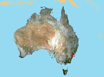
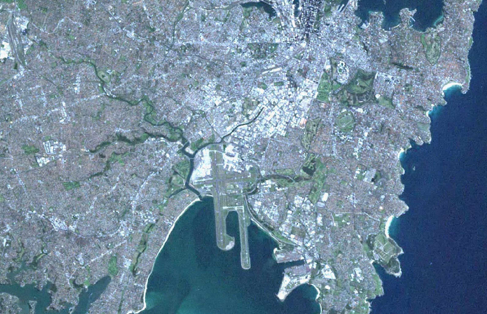
Image made from blue, near infrared, and middle infrared spectral bands
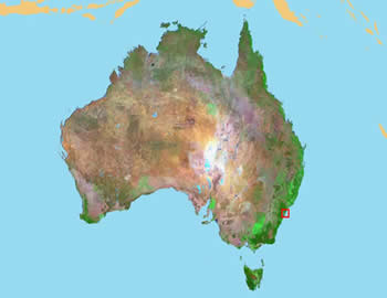
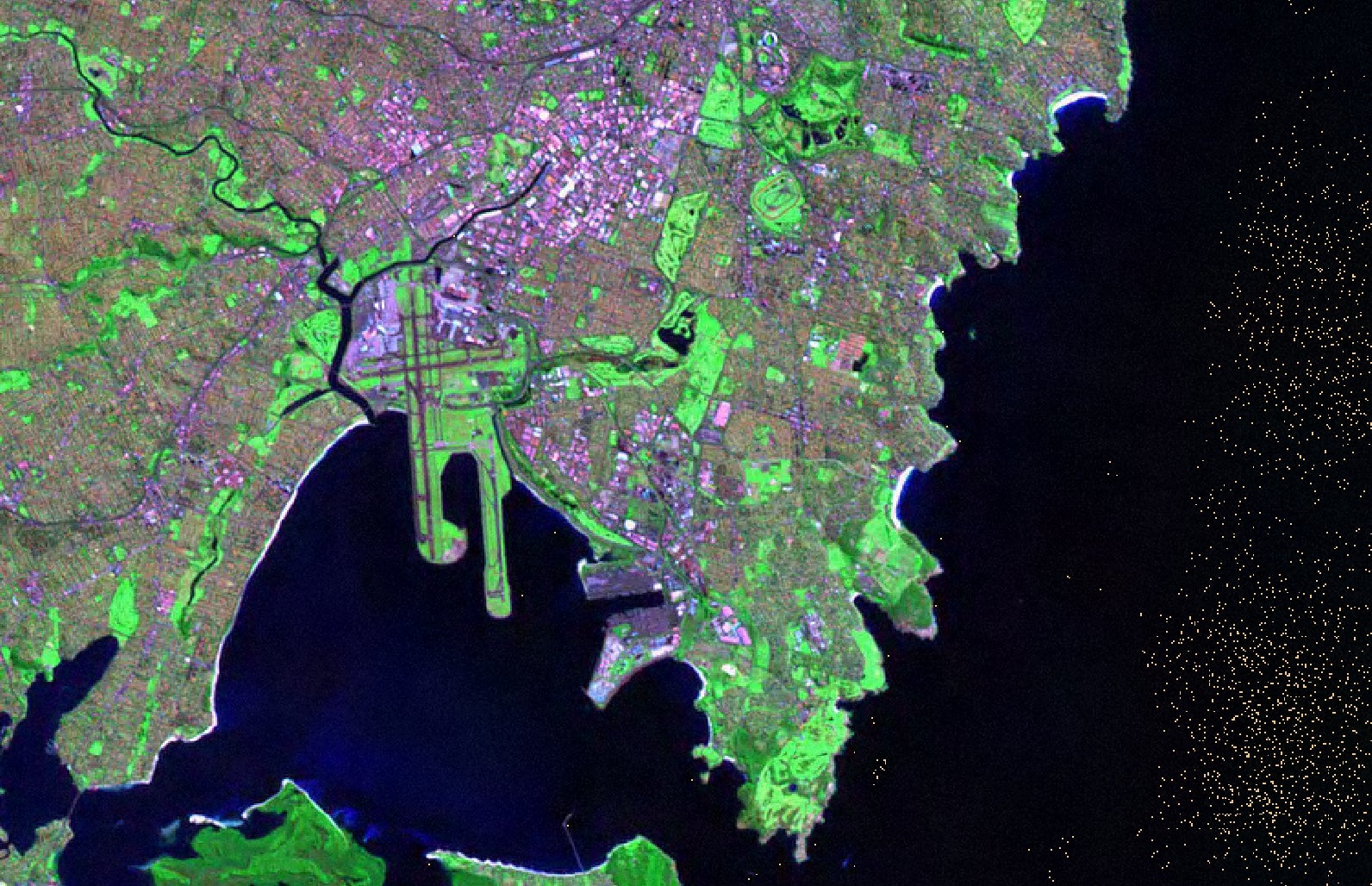
Imagery courtesy of the Australian Greenhouse Office