Description
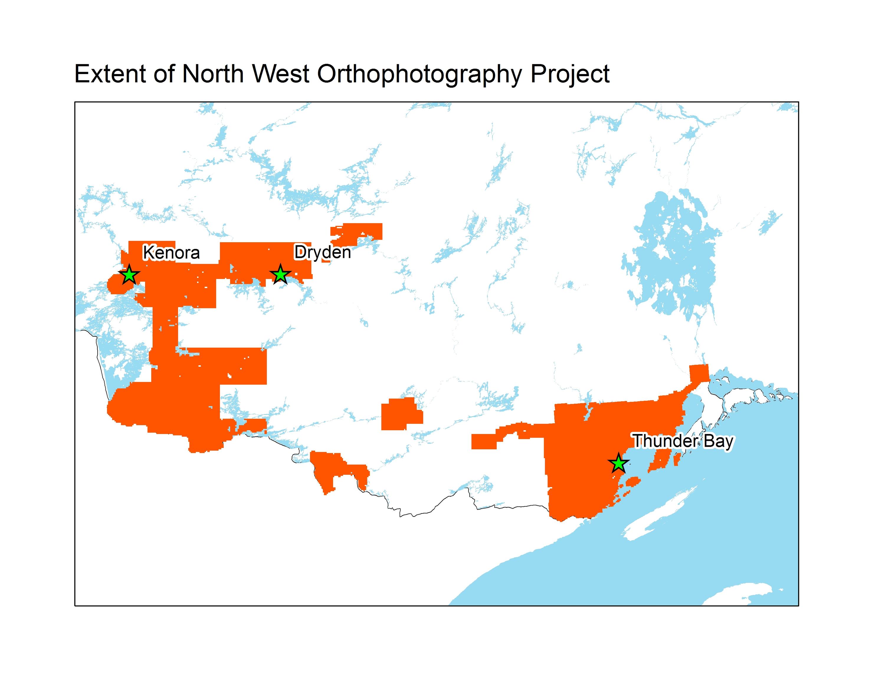
The North West Ontario Orthophotography Project (NWOOP) 2017 was received from the Ontario Ministry of Natural Resources. The acquisition was contracted out to Fugro Geospatial. An ADS100 Leica digital camera system was used to capture the imagery, which covers approximately 22,700 square kilometres in Northwestern Ontario and was taken during leaf off conditions between May 7th and May 19th, 2017. The 4 band Red Green Blue Near infrared (RGB-NIR) imagery has a pixel resolution of 20 cm and is available in 1 km tiles.
Spatial reference and data type
These georeferenced images are available in Universal Transverse Mercator (UTM) coordinates; horizontal datum is North American Datum (NAD) 83. Data are stored as 1km x 1km jpg2 tiles. The average file size for each 1km tile is 18MB.
Data access
There are public workstations in the Geospatial Centre that provide access to the ArcGIS software program, program extensions and data manipulation utilities. Patrons may use the Geographic Information System (GIS) and image processing software in the library to view and manipulate the data. UWaterloo faculty, students and staff may copy these data to other media (for example: CD, DVD or Zip disc) for use elsewhere.
Data manipulation and storage
There are public workstations in the Geospatial Centre that provide access to the ArcGIS software program, program extensions and data manipulation utilities. Patrons may use the Geographic Information System (GIS) and image processing software in the library to view and manipulate the data. UWaterloo faculty, students and staff may copy these data to other media (for example: CD, DVD or Zip disc) for use elsewhere.
Data output
These images may be exported from ArcGIS in a choice of bitmapped formats (also known as raster graphics) including JPG, TIFF, GIF, and BMP or in a choice of vector graphics formats including Adobe Illustrator (AI), Encapsulated Postscript (EPS), and Scalable Vector Graphics (SVG). Yet another option is PDF. The user defines the output resolution.
Use restrictions/licensing/copyright
These data are provided for personal use for academic, research, and/or teaching purposes. The Ontario Ministry of Natural Resources must be acknowledged on any derivative product, whether printed or electronic, including, for example, a printed map, a raster or vector graphic, a web-based application, etc. Patrons are advised to fully respect the provisions of Canada's Copyright Act as well as the terms and conditions imposed by the data provider.
Citation
North West Ontario Orthophotography Project (NWOOP) 2017 [computer file]. Ontario Ministry of Natural Resources.
Sample view of the data
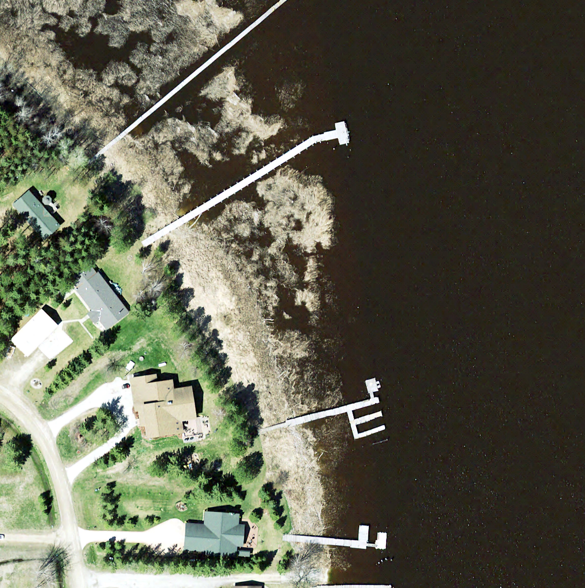
Data Courtesy of the Ministry of Natural Resources