Data access
Full access to our resources is available to current students, faculty, and staff of the University of Waterloo. To request access, please complete the Ask-Us form indicating the specific layers (shapefiles) you require. Upon completion of the data release agreement form, the dataset will be provided to you via OneDrive.
In-person consultations may also be requested through the Ask-Us form.
Description
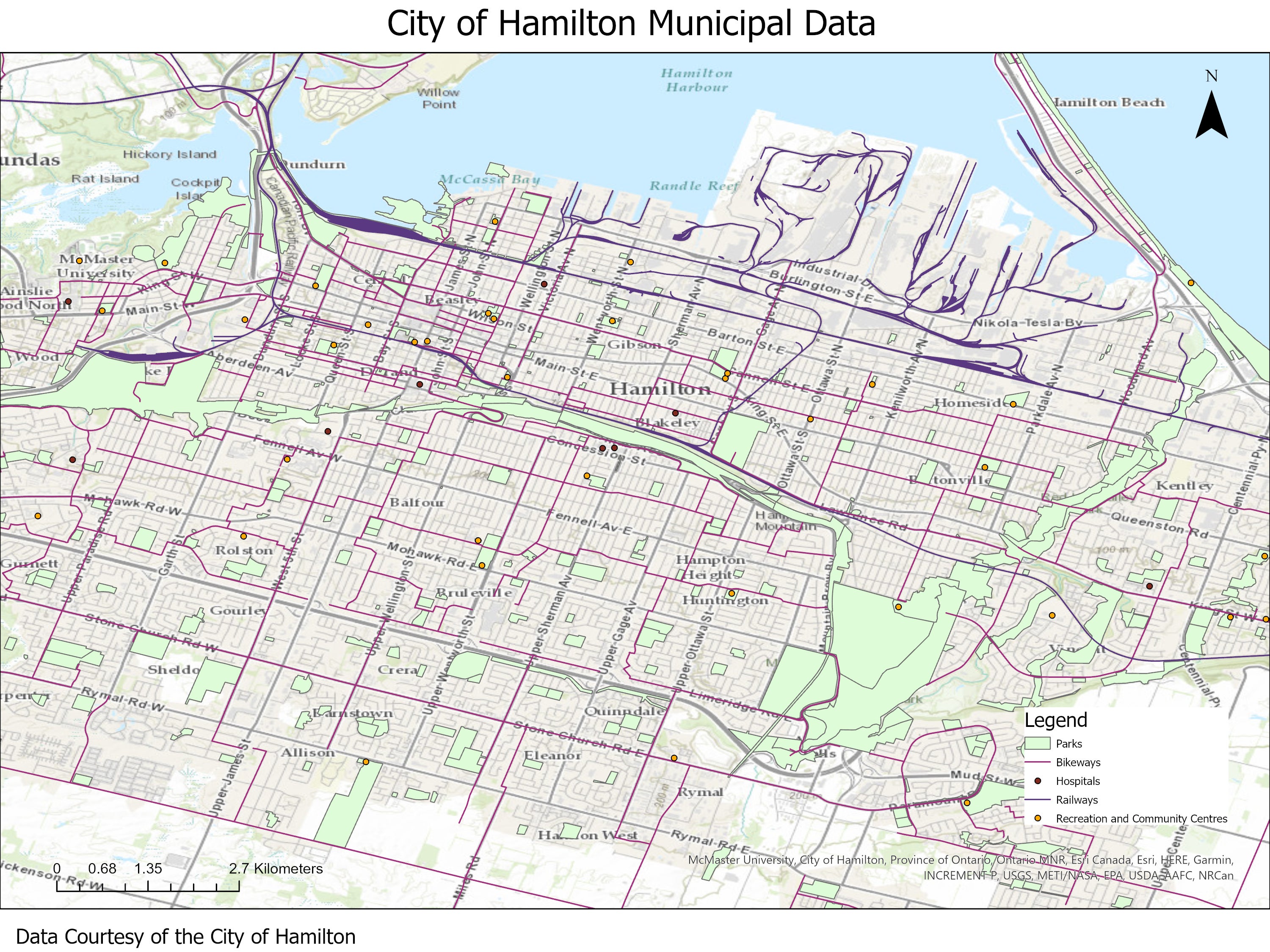
Also available through Scholars GeoPortal, this vector data resource provides topographic and planning information for the area encompassed by the City of Hamilton. This includes former cities of Hamilton, Flamborough, Dundas, Ancaster, Stoney Creek and Glanbrook. These 2006 - 2026 datasets were provided to the Geospatial Centre by the City of Hamilton. Updated datasets are available via the Open Hamilton website.
The Geospatial Centre has coverage for the following:
- addresses
- airport boundary
- arenas
- beaches
- bikeways
- bus stops
- building footprints
- cemeteries
- city boundaries
- city play lots
- city pools
- college/ universities
- conservation authorities
- contours (1 metre)
- digital terrain model (DTM) (10 metre and 20 metre)
- direction arrow
- drinking fountains
- educational institutions
- election poll boundaries
- electric vehicle charging stations
- emergency response times (table)
- escarpment
- fire hydrants
- fire stations
- golf courses
- hospitals
- HSR annual ridership (table)
- HSR monthly ridership (table)
- lakes
- land use (2016)
- libraries
- licensed real housing units
- long term care facilities
- major lake fill
- municipal boundaries
- municipal services
- museums/ galleries
- neighbourhood boundaries
- neighbourhood speed reduction zones
- parks
- park washrooms
- parking lots
- places of worship
- planning units
- planning applications reported since 2023
- police stations
- public sector energy consumption and greenhouse gas emission reporting (table)
- railways: bridge, line, tunnel
- recreational community centres
- residential care (senior care facilities and retirement homes)
- residential rice causes (table)
- respiratory and enteric outbreaks (table)
- rivers
- road access ramps
- road intersections
- roads and road features (i.e. ramps, bridges, tunnels, casings, centre line)
- sanitation sewer wastewater catchment areas
- schools
- settlements
- sewer lift station
- sewer manhole/ node/ main
- sewer flow arrows
- sewer treatment plants
- shelter beds available (table)
- shelter occupancy (table)
- shorelines
- sidewalks
- stormwater management facilities
- trails
- transit routes
- transmission lines
- tree inventory
- urban boundaries
- water bodies
- ward boundaries
- water hydrants, branches, mains, nodes, valves
- water pressure district
- water reservoirs
- water storage tanks
- zoning
Spatial reference and data type
These data sets are available in Universal Transverse Mercator (UTM) co-ordinates; horizontal datum is North American Datum (NAD) 83. These data are stored as Esri shapefiles. Other data formats can be accommodated, as the Geospatial Centre has access to a number of conversion utilities.
Use restrictions/licensing/copyright
These data are provided for personal use for academic, research, and/or teaching purposes. A data release agreement must be agreed to before these licensed data can be released. The City of Hamilton must be acknowledged on any derivative product, whether printed or electronic, including for example, a printed map, a raster or vector graphic, a web-based application, etc. Patrons are advised to fully respect the provisions of Canada's Copyright Act as well as terms and conditions imposed by the data provider.
Citation
The City of Hamilton Municipal Data [computer file]. Hamilton, Ontario : The City of Hamiltion Department of Information Technology Services, [2016].
Sample view of the data