Description:
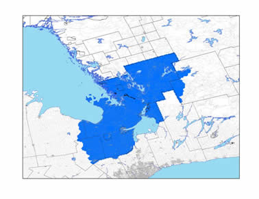
These 30 cm digital orthoimages from the Ontario Ministry of Natural Resources and Forestry were flown in 2008 and provide full-colour aerial coverage of Muskoka, Simcoe and part of Dufferin. Mosaics come in 20 km tiles as shown in index (PDF).
Coverage of Imagery:
Spatial reference and data type
These georeferenced images are available in Universal Transverse Mercator (UTM) 17 coordinates; horizontal datum is North American Datum (NAD) 83. They are stored as compressed MrSID data files and have an average file size is 500 mb.
Data access
In order to access these data sets, please visit the Geospatial Centre reference desk during reference hours. Library reference staff are available to provide further information about these data sets and to deliver data upon request. Under the terms of the library's license agreement, these data sets are for use by students, faculty, and staff at the University of Waterloo only.
Data manipulation and storage
There are public workstations in the Geospatial Centre that provide access to the ArcGIS software program, program extensions and data manipulation utilities. Patrons may use the Geographic Information System (GIS) and image processing software in the library to view and manipulate the data. UWaterloo faculty, students and staff may copy these data to other media (for example: CD, DVD or Zip disc) for use elsewhere.
Data output
These images may be exported from ArcGIS in a choice of bitmapped formats (also known as raster graphics) including JPG, TIFF, GIF, and BMP or in a choice of vector graphics formats including Adobe Illustrator (AI), Encapsulated Postscript (EPS), and Scalable Vector Graphics (SVG). Yet another option is PDF. The MrSID GeoViewer may also be used to export the image, in whole or in part, as either a TIFF or GeoTIFF image. The user defines the output resolution.
Use restrictions/licensing/copyright
These data are provided for personal use for academic, research, and/or teaching purposes. A data release agreement must be agreed to before these licensed data can be released. The Ministry of Environment must be acknowledged on any derivative product, whether printed or electronic, including, for example, a printed map, a raster or vector graphic, a web-based application, etc. Patrons are advised to fully respect the provisions of Canada's Copyright Act as well as the terms and conditions imposed by the data provider.
Citation
Huntsville : Orthoimagery 2008 [computer file]. Ontario Ministry of Environment, Toronto, Ontario.
Sample view of the data
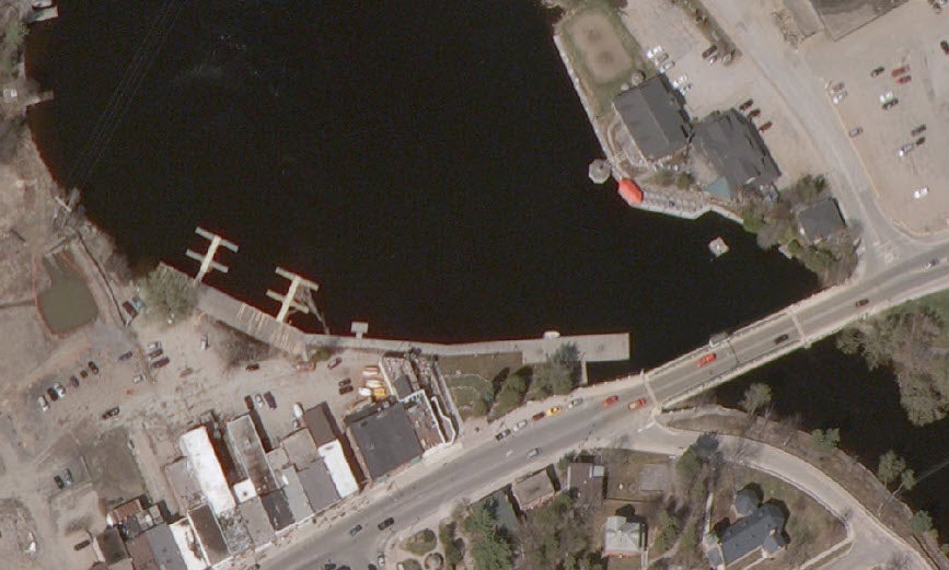
Data courtesy of the Ministry of Environment