Description
This data resource contains digital orthophotos of the Gatineau Park and the National Capital Region. These images share the same 1994 and 1998 orthophoto index (PDF) however, were taken at different times. Gatineau Park (in Quebec) was flown in October 1994, and images have a resolution of 0.25 m. Images of urban areas were flown in 1998 and have a resolution of 0.5 m.
The title of this data resource in Primo, our discovery tool and library catalogue, is National Capital Region digital orthophotos 1994 & 1998.
Spatial reference and data type
These images are available in Modified Transverse Mercator (MTM) zone 9, North American Datum (NAD) 83 coordinate system. The 1998 data are available in .TIFF format, whereas the 1994 data are available in .JPG format.
Data access
In order to access these data sets, please visit the Geospatial Centre reference desk during reference hours. Library reference staff are available to provide further information about these data sets and to deliver data upon request. Under the terms of the library's license agreement, these data sets are for use by students, faculty, and staff at the University of Waterloo only.
Data manipulation and storage
There are public workstations in the Geospatial Centre that provide access to both ArcGIS and ArcView software programs, program extensions and data manipulation utilities. Patrons may use the Geographic Information System (GIS) and image processing software in the library to view and manipulate the data. UWaterloo faculty, students and staff may copy these data to other media (for example: CD, DVD or Zip disc) for use elsewhere.
Data output
These images may be exported from ArcGIS in a choice of bitmapped formats (also known as raster graphics) including JPG, TIFF, GIF, and BMP or in a choice of vector graphics formats including Adobe Illustrator (AI), Encapsulated Postscript Scalable (EPS), and Scalable Vector Graphics (SVG). Yet another option is PDF.
Use restrictions/licensing/copyright
These data are provided for personal use for academic, research, and/or teaching purposes. A data release agreement must be agreed to before these licensed data can be released. The National Capital Commission must be acknowledged on any derivative product, whether printed or electronic, including for example, a printed map, a raster or vector graphic, a web-based application, etc. Patrons are advised to fully respect the provisions of Canada's Copyright Act as well as terms and conditions imposed by the data provider.
Citation
The National Capital Region Digital Orthophotos [computer file]. Ottawa, Ontario: National Capital Commission, [1994, 1998].
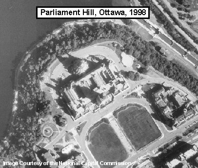
Sample view of the data