Contact the Geospatial Centre
Dana Porter Library, Room 328
University of Waterloo Library
Waterloo, Ontario N2L 3G1
Email: librarygeo@uwaterloo.ca
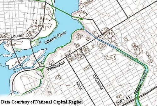
This vector data resource provides topographic and recreational information for the area encompassed by the National Capital Region including the Gatineau Park area. This data set was originally received from the National Capital Commission (NCC) in 1998. In 2002, the author of the series was changed from the NCC to the City of Ottawa. Current datasets are available at two different scales: 1:2,000 (1:2000 scale feature code list (PDF)) and 1:10,000. The larger-scale layers provide coverage of the urbanized area within the City of Ottawa and are dated 2004-2023. The smaller scale layers cover the entire City of Ottawa and are current (i.e. 2008). More recent data is avaialable from the Ottawa Open Data site.
The layers in the 2004/ 2008 datasets include:
The title of the 1998 data resource in Primo, our discovery tool and library catalogue, is Vector files of the National Capital Region (NCR) [computer file].
These data sets are available in Modified Transverse Mercator (MTM) zone 9, North American Datum (NAD) 83 co-ordinate system. These data are stored as Esri shapefiles. Other data formats can be accommodated, as the Geospatial Centre has access to a number of conversion utilities.
To request this data, please fill out the Ask-Us form and include which layers (shapefiles) you are interested in obtaining. The dataset will be shared with you via OneDrive upon completion of the data release agreement form. You may also make an in-person appointment using the same form.
These data are provided for personal use for academic, research, and/or teaching purposes. A data release agreement must be agreed to before these licensed data can be released. The city of Ottawa must be acknowledged on any derivative product, whether printed or electronic, including for example, a printed map, a raster or vector graphic, a web-based application, etc. Patrons are advised to fully respect the provisions of Canada's Copyright Act as well as terms and conditions imposed by the data provider.
The National Capital Region Topographic and Recreation Data [computer file]. Ottawa, Ontario: The city of Ottawa, [2008].

Dana Porter Library, Room 328
University of Waterloo Library
Waterloo, Ontario N2L 3G1
Email: librarygeo@uwaterloo.ca
The University of Waterloo acknowledges that much of our work takes place on the traditional territory of the Neutral, Anishinaabeg, and Haudenosaunee peoples. Our main campus is situated on the Haldimand Tract, the land granted to the Six Nations that includes six miles on each side of the Grand River. Our active work toward reconciliation takes place across our campuses through research, learning, teaching, and community building, and is co-ordinated within the Office of Indigenous Relations.