Contact the Geospatial Centre
Dana Porter Library, Room 328
University of Waterloo Library
Waterloo, Ontario N2L 3G1
Email: librarygeo@uwaterloo.ca
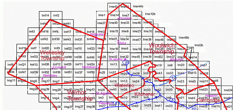
This is an index to the Multispectral Electro-Optical Image Sensor (MEIS) images held by the Geospatial Centre for the northern half of the Regional Municipality of Waterloo. This index provides geographic coverage of Wellesley Township, Woolwich Township, and City of Waterloo plus the northern half of the City of Kitchener and Wilmot Township. University of Waterloo campus is on image tile number Im12.

Dana Porter Library, Room 328
University of Waterloo Library
Waterloo, Ontario N2L 3G1
Email: librarygeo@uwaterloo.ca
The University of Waterloo acknowledges that much of our work takes place on the traditional territory of the Neutral, Anishinaabeg, and Haudenosaunee peoples. Our main campus is situated on the Haldimand Tract, the land granted to the Six Nations that includes six miles on each side of the Grand River. Our active work toward reconciliation takes place across our campuses through research, learning, teaching, and community building, and is co-ordinated within the Office of Indigenous Relations.