Description
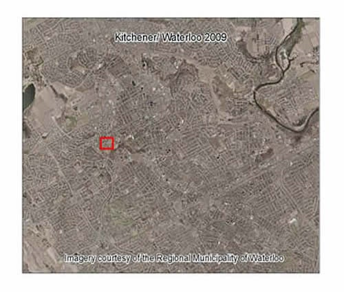
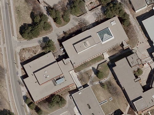
This data resource contains eight orthomosaics, one for each of the cities of Waterloo, Kitchener and Cambridge and also coverage of the regional communities of Ayr, Breslau, Elmira, Conestogo, Wellesley, Baden, New Hamburg and North Dumfries. Aerial photography was captured in March 2009, and then scanned to digital format. Pixel resolution is 12 cm. The orthomosaics were provided to the Library by the Region of Waterloo in October 2009.
Spatial reference and data type
These georeferenced mosaics are available in Universal Transverse Mercator (UTM) zone 17 coordinates; horizontal datum is North American Datum (NAD) 83. They are stored as compressed MrSID data files, with accompanying Sid World (SDW) files. File sizes range from 74 MB to 2.3 GB.
Data access
To request this data, please fill out the Ask-Us form and include which layers (shapefiles) you are interested in obtaining. The dataset will be shared with you via OneDrive upon completion of the data release agreement form. You may also make an in-person appointment using the same form.
Use restrictions/licensing/copyright
These data are provided for personal use for academic, research, and/or teaching purposes. A data release agreement must be agreed to before these licensed data can be released. The Regional Municipality of Waterloo must be acknowledged on any derivative product, whether printed or electronic, including for example, a printed map, a raster or vector graphic, a web-based application, etc. Patrons are advised to fully respect the provisions of Canada's Copyright Act as well as terms and conditions imposed by the data provider.
Citation
Regional Municipality of Waterloo Communities [computer file]. Waterloo, Ontario: The Regional Municipality of Waterloo [2009].
Sample view of the data