Description
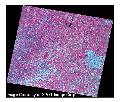
Two image files, one multispectral, and one panchromatic, were acquired by the SPOT remote sensing satellite in 1999.
Spatial reference and data type
The first channel of the multispectral image is band high resolution visible (HRV) 3 (near infrared (IR), 0.79-0.89 µm) from the SPOT satellite; the second multispectral channel is SPOT HRV2 (red, 0.61-0.68 µm); and the third multispectral channel is SPOT HRV1 (green, 0.50-0.59 µm). The multispectral image has been georeferenced to the Universal Transverse Mercator (UTM) projection (UTM zone 17 North American Datum (NAD) 83) with a precision accuracy of better than 20 metres. The spatial resolution of this image is 20 metres. There have been no contrast enhancements applied to this image.
The panchromatic image is a single-channel (i.e. black and white) scene acquired on September 19, 1999. This image was recorded in the visible light spectral region (0.51-0.73 µm). The panchromatic image has been georeferenced to the UTM projection (UTM zone 17 NAD83) with a precision accuracy of better than 10 m. The spatial resolution of this image is 10 m. There have been no contrast enhancements applied to this image.
There are 4 files differentiated by unique file extensions - associated with each image:
- JPG: This is a small "thumbnail" view of the entire scene in JPG format. You may want to have a glance at this file first to see exactly what area the image covers.
- TIFF: This is the image file in TIFF format; it is approximately 50 MB.
- TFW: This is the TIFF World File containing the geo-referencing information. You will need this file to import the image into a GIS.
- TXT: This is a text header file. This file is not required to use the image, but it contains some more details about the scene.
Image description courtesy of Joseph M. Piwowar, Ph.D.
Data access
To request this data, please fill out the Ask-Us form and include which layers (shapefiles) you are interested in obtaining. The dataset will be shared with you via OneDrive upon completion of the data release agreement form. You may also make an in-person appointment using the same form.
Use restrictions/licensing/copyright
These data are provided for personal use for academic, research, and/or teaching purposes. A data release agreement must be agreed to before these licensed data can be released. Spot Image Corporation must be acknowledged on any derivative product, whether printed or electronic, including for example, a printed map, a raster or vector graphic, a web-based application, etc. Patrons are advised to fully respect the provisions of Canada's Copyright Act as well as terms and conditions imposed by the data provider.
Citation
SPOT Satellite Imagery of The Regional Municipality of Waterloo. [computer file]. Chantilly, Virginia: SPOT Image Corporation, [1999].
Sample view of the data