Description
The National Topographic System provides general-purpose topographic map coverage of Canada. These maps depict in detail ground relief (landforms and terrain), drainage (lakes and rivers), forest cover, administrative areas, populated areas, transportation routes and facilities (including roads and railways), and other human-made features.
The Geospatial Centre has access to all series of NTS topographic maps; the 1:50,000 and 1:250,000 series. The now-discontinued 1:25,000 and 1:125,000 map series are available as well. For access to scanned copies, please contact Geospatial Centre staff.
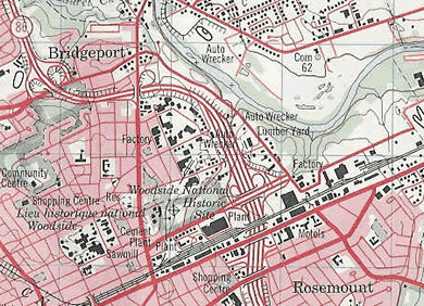
The 1:50 000 scale topographic map accurately shows hills, valleys, lakes, rivers, streams, rapids, portages, trails and wooded areas; major, secondary and side roads, and all human-made features such as buildings, power lines, dams and cut lines. A 1:50,000 scale map covers an area approximately 1000 square kilometres.
The 1:250 000 scale topographic map is considered to be a reconnaissance-type map. It covers the same area of land as sixteen 1:50 000 scale maps. This scale is popular not only as a detailed overview of a large area, but also as a detailed road map for use when travelling on back roads and side roads. A full 1:250 000 scale map shows an area approximately the size of Prince Edward Island.
*This description is courtesy of the Natural Resources Canada website.
Coverage
The Geospatial Centre has in its collection, the most recent editions of all three series of NTS maps. The 1:25,000 and 1:125,000 series has been discontinued and limited coverage is available. Please note that at the 1:50,000 scale, all of Canada is not mapped. A coverage index, as well as a search tool can be found on the Natural Resources Canada website.
Call number
G3400 s50 .C3 Geospatial Vertical Cabinets.
Samples
1:50,000 NTS map sheet
1:250,000 NTS map sheet
