Description
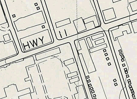
The Ontario Base Map series (no longer in production in paper form) provides general-purpose topographic map coverage of Ontario. Southern Ontario is covered at a scale of 1:10,000, and Northern Ontario at a scale of 1:20,000. These black and white maps depict detailed ground relief (landforms and terrain), drainage (lakes and rivers), buildings, roads, railways, and other human-made features. This map series was produced by the Ontario Ministry of Natural Resources.
The Geospatial Centre has access to paper copies covering the Regional Municipality of Waterloo. This series of maps is being replaced by the Digital Map of Ontario project. For more information on digital data of Ontario, please see our digital resource guide for NRVIS (Natural Resources Values and Information System) data.
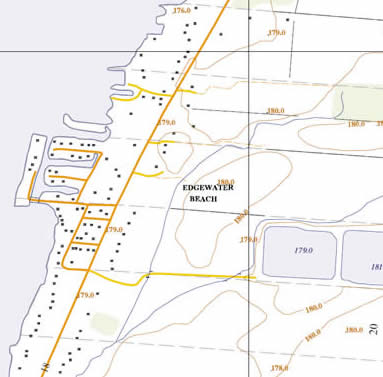
In July 2008 the Geospatial Centre acquired from University of Toronto scanned OBM tiles (adobe PDF format) for Universal Transverse Mercator (UTM) zones 17 (3,656 tiles) and zone 18 (1,791 tiles). These documents are from that part of Ontario that was originally mapped at 1:10,000 by the Ontario Ministry of Natural Resources and published in the late 1970's to early 1980's. These OBMs have been colourized (green for vegetation, brown for contours, orange for roads, etc.) and are therefore more useful than their paper equivalents. The OBMs were scanned at high resolution and therefore suitable for printing at original map size. Please contact Geospatial Centre staff for access to digital versions.
Zone 15, 16, 17 and 18 (1:20,000) PDFs can be made available upon request.
Coverage for paper OBM
Coverage of Southern Ontario varies. See index sheets in the Geospatial Centre.
Call number
G3460 svar .O5x Horizontal Cabinets
Sample
Ontario base map 1:10,000

Coverage for paper OBMs
Zone 15, 16, 17 and 18.
Scanned and colourized Ontario base map 1:10,000
