Description
This near-worldwide set of 609 satellite imagery mosaics, marketed as 1990 GeoCover by Land Info Worldwide Mapping, is from Landsat 4/5 Thematic Mapper (TM) and includes three 30 metre multi-spectral bands 7-4-2. The Landsat images have been ortho-rectified, tonally balanced, mosaicked, tiled and wavelett compressed.
Coverage date is scene-dependent, nominally 1990 +/- 3 years. Pixel size is 28.5 metres. Absolute positional accuracy is 50 meters root mean square error.
Spatial reference and data type
The GeoCover Landsat mosaics are delivered in a Universal Transverse Mercator (UTM)/World Geodetic System 1984 (WGS84) projection. The mosaics generally extend north-south over 5 degrees of latitude, and span east-west for the full width of the UTM zone. For mosaics between 60 degrees north and 60 degrees south latitude, the width of the mosaic is the standard UTM zone width of 6 degrees south latitude, the width of the mosaic is the standard UTM zone width of 6 degrees of longitude. For mosaics above 60 degrees of latitude, the UTM zone is widened to 12 degrees, centered on the standard UTM meridian. To insure overlap between adjacent UTM zones, each mosaic extends for at least 50 kilometers to the east and west, and 1 kilometer to the north and south.
Non-standard UTM definition: for the southern hemisphere, the files contain positive zone numbers with negative northing coordinates.
The mosaics are stored as compressed MrSID filies, with accompanying SDW world files. File sizes vary from less than 10 MB to more than 60 MB, most being at least 30 MB.
Data access
In order to access these data sets, please visit the Geospatial Centre reference desk during reference hours. Library reference staff are available to provide further information about these data sets and to deliver data upon request. Under the terms of the library's license agreement, these data sets are for use by students, faculty, and staff at the University of Waterloo only.
Data manipulation and storage
There are public workstations in the Geospatial Centre that provide access to both ArcGIS and ArcView software programs, program extensions and data manipulation utilities. Patrons may use the Geographic Information System (GIS) and image processing software in the library to view and manipulate the data. Waterloo faculty, students and staff may copy these data to other media.
Data output
These images may be exported from ArcGIS in a choice of bitmapped formats (also known as raster graphics) including JPG, TIFF, GIF, and BMP or in a choice of vector graphics formats including Adobe Illustrator (AI), Encapsulated Postscript (EPS), and Scalable Vector Graphics (SVG). Yet another option is PDF. The user defines the output resolution.
Use restrictions/licensing/copyright
GeoCover Landsat imagery is provided through NASA's Earth Science Enterprise, Scientific Data Purchase Project Produced under NASA contract by the Earth Satellite Corporation. There are no restrictions on use or distribution of these data. NASA distribution of these data does not constitute an endorsement of the data provider or a warranty of data availability or suitability for a particular use.
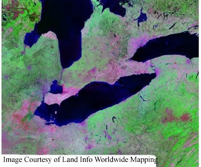
Sample image
Landsat 4/5
Mosaic N-17-40