Data access
Full access to our resources is available to current students, faculty, and staff of the University of Waterloo. To request access, please complete the Ask-Us form indicating the specific layers (shapefiles) you require. Upon completion of the data release agreement form, the dataset will be provided to you via OneDrive.
In-person consultations may also be requested through the Ask-Us form.
Description
Received from LandInfo Worldwide Mapping, VMap (Vector Map Level 0), version 5, provides seamless world coverage of many topographic map themes. The original Vector Smart Map (VMAP) files were created by the United States Defense Mapping Agency, based on the Digital Chart of the World 1:1,000,000. Version 5 is based on the newest editions of the 1:1,000,000 Operational Navigation Charts, published by the United States National Imagery and Mapping Agency on September 30, 2000.
Although coverage for some layers is near worldwide, other layers are less extensive. There are some parts of the world where no data are available.
Global layers from VMap0
- airports
- city areas
- coast lines
- fish hatcheries
- industry areas
- miscellaneous population points
- native settlements
- place names
- railroads
- spot elevation
- trails
- tree areas
- barriers
- city points
- crop areas
- grass areas
- lakes
- miscellaneous transmission lines
- ocean sea areas
- political boundaries
- rail yards
- sand areas
- storage points
- transportation lines
- tundra areas
- bathymetry
- contours
- danger points
- highways
- land ice
- miscellaneous water lines
- pipelines
- power plants
- rivers
- sea ice
- swamps
- transportation points
- utility lines
Spatial reference and data type
These data sets are available in geographic co-ordinates; horizontal datum is World Geodetic System 1984 (WGS84). They are stored in two formats: shapefile and .TAB files. Other data formats can be accommodated, as the Geospatial Centre has access to a number of conversion utilities. Files sizes vary from 30 KB to 559 MB, many being less than 28 MB.
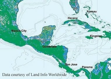
Sample view of data