Contact the Geospatial Centre
Dana Porter Library, Room 328
University of Waterloo Library
Waterloo, Ontario N2L 3G1
Email: librarygeo@uwaterloo.ca
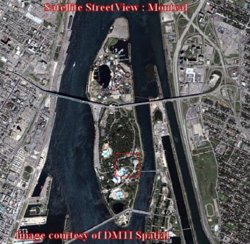
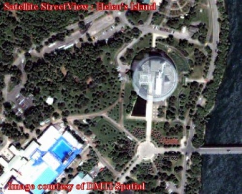
Satellite StreetView is a geospatial product which combines the spatial detail of DigitalGlobe's high-resolution satellite imagery with the content of DMTI Spatial's digital streetmap. The satellite images are 60 cm resolution, the highest resolution available on the commercial market. The imagery dates from 2002 to present.
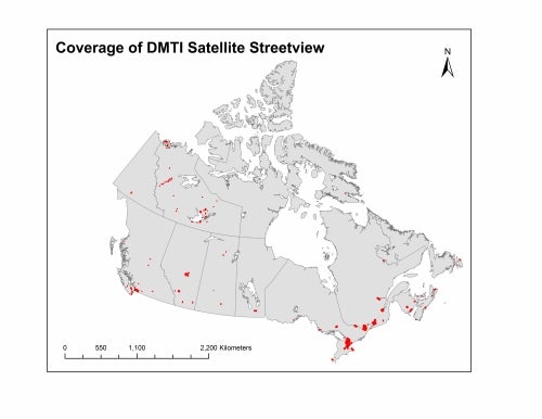
Satellite StreetView is currently available for the following cities:
The Geospatial Centre has access to all of the above imagery however some images have not yet been uploaded to the server. Please contact library reference staff (email) for details.
These georeferenced images are available in Universal Transverse Mercator (UTM) coordinates; horizontal datum is North American Datum (NAD) 83. They are stored as GeoTIFF image files. The Tiff image tiles range in size from 80MB to over 550MB.
In order to access these data sets, please visit the Geospatial Centre public services desk during reference hours. Library reference staff are available to provide further information about these data sets and to deliver data upon request. Under the terms of the library's license agreement, these data sets are for use by students, faculty, and staff at the University of Waterloo only.
There are public workstations in the Geospatial Centre that provide access to ArcGIS software programs, program extensions, and data manipulation utilities. Patrons may use the Geographic Information System (GIS) and image processing software in the library to view and manipulate the data. UWaterloo faculty, students, and staff may copy these data to other media (for example: CD, DVD or Zip disc) for use elsewhere.
These images may be exported from ArcGIS in a choice of bitmapped formats (also known as raster graphics) including JPG, TIFF, GIF, and BMP or in a choice of vector graphics formats including Adobe Illustrator (AI), Encapsulated Postscript (EPS), and Scalable Vector Graphics (SVG). Yet another option is PDF. The user defines the output resolution.
These data are provided for personal use for academic, research, and/or teaching purposes. Library staff will ask patrons to read and sign a data release agreement before these licensed data can be released. The Ministry of Natural Resources must be acknowledged on any derivative product, whether printed or electronic, including for example, a printed map, a raster or vector graphic, a web-based application, etc. Patrons are advised to fully respect the provisions of Canada's Copyright Act as well as terms and conditions imposed by the data provider.
Satellite StreetView [computer file]. Markham, Ontario: DMTI Spatial Inc., 2002-present.