Data access
Full access to our resources is available to current students, faculty, and staff of the University of Waterloo. To request access, please complete the Ask-Us form indicating the specific layers (shapefiles) you require. Upon completion of the data release agreement form, the dataset will be provided to you via OneDrive.
In-person consultations may also be requested through the Ask-Us form.
Description
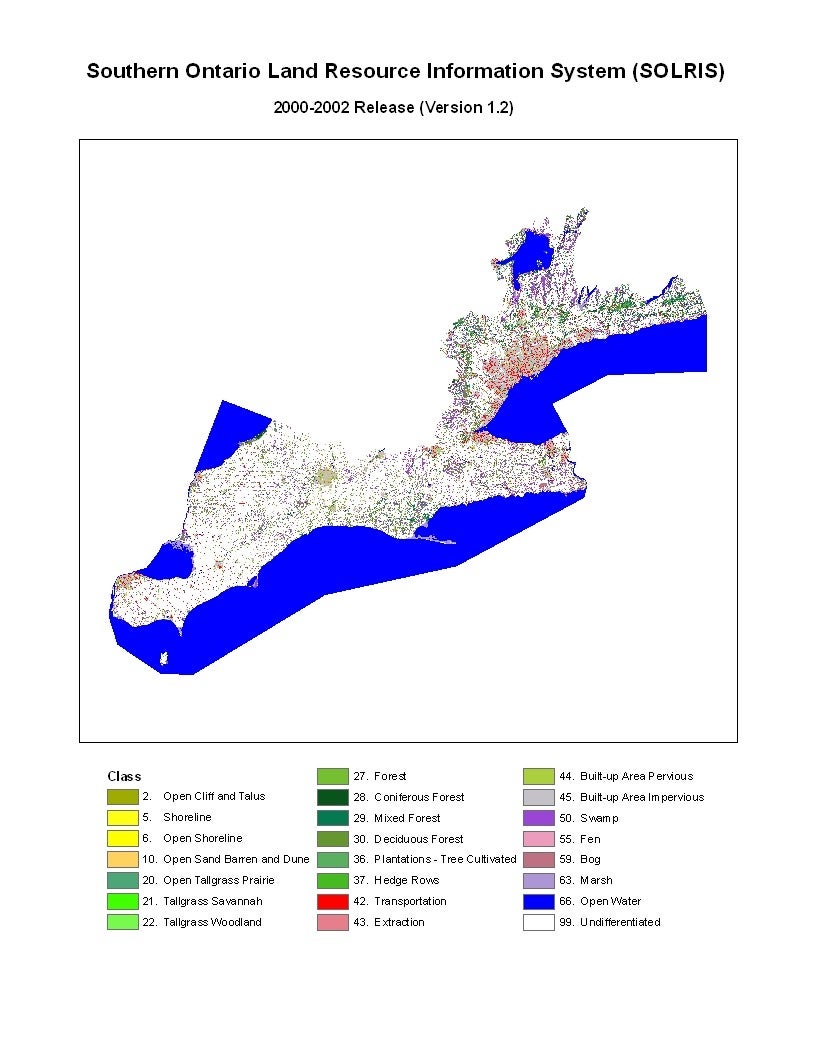
The Southern Ontario Land Resource Information System (SOLRIS) is a landscape-level inventory of natural, rural and urban areas. Version 1.1 covering the Greater Toronto Area (GTA) was released in 2007. Version 1.2 (JPG) was released in November - December 2007. In April 2008, the Geospatial Centre received updates to version 1.2, with landcover coverage for all of Southwestern Ontario, Central Ontario, and Eastern Ontario. In 2019, the Geospatial Centre received version 3.0, data that covers the date ranges from 2000-2015 in Ecoregions 7E, 6E and 5E (Growth Plan for the Greater Golden Horseshoe Study Area and an Eastern Ontario extension to the Forest Resources Inventory boundary).
SOLRIS was developed to support landscape-scale planning initiatives in southern Ontario such as source water protection, biodiversity conservation, natural spaces, and state of resources reporting. The SOLRIS inventory is a compilation of data from various sources including topographic maps, aerial photos and satellite imagery. Computer modelling, visual interpretation and field validation were used to create a seamless inventory for Southern Ontario.
There are a total of 23 categories in the SOLRIS Data; examples include: forests, built-up areas and plantations. The following categories are available:
- Alvar
- Bog
- Built-up area: impervious/ pervious
- Extraction
- Fen
- Forest: coniferous/ deciduous/ mixed
- Hedge rows
- Marsh
- Open cliff and talus
- Open water
- Plantations" tree/ cultivated
- Swamp
- Tall grass: savannah/ woodland/ open prairie
- Transportation
Spatial reference and data type
This resource is available in shapefile and Esri grid formats. The shape file coordinate system is in MNR Lambert Conformal Conic. Esri grid coordinate system is in Universal Transverse Mercator (UTM) zone 17, NAD 83 and UTM zone 18, NAD83. Other data formats can be accommodated, as the Geospatial Centre has access to a number of conversion utilities.
Use restrictions/licensing/copyright
These data are provided for personal use for academic, research, and/or teaching purposes. A data release agreement must be agreed to before these licensed data can be released. The Ontario Ministry of Natural Resources must be acknowledged on any derivative product, whether printed or electronic, including for example, a printed map, a raster or vector graphic, a web-based application, etc. Patrons are advised to fully respect the provisions of Canada's Copyright Act as well as terms and conditions imposed by the data provider.
Citation
Southern Ontario Land Resource Information System (SOLRIS) Land Use Data. Toronto, Ontario: The Ontario Ministry of Natural Resources, 2015.
Sample view of the data
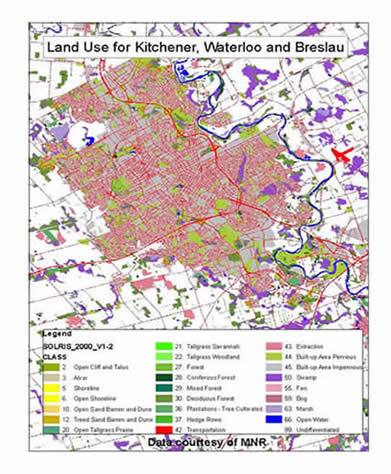
Data courtesy of the Ontario Ministry of Natural Resources