Contact the Geospatial Centre
Dana Porter Library, Room 328
University of Waterloo Library
Waterloo, Ontario N2L 3G1
Email: librarygeo@uwaterloo.ca
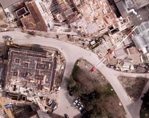
The Geospatial Centre has access to full colour orthoimagery for the Region of Waterloo for the years 2014, 2018 and 2020. 2014 imagery was received from the Region of Waterloo. These 1 km tiles have a resolution of 12 cm. 2018 and 2020 images are currently available for download from the Scholar's GeoPortal, as well. 2018 images are 12 cm resolution and 2020 are 10cm.
These georeferenced tiles are available in Universal Transverse Mercator (UTM) zone 17N coordinates; horizontal datum is North American Datum (NAD) 83.
To request this data, please fill out the Ask-Us form and include which layers (shapefiles) you are interested in obtaining. The dataset will be shared with you via OneDrive upon completion of the data release agreement form. You may also make an in-person appointment using the same form.
These data are provided for personal use for academic, research, and/or teaching purposes. A data release agreement must be agreed to before these licensed data can be released. The Regional Municipality of Waterloo must be acknowledged on any derivative product, whether printed or electronic, including for example, a printed map, a raster or vector graphic, a web-based application, etc. Patrons are advised to fully respect the provisions of Canada's Copyright Act as well as terms and conditions imposed by the data provider.
Regional Municipality of Waterloo [computer file]. Waterloo, Ontario: The Regional Municipality of Waterloo [2020].
Data courtesy of the Region of Waterloo


