Contact the Geospatial Centre
Dana Porter Library, Room 328
University of Waterloo Library
Waterloo, Ontario N2L 3G1
Email: librarygeo@uwaterloo.ca
Land Information Ontario, as well as most municipalities in Southcentral Ontario and a number of other public and private sector organizations collaborated to acquire digital orthophotography for approximately 35,762 square kilometers, covering parts of South Central Ontario in 2013 including Peterborough, Haliburton, Muskoka, Simcoe and surrounding areas. In 2018, additional cities were added including Oakville, Mississauga, Brampton, Toronto, Markham, Pickering, Oshawa.
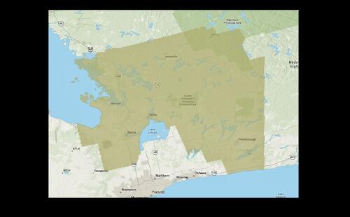
2013 Coverage
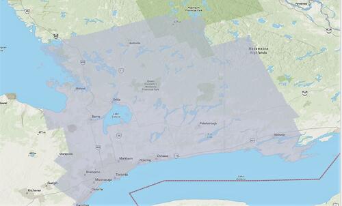
2018 Coverage
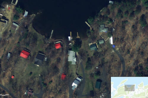
Resolution for airphotos is 20 cm with horizontal and vertical accuracy of 50 cm. The air photos were taken in April/May 2013, as well as again, in 2018.
Images are available for download from the Scholars Geoportal, as well as from the Geospatial Centre.
These georeference 1km square images are available in Universal Transverse Mercator (UTM) coordinates; horizontal datum is North American Datum (NAD) 83 UTM zone 17. They are stored as compressed JPEG 2000 format. Average files size is 5 MB.
To request this data, please fill out the Ask-Us form and include which layers (shapefiles) you are interested in obtaining. The dataset will be shared with you via OneDrive upon completion of the data release agreement form. You may also make an in-person appointment using the same form.
These data are provided for personal use for academic, research, and/or teaching purposes. A data release agreement must be agreed to before these licensed data can be released. The Ontario Ministry of Natural Resources must be acknowledged on any derivative product, whether printed or electronic, including for example, a printed map, a raster or vector graphic, a web-based application, etc. Patrons are advised to fully respect the provisions of Canada's Copyright Act as well as terms and conditions imposed by the data provider.
SCOOP: Orthophotography 2018 [computer file]. Land Information Ontario, Ministry of Natural resources, [2018].