Contact the Geospatial Centre
Dana Porter Library, Room 328
University of Waterloo Library
Waterloo, Ontario N2L 3G1
Email: librarygeo@uwaterloo.ca
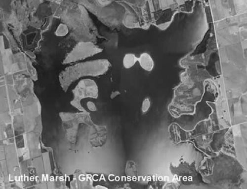
This digital orthomosaic covers the entire Grand River watershed. The watershed extends from the headwaters of the Grand River near Luther Marsh Reservoir to the mouth of the Grand River at Port Maitland on Lake Erie. Aerial photography was flown between April 4th-30th, 2000, and was provided to the Library by the Grand River Conservation Authority (GRCA) in September 2004. The pixel resolution of the orthomosaic is 30 cm.
This orthomosaic, because of its large file size is divided into two halves, a north and a south half, with the line of division passing through the City of Waterloo, and more specifically, through the University of Waterloo south campus. These georeferenced mosaics are available in Universal Transverse Mercator (UTM) coordinates; horizontal datum is North American Datum (NAD) 83. They are stored as compressed MrSID data files, with accompanying Sid World (SDW) files. The mosaics are approximately 2 GB each.
To request this data, please fill out the Ask-Us form and include which layers (shapefiles) you are interested in obtaining. The dataset will be shared with you via OneDrive upon completion of the data release agreement form. You may also make an in-person appointment using the same form.
These data are provided for personal use for academic, research, and/or teaching purposes. A data release agreement must be agreed to before these licensed data can be released. The Grand River Conservation Authority (GRCA) must be acknowledged on any derivative product, whether printed or electronic, including for example, a printed map, a raster or vector graphic, a web-based application, etc. Patrons are advised to fully respect the provisions of Canada's Copyright Act as well as terms and conditions imposed by the data provider.
Grand River Watershed Orthomosaic 2000 [computer file]. Cambridge, Ontario: Grand River Conservation Authority, [2000].
Data courtesy of the Grand River Conservation Authority


