Data access
This data is available for free download from the NRCAN website.
Description
CLUMP is the Canada Land Use Monitoring Program, which examines land use from 1966 through 1986 on a five-year basis, corresponding to Canada's census years. The classification scheme for CLUMP (PDF) is based on air photo interpretation, field surveys and census information.
Data for the Kitchener-Waterloo Urban Centred Region (UCR) and 22 other Canadian urban regions can be downloaded directly from NRCAN: https://ftp.maps.canada.ca/pub/nrcan_rncan/archive/vector/clump_psutc/.
At the CLUMP download site, available data is coded by coverage location. Choose the year you want, and the associated areas, based on the codes listed below.
Areas not included in the list below are not covered by CLUMP data.
- British Columbia
- Victoria (VICBC)
- Vancouver (VANBC)
- Alberta
- Calgary (CALAB)
- Edmonton (EDMAB)
- Saskatchewan
- Regina (REGSA)
- Saskatoon
- Manitoba
- Winnipeg (WINMA)
- Ontario
- Thunder Bay (THBON)
- Sudbury (SUDON)
- Windsor (WINON)
- London (LONON)
- Kitchener (KITON)
- Hamilton (HAMON)
- St. Catharines - Niagara (NIAON)
- Toronto (TORON)
- Oshawa (OSWON)
- Ottawa-Hull (OTTON)
- Quebec (QUEQC)
- Montreal (MONQC)
- Chicoutimi-Jonquiere (CHIQC)
- Atlantic Canada
- St. John (STJNB)
- Halifax-Dartmouth (HFXNS)
- St. John's (SJSNF)
Spatial reference and data type
These data sets are available in Universal Transverse Mercator (UTM) co-ordinates; horizontal datum is North American Datum (NAD) 27. These data are available as ArcInfo export files, .wmf, and .gif images. Other data formats can be accommodated, as the Geospatial Centre has access to a number of conversion utilities.
Data access
This data is available for free download from the NRCAN website.
Data manipulation
There are public workstations in the Geospatial Centre that provide access to ArcGIS software programs, program extensions and data manipulation utilities. Patrons may use the Geographic Information System (GIS) and image processing software in the library to view and manipulate the data. UWaterloo faculty, students and staff may copy these data to other media.
Data output
These data may be exported from ArcGIS in a choice of bitmapped formats (also known as raster graphics) including JPG, TIFF, GIF, and BMP or in a choice of vector graphics formats including Adobe Illustrator (AI), Encapsulated Postscript (EPS), and Scalable Vector Graphics (SVG). Yet another option is PDF.
Use restrictions/licensing/copyright
This material is provided for academic, research, teaching, and personal use only. The Ministry of Natural Resources Canada should be acknowledged on any derivative product, such as a map or an image.
Citation
Canada Land Use Monitoring Program [computer file]. Ottawa, ON: Ministry of Natural Resources, 1966-1986.
Sample view of the data
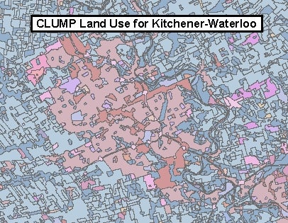
Data courtesy of the Ministry of Natural Resources Canada