Contact the Geospatial Centre
Dana Porter Library, Room 328
University of Waterloo Library
Waterloo, Ontario N2L 3G1
Email: librarygeo@library.uwaterloo.ca
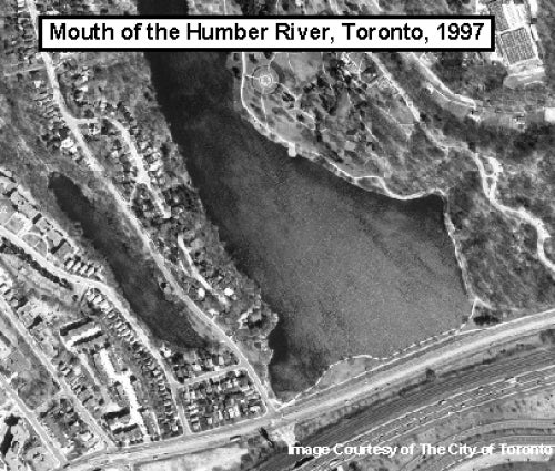
This set of digital orthoimages provides coverage of the City of Toronto (post-amalgamation). These images were flown in 1997 and then provided to the Geospatial Centre by the City of Toronto, Survey and Mapping Services in 2003. Pixel resolution of these geotiff images is 50 cm.
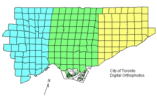
This map illustrates how the index for Toronto is divided into three areas: west, central, and east. Click on the area of interest to display a detailed index map showing the individual image numbers.
These images are available in Modified Transverse Mercator (MTM) zone 10, North American Datum (NAD) 27 co-ordinate system. The images are available in compressed MrSID format. Other data formats can be accommodated, as the Geospatial Centre has access to a number of conversion utilities.
In order to access these images, please visit the Geospatial Centre information desk during reference hours. Information staff are available to provide further information about these data sets and to deliver data upon request. Under the terms of the library's license agreement, these data sets are for use by students, faculty, and staff at the University of Waterloo only.
There are public workstations in the Geospatial Centre that provide access to Geographic Information System (GIS) software, program extensions and data manipulation utilities. Patrons may use the GIS software in the library to view and manipulate the data. UWaterloo faculty, students and staff may copy these data to other media (Zip disk or CD-R) for use elsewhere.
These data may be exported from the GIS software as a bitmapped image (e.g., jpg) or may be printed as a map view using one of the library's colour printers.
This material is provided for academic, research, teaching, and personal use only. A data release agreement must be agreed to before the data is delivered. The City of Toronto Geospatial Competency Centre should be acknowledged on any derivative product, such as a map or an image.
City of Toronto digital orthophotos [computer file]. Toronto, Ontario: City of Toronto, Geospatial Competency Centre [1997].