Contact the Geospatial Centre
Dana Porter Library, Room 328
University of Waterloo Library
Waterloo, Ontario N2L 3G1
Email: librarygeo@library.uwaterloo.ca
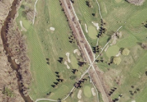
These digital orthoimages provide full-colour aerial coverage of the Regions of Durham, York, Peel and Halton, the City of Toronto and the City of Hamilton. These images were flown in April 2005 by First Base Solutions. The resolution of these images is 20 cm.
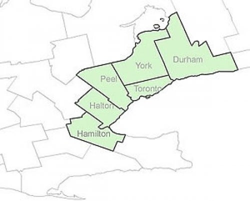
These georeferenced images are available in Universal Transverse Mercator (UTM) coordinates; horizontal datum is North American Datum (NAD) 83. They are stored as compressed MrSID data files, with accompanying Sid World (SDW) files. MrSID mosaics are available for each of the lower tier municipalities in the regions of Durham, Halton, York and Peel. The cities of Toronto and Hamilton are both divided into three sectional areas; MrSID mosiacs are available for each sectional area.
In order to access these data sets, please visit the Geospatial Centre reference desk during reference hours. Library reference staff are available to provide further information about these data sets and to deliver data upon request. Under the terms of the library's license agreement, these data sets are for use by students, faculty, and staff at the University of Waterloo only.
There are public workstations in the Geospatial Centre that provide access to both ArcGIS and ArcView software programs, program extensions and data manipulation utilities. Patrons may use the Geographic Information System (GIS) and image processing software in the library to view and manipulate the data. UWaterloo faculty, students and staff may copy these data for use elsewhere.
These images may be exported from ArcGIS in a choice of bitmapped formats (also known as raster graphics) including JPG, TIFF, GIF, and BMP or in a choice of vector graphics formats including Adobe Illustrator (AI), Encapsulated Postscript (EPS), and Scalable Vector Graphics (SVG). Yet another option is PDF. The user defines the output resolution.
These data are provided for personal use for academic, research, and/or teaching purposes. A data release agreement must be agreed to before these licensed data can be released. The Ministry of Natural Resources must be acknowledged on any derivative product, whether printed or electronic, including for example, a printed map, a raster or vector graphic, a web-based application, etc. Patrons are advised to fully respect the provisions of Canada's Copyright Act as well as terms and conditions imposed by the data provider.
Greater Toronto Area: orthoimagery 2005 [computer file]. Toronto, Ontario: The Ontario Ministry of Natural Resources, [2005].
Data courtesy of Ontario Ministry of Natural Resources


