Contact the Geospatial Centre
Dana Porter Library, Room 328
University of Waterloo Library
Waterloo, Ontario N2L 3G1
Email: librarygeo@uwaterloo.ca
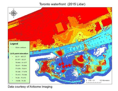
This data resource was received from Airborne Imaging in April, 2020 and updated in January, 2021. The 1 km x 1 km tiled data was collected April 2015 with an average flying height above ground of 1,300 metres (m) producing a Horizontal Accuracy, 95% or 2σ: 30 cm and a Fundamental Vertical Accuracy (on flat hard surfaces), 95% or 2σ: 10 cm.
The data set includes 1 metre Grids (XYZ ASCII), Hillside Images (Geotiffs), Point cloud (LAS v1.2) and 50cm Contours.
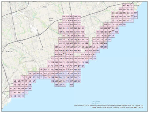
Lidar index
These non-georeferenced data LASer data files have an average file size is 255 MB with the total data package size of 7 GB.
To request this data, please fill out the Ask-Us form and include which layers (shapefiles) you are interested in obtaining. The dataset will be shared with you via OneDrive upon completion of the data release agreement form. You may also make an in-person appointment using the same form.
These data are provided for personal use for academic, research, and/or teaching purposes. A data release agreement must be agreed to before these licensed data can be released. Airborne Imaging must be acknowledged on any derivative product, whether printed or electronic, including for example, a printed map, a raster or vector graphic, a web-based application, etc. Patrons are advised to fully respect the provisions of Canada's Copyright Act as well as terms and conditions imposed by the data provider.
The City of Toronto Lidar data [computer file]. Airborne Imaging [2019].