Data access
Full access to our resources is available to current students, faculty, and staff of the University of Waterloo. To request access, please complete the Ask-Us form indicating the specific layers (shapefiles) you require. Upon completion of the data release agreement form, the dataset will be provided to you via OneDrive.
In-person consultations may also be requested through the Ask-Us form.
Description
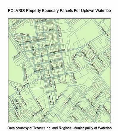
These datasets were provided to the Geospatial Centre by Teranet in 2005-2010, 2012, 2014, 2016, 2018, 2023-2026. Ownership parcels are based on title records from the Ministry of Government Services, reflecting the ownership boundaries of each property.
The library has assessment parcels (not assessment values) which are based on records from Municipal Property Assessment Corporation (MPAC) and reflect assessment boundaries of each property. While these are typically one-to-one in urban areas, they are not always. An example could be a farmer who owns a single large parcel that is assessed for tax purposes as two properties – one at an agricultural rate and a second at a residential or industrial rate.
Please note that we do not have access to any property values, prices, sale history, etc.
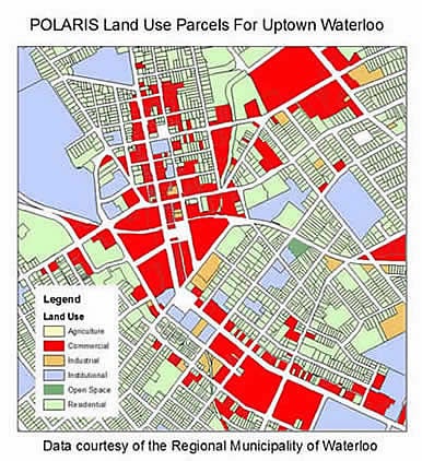
In October 2007, the Regional Municipality of Waterloo provided to the Geospatial Centre a parcel-based file of coded land use information for the Region. This record has been joined to Teranet's ownership parcels for Waterloo in order to create a property parcel land use map of the Region of Waterloo.
This unique product was created by Geospatial Centre staff by combining: Southern Ontario Land Resource Information System (SOLRIS) 3.0 (2000 - 2015) with Teranet's Waterloo Assessment (2018).
Spatial reference and data type
These data sets are available in both geographic (lat/long) and Universal Transverse Mercator (UTM) co-ordinates; horizontal datum is North American Datum (NAD) 83. The data for Halton is in decimal degrees. These data are stored as Esri shapefiles. Other data formats can be accommodated, as the Geospatial Centre has access to a number of conversion utilities.
Use restrictions/licensing/copyright
These data are provided for personal use for academic, research, and/or teaching purposes. A data release agreement must be agreed to before these licensed data can be released. Teranet must be acknowledged on any derivative product, whether printed or electronic, including for example, a printed map, a raster or vector graphic, a web-based application, etc. Patrons are advised to fully respect the provisions of Canada's Copyright Act as well as terms and conditions imposed by the data provider.
Citation
Regional Municipality of Waterloo Property Parcels [computer file]. Toronto, Ontario: Teranet Incorporated, [2023].
Sample views of the data