Contact the Geospatial Centre
Dana Porter Library, Room 328
University of Waterloo Library
Waterloo, Ontario N2L 3G1
Email: librarygeo@library.uwaterloo.ca
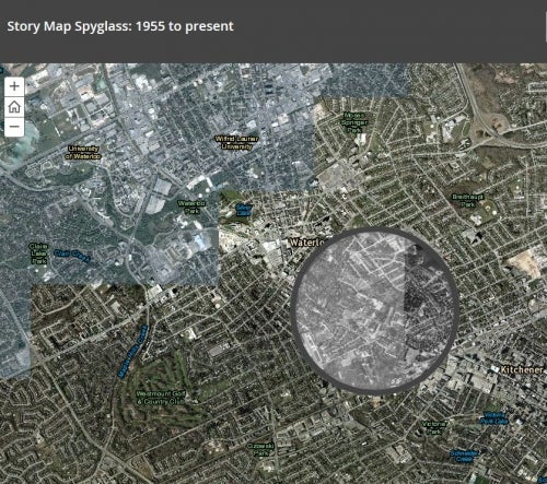
Story Map "Swipe" and "Spyglass" is an ArcGIS online application that enables users to interact with two web maps or two layers. A vertical bar or spyglass is used to alternate between two map interfaces, giving a visual comparison and also a useful tool for illustrating change over time.
By utilizing historical maps in the Geospatial Centre's collection, the "Spyglass" application vividly shows change over time.
* For best results view in firefox
To illustrate Kitchener-Waterloo (1955 to present), the Geospatial Centre's 1955 air-photo collection is utilized for both the Story Map "Swipe" and Story Map "Spyglass" applications in ArcGIS online.