Contact the Geospatial Centre
Dana Porter Library, Room 328
University of Waterloo Library
Waterloo, Ontario N2L 3G1
Email: librarygeo@uwaterloo.ca
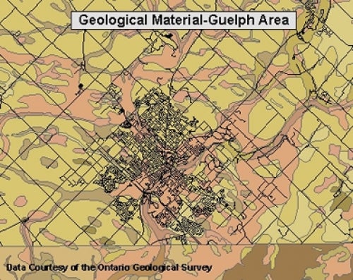
This data resource is provided by the Ontario Geological Survey and shows general bedrock (iron formations, kimberlites, dikes, etc.) and quaternery geology (dunes, hummocky terrain, etc.) for all of Ontario. This represents data collected from 1950-2020. A more in depth level of data is provided for select 1:50,000 nts map sheet areas; 40p1, 40p2, and 40p7-10. This level of data contains information on specific primary material, secondary material, veneer, carbon content, age, provenance, and formation.
This physiography data covers Southern Ontario and is based on the Chapman and Putnam survey of the 1950's, with minor revisions in 1984. For more information please consult the book entitled: The Physiography of Southern Ontario by L J Chapman and D F Putnam, 3rd edition (Toronto, 1984) located in the Geospatial Centre, G3461.C5 svar P7x no. P-2715).
These data sets are available in Universal Transverse Mercator (UTM) co-ordinates; horizontal datum is North American Datum (NAD) 83. These data are stored as Esri shapefiles. Other data formats can be accommodated, as the Geospatial Centre has access to a number of conversion utilities.
To request this data, please fill out the Ask-Us form and include which layers (shapefiles) you are interested in obtaining. The dataset will be shared with you via OneDrive upon completion of the data release agreement form. You may also make an in-person appointment using the same form.
This material is provided for academic, research, teaching, and personal use only. A data release agreement must be agreed to before the data is delivered. The Ontario Geologic Survey should be acknowledged on any derivative product, such as a map or an image.
Ontario Geologic Survey [computer file]. Toronto, Ontario: Ontario Geologic Survey, [1997].