Contact the Geospatial Centre
Dana Porter Library, Room 328
University of Waterloo Library
Waterloo, Ontario N2L 3G1
Email: librarygeo@uwaterloo.ca
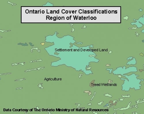
This data resource shows general land cover classification types for the province of Ontario. This information is provided by the Ontario Ministry of Natural Resources (OMNR), and is based on the 1:250,000 National Topographic System (NTS) map sheets, and was made using Landsat TM imagery. The Geospatial Centre has access to data for all of Ontario, comprised of 3 separate land cover databases:
The following is a list of the land cover classification types:
These data sets are available in geographic (lat/long) co-ordinates; horizontal datum is Norrth American Datum (NAD) 83. This data is stored as Esri shapefiles by the Geospatial Centre. Other data formats can be accommodated, as the Geospatial Centre has access to a number of conversion utilities.
To request this data, please fill out the Ask-Us form and include which layers (shapefiles) you are interested in obtaining. The dataset will be shared with you via OneDrive upon completion of the data release agreement form. You may also make an in-person appointment using the same form.
This material is provided for academic, research, teaching, and personal use only. A data release agreement must be agreed to before the data is released. The Ontario Ministry of Natural Resources should be acknowledged on any derivative product, such as a map or an image.
Ontario Land Cover Data [computer file]. Toronto, Ontario: The Ontario Ministry of Natural Resources, [2016].