Contact the Geospatial Centre
Dana Porter Library, Room 328
University of Waterloo Library
Waterloo, Ontario N2L 3G1
Email: librarygeo@uwaterloo.ca
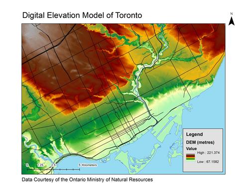
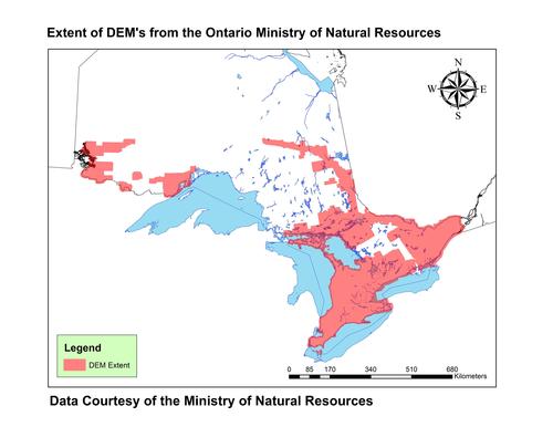
Received from the Ontario Ministry of Natural Resources, these data packages provide digital elevation models (DEMs) for Southern Ontario and parts of the northeast and northwest of Ontario. These DEMs come from the following data packages:
KMZ files (showing indexes) open in Google Earth:
These data are available in geographic co-ordinates; horizontal datum is North American Datum (NAD) 83, UTM zone 17N. These rasters are stored as 1km square tiles. Other data formats can be accommodated as the Geospatial Centre has access to a number of conversion utilities.
To request this data, please fill out the Ask-Us form and include which layers (shapefiles) you are interested in obtaining. The dataset will be shared with you via OneDrive upon completion of the data release agreement form. You may also make an in-person appointment using the same form.
These data are provided for personal use for academic, research, and/or teaching purposes. A data release agreement must be agreed to before these licensed data can be released. The Ontario Ministry of Natural Resources must be acknowledged on any derivative product, whether printed or electronic, including for example, a printed map, a raster or vector graphic, a web-based application, etc. Patrons are advised to fully respect the provisions of Canada's Copyright Act as well as terms and conditions imposed by the data provider.
Ministry of Natural Resources [computer file]. Toronto, Ontario: The Ontario Ministry of Natural Resources, [2002].