Description
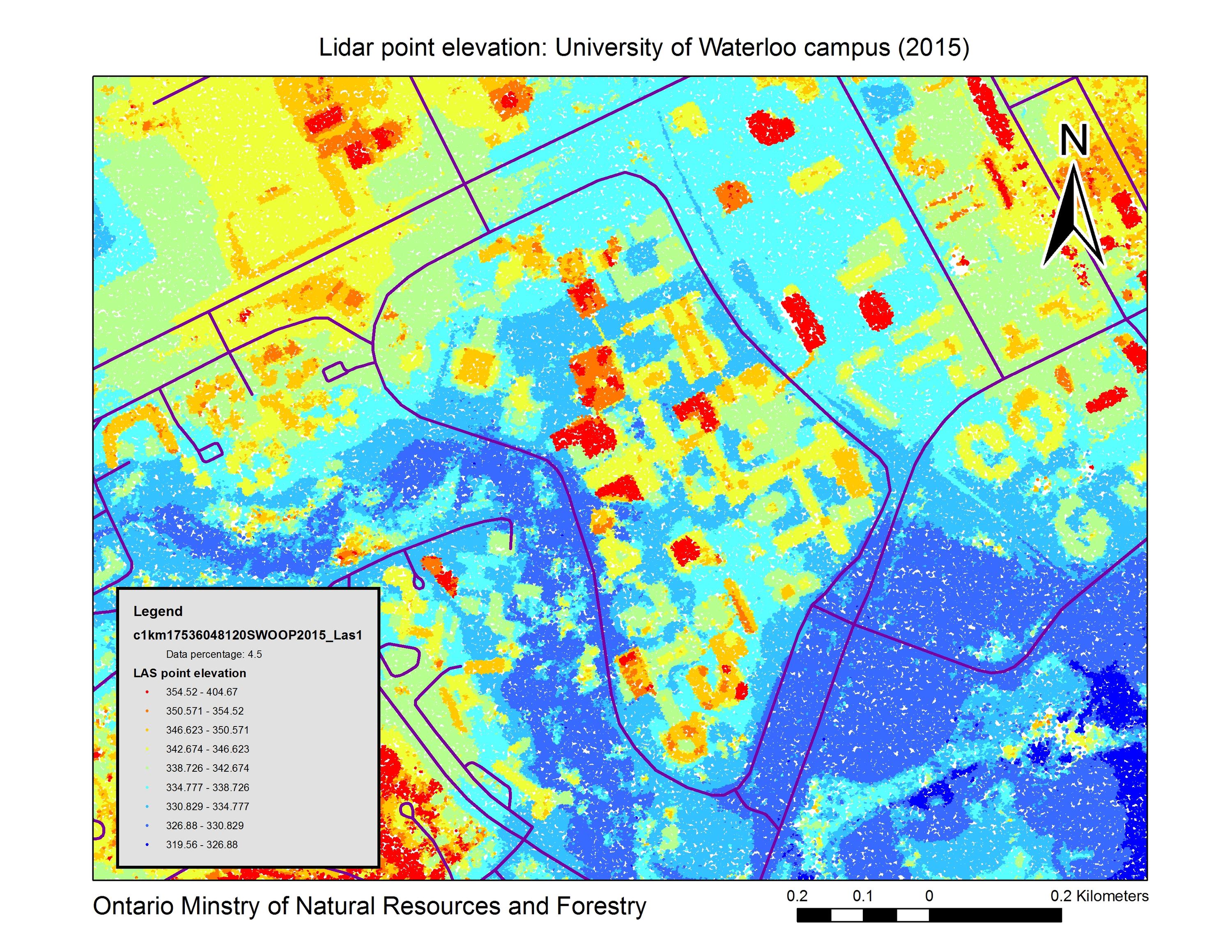
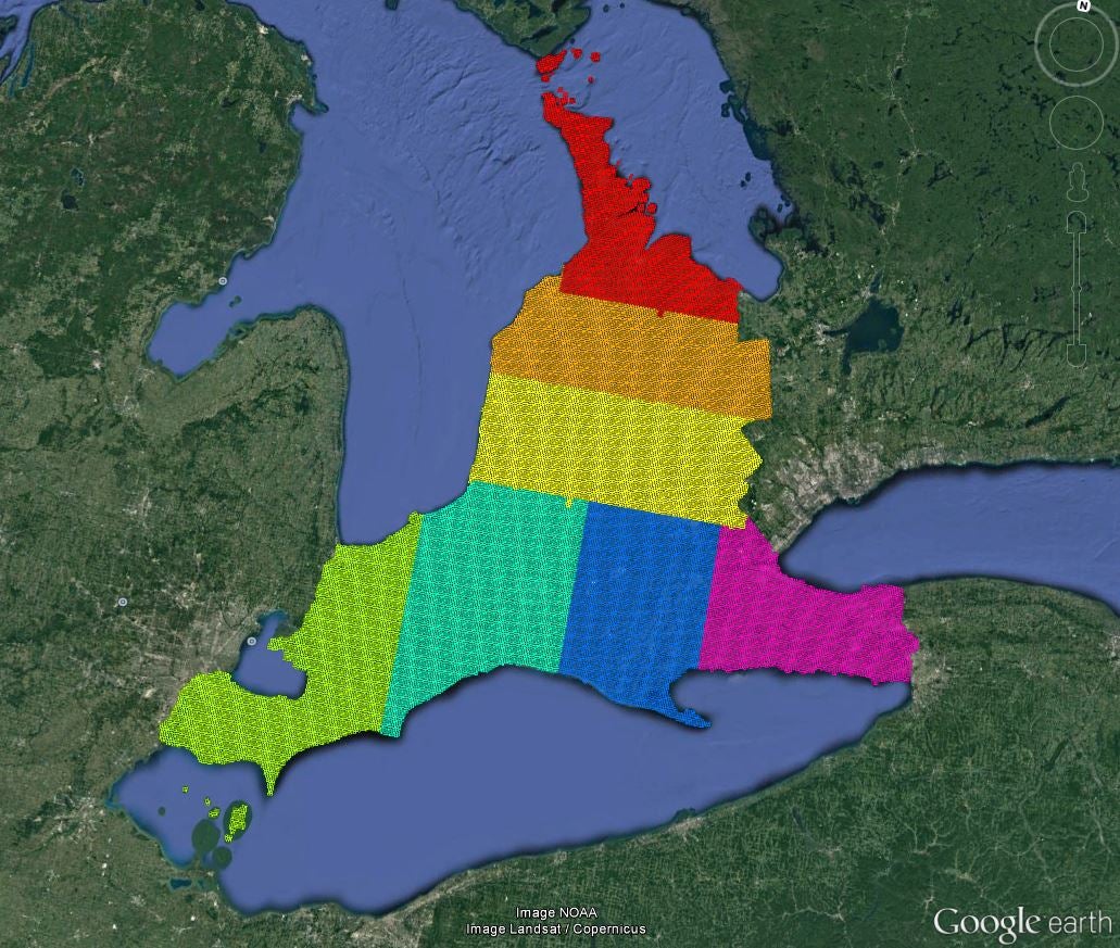
The 2015 Southwestern Ontario Orthophotography Project (SWOOP) was created using Fugro acquired digital imagery using sensor Leica geosystems ADS100. Collected between April 12th and May 23rd, 2015. The project covers an area of approximately 49,167 square kilometers. Imagery acquisition was performed at 2,377 metres above mean terrain (AMT) to produce 20 cm full colour orthorectified imagery (horizontal and vertical accuracy of 50 cm).
Related products derived from SWOOP 2015 include:
- Lidar (LAS),
- Digital Terrain Model (DTM) (2 metre)
- Digital Surface Model (DSM) (2 metre)
- Digital Elevation Model (DEM) (2 metre)
Access Swoop 2015 index in Google Earth by opening this KML file.
In addition to the above coverage, Scholars GeoPortal also has a DEM, LAS and RBG Orhoimagery covering most of Algonquin park.
Spatial reference and data type
These 1km square images are available in Universal Transverse Mercator (UTM) coordinates; horizontal datum is North American Datum (NAD) 83 UTM zone 17 North.
Data access
Access Swoop 2015 full colour imagery through Scholars GeoPortal. For DTM, DSM and LAS data sets, please visit the Geospatial Centre Reference Desk during reference hours. Library reference staff are available to provide further information about these data sets and to deliver data upon request. Under the terms of the library's license agreement, these data sets are for use by students, faculty, and staff at the University of Waterloo only.
Data manipulation and storage
There are public workstations in the Geospatial Centre that provide access to ArcGIS software programs, program extensions and data manipulation utilities. Patrons may use the Geographic Information System (GIS) and image processing software in the library to view and manipulate the data. Waterloo faculty, students and staff may copy these data for use elsewhere.
Data output
These images may be exported from ArcGIS in a choice of bitmapped formats (also known as raster graphics) including JPG, TIFF, GIF, and BMP or in a choice of vector graphics formats including Adobe Illustrator (AI), Encapsulated Postscript (EPS), and Scalable Vector Graphics (SVG). Yet another option is PDF. GeoExpressView may also be used to export the image, in whole or in part. The user defines the output resolution.
Use restrictions/licensing/copyright
These data are provided for personal use for academic, research, and/or teaching purposes. A data release agreement must be agreed to before these licensed data can be released. The Ontario Ministry of Natural Resources and Foresty must be acknowledged on any derivative product, whether printed or electronic, including for example, a printed map, a raster or vector graphic, a web-based application, etc. Patrons are advised to fully respect the provisions of Canada's Copyright Act as well as terms and conditions imposed by the data provider.
Citation
SWOOP 2015: Lidar [computer file]. Land Information Ontario, Ontario Ministry of Natural Resources and Forestry, [2015].
Sample View of the Data