News by audience
- Current students (3)
- Future students (2)
- Faculty (3)
- Staff (3)
News archive
Thursday, June 12, 2014
Google Map’s Street View has always been an amazing feature. It provides photo coverage of more than six million miles of road. In the past, when Google finished updating the street view photos, they removed the old imagery. They recently discovered the value in those old Street View images due to the many user requests to view them again. Eventually they decided to add all of the archived photography back to the maps for users to view and dig through. On April 23, Google officially announced the launch of Historical Street View.
Street View photos from 2007
“If you’ve ever dreamt of being a time traveler like Doc Brown, now’s your chance,” Google stated in their blog as the first line of their introduction to Historical Street View. It allows people to “go back in time” and view old Street View imageries up to eight years ago, from 2014 to the year 2007. This means you can now check every single photo Google took within the eight year time period at a same location; the photos are aligned to have the same perspective as one another as much as possible. At some locations there will only be two versions of photos; in others, there might be more and at very few places, Google has taken photos every year so you will be able to view the photos from every previous year.
It is carried out by a simple application added to the normal Street View interface. When you are on Google Street View, the area with the historical Street View feature will have a small clock icon on the top left corner, right below the address.
![]()
Click on it and a small window that has a timeline you can drag will pop up. Move the time slider around to view past images categorized by the years they were taken. Click on the image to enter full Historical Street View mode which will zoom you into the picture and replace the current street view.
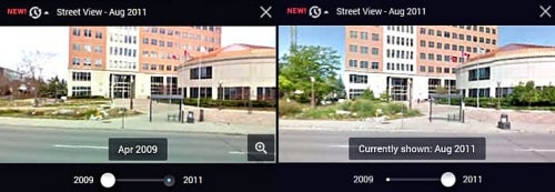
Street View time slider, 2009-2011
Featured landmarks
A few landmarks Google suggests to check out are the Freedom Tower in Lower Manhattan, New York City; the building of One World Trade Center, and the 2014 World Cup Stadium in Fortaleza, Brazil. Serving as a digital timeline, this feature allows you to browse through recent history and see how these three landmarks were built from scratch. Experience the reconstruction process of places such as Onagawa, Japan after the devastating 2011 earthquake. Since the GPS coordinates are locked on Google Maps, you can actually see that the ground was shifted three meters by the earthquake by comparing the before and after Street View. You can also experience what it would be like to cruise Italian roadways in different seasons by changing time, or use it to keep track of the changes in gas prices on billboards.
Before this new feature appeared on Google Maps, Google had an existing feature similar to Historical Street View in Google Earth. The Historical Satellite Imagery in Google Earth allows people to view certain areas from above. But viewing photos from a ground level point of view is an entirely new perspective. Historical Street View will be available in 55 countries. This feature is not yet available for all areas with Street View coverage since adding the archives back will take some time. It will not be available for the areas that did not have Street View coverage two years ago, or countries that do not permit Street View. Also not available are underwater places like the Great Barrier Reef, because Google had only documented the photos once.
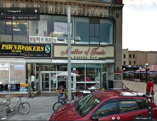
Here are some examples of Historical Street View in the Kitchener-Waterloo area.
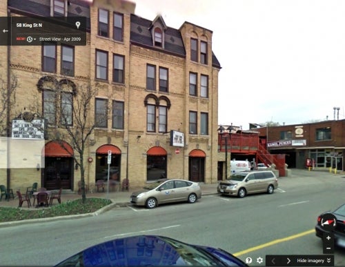
Huether Hotel, Waterloo (2009)
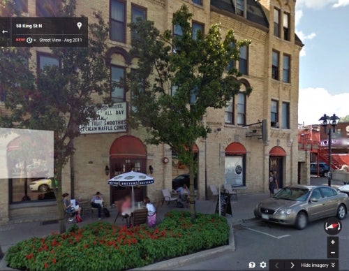
Huether Hotel, Waterloo (2011)
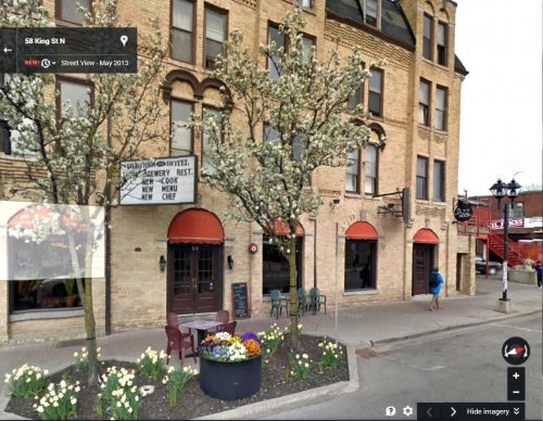
Huether Hotel, Waterloo (2013)
Perimeter Development Corporation, Kitchener (2011)

Perimeter Development Corporation, Kitchener (2013)
To learn more about Historical Street View, see Google's launch announcement.
Article by Allen YuFor more information, contact:
Eva Dodsworth
Geospatial Data Services Librarian
519-888-4567, ext. 36931


