News by audience
- Current students (3)
- Future students (2)
- Faculty (3)
- Staff (3)
News archive
Monday, August 6, 2018
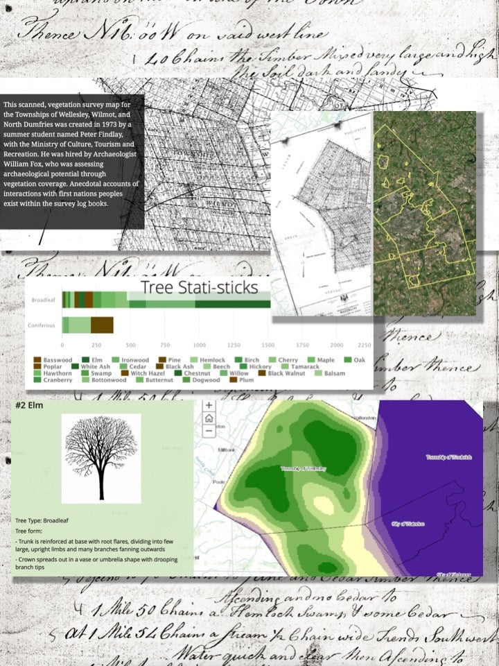
University of Waterloo Library's Geospatial Centre has recently finished a two-year project to digitize the maps from an 1843 vegetation survey of Waterloo Region.

The maps and documents - including hand-written field notes - have been compiled using ESRI Story Maps. The interactive story map allows users to learn about early vegetation survey methods and present day forest management, view survey maps and compare the historical forests with present day land use.
Scroll down the story map to learn more about how the composition of forests in the area have changed, and zoom in to see which historical forests still exist today! You can even fly over a 3D rendering of a forest generated by point cloud processing.
This resource is freely available to anyone in the world, so take your time and enjoy some digital shinrin-yoku!