2024 - Stormwater Management Facility #64
Student: Liahm Ruest
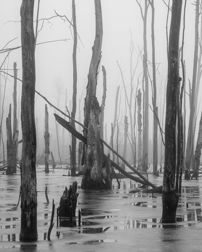
Description: While conducting site selection, I photographed Stormwater Management Facility #64 in December of 2023 at Huron Natural Area. SWMP 64 has become one of many field sites I will examine for my thesis work. The black-and-white landscape image portrays a stormwater pond, also classified as a natural marsh area. The landscape is a striking juxtaposition of dead trees standing in partially frozen water, with fog cascading among
them and fading into the distance. This eerie ambiance reflects the uncertain nature of these liminal habitats and unveils the intricate beauty of urban ecosystems.
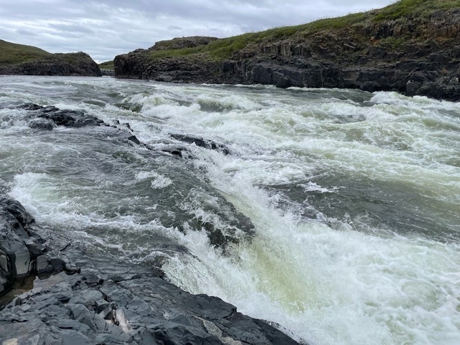
2025 - Kugluk/Bloody Falls: A cascade faced by migratory chars of the Coppermine River, near Kugluktuk, Nunavut
Student - Hannah Thibault
Description: This is an image I took of the Coppermine River at Kugluk/Bloody Falls in June 2024 when I was conducting fieldwork for my PhD degree. This was my first trip to Kugluktuk (NU) to meet the community and project partners I would be working with, and I also did some environmental DNA sampling and acoustic tagging of migratory chars at many different sites, including here at Kugluk Falls. Kugluk Falls is an important National Historic Site in Canada for its significance as a traditional fishing and hunting location. Kugluk Falls is also an important part of the story of the Inuit community living in Kugluktuk, as a massacre of Copper Inuit occurred here in the late 1700s. Kugluk Falls is a key site of interest for our community-centred fish research project as we aim to explore reasons why some chars successfully navigate this challenging migratory obstacle while others do not.