
The inaugural Environment Capstone Symposium will be a multidisciplinary showcase celebrating the innovative and community-driven work of graduating undergraduate students across the Faculty of Environment. The event will bring together students, faculty, alumni, donors, and industry partners to highlight student-led capstone projects, foster connections, and demonstrate the Faculty’s commitment to empowering, uniting, and inspiring through experiential learning.
The event will conclude with the distribution of awards, to teams whose projects embody the mission and vision of the faculty to empower, unite and inspire.
Capstone courses & student projects
Our capstone projects address a diverse array of real-world challenges, reflecting the interdisciplinary nature of the Faculty of Environment. To highlight the breadth of this work, we have organized the cohorts into distinct thematic streams, each focusing on a critical area of impact. Explore the categories below to discover this year's specific themes and the student teams driving solutions within them.
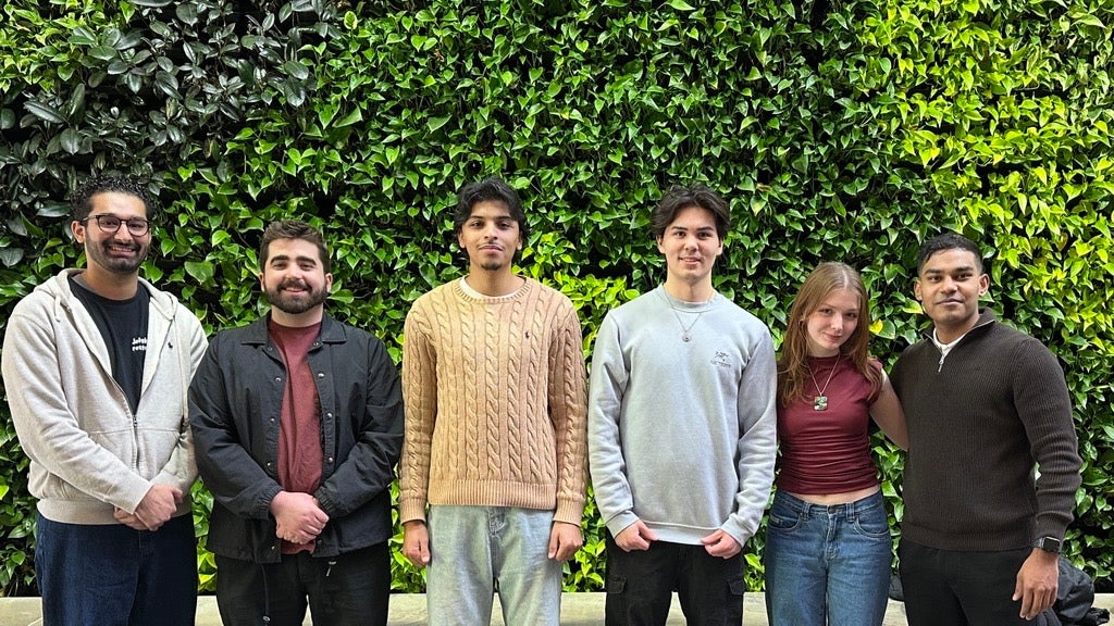
ENBUS 409: Special Topics in Environment and Business

Bonnie Hang, Even Ding, Yunya Wang, Janney Chen
AU Flax Economy
This study explores how sustainability information about Canadian linen textiles can be communicated more clearly to consumers who are interested in fashion. Many consumers say they care about sustainable clothing, but they often find sustainability labels difficult to understand or do not fully trust them. This study uses qualitative document analysis to review 40 academic, policy, and industry documents published between 2015 and 2025. The goal is to identify which sustainability indicators and label designs can better support consumer understanding and trust. The results show that using a small number of clear indicators—such as environmental impact, social responsibility, and local origin—can make sustainability information easier to understand. In addition, a layered communication format that combines simple visual labels with QR codes for more detailed information can help consumers quickly understand the product while still allowing access to deeper information. Digital traceability can also improve transparency, but its use should consider the practical conditions of the Canadian linen supply chain. Overall, the study suggests that simple, clear, and credible labels can better support sustainable purchasing decisions.
Zixi Qian, Mengfan Wang, Xingyu Liu, Huanqi Wang
Sourcing Innovative and Sustainable Textile
Independent fashion brands face growing pressure to adopt sustainable materials while operating under significant supply chain constraints. For brands like Carmico, which produces handbags in small batches using polyurethane (PU) synthetic leather, the search for alternatives is complicated by PU’s environmental drawbacks—including aging-related waste and microplastic pollution—and the practical limitations of supplier availability, minimum order quantities (MOQs), and processing compatibility. This study investigates how Carmico can evaluate and select sustainable alternative materials to replace PU in handbag manufacturing without disrupting its existing production capabilities in China. A document analysis methodology was employed, integrating academic literature, technical data sheets, supplier listings, and industry reports. Evidence was synthesized through a weighted decision matrix following the Pahl and Beitz method, structured around three dimensions: Cost & Feasibility, Product Performance, and Sustainability Value. Four shortlisted materials—silicone vegan leather, cork leather, apple bio-based leather, and mycelium leather—were evaluated using criterion-specific scoring rubrics anchored to predefined benchmarks. The expected benefits include reduced environmental impact, improved product durability, and maintained supply chain feasibility. Results show that silicone vegan leather achieved the highest weighted score, driven by strong feasibility and durability, though it exhibited the weakest sustainability profile due to end-of-life persistence concerns. Cork leather followed closely with the most balanced performance across all dimensions. Mycelium leather demonstrated high performance potential but faced implementation readiness challenges, while apple leather showed moderate but non-dominant results. The findings reveal that bio-based materials often retain synthetic polymer coatings, complicating their sustainability claims. Material substitution for small-batch brands requires navigating trade-offs among feasibility, performance, and sustainability, with no single material excelling across all criteria. This study provides a replicable framework for evaluating material alternatives under real-world production constraints.
Harman Brar, Lizzie Smith, Haneen Khan, Aimaan Sayani, Khalid Bakr
Closing the Gap: The Decarbonization Investment Case
Decarbonizing Ontario’s existing Part 3 buildings (≥ 600 m² or ≥ 3 storeys) is critical to achieving provincial climate targets, yet the uptake of low-carbon and grid-smart retrofits remains limited. This research examines how financial incentives and policy instruments can be designed to close the decarbonization investment gap. The study combines document analysis of retrofit policies and programs with interviews conducted with building owners and energy service providers. The analysis identifies key barriers influencing investment decisions, including perceived financial risk, long payback periods, and difficulties navigating or accessing existing incentive programs. These challenges create a misalignment between existing government supports and the financial realities that shape retrofit decisions. Based on these insights, the research develops policy and financial incentive recommendations aimed at accelerating retrofit adoption across Ontario’s existing Part 3 building stock.

Manshu Zhang, Cynthia Shen, Lyric Huang, Vicky Liu
Climate Impact Food Labels
Food systems contribute significantly to global greenhouse gas emissions, but information about the climate impact of different foods is rarely available to consumers when they are making food choices. On the University of Waterloo (UW) campus, students regularly purchase meals from campus dining locations, but the information currently provided focuses mainly on nutrition and allergens rather than environmental impacts. As a result, students who want to make more climate-friendly food choices may not have the information needed to do so, especially in fast-paced dining settings.
The objective of this project is to explore how to design and implement a climate impact food labeling system at the UW, making it clear, reliable and practical, suitable for the campus dining environment. In particular, the study examines students’ current awareness of the environmental impacts of food, their trust in climate-related labels, and how they interpret and evaluate different label designs.
To address this objective, the project used an online survey distributed to members of the UW community who purchase food on campus. The survey included questions about eating habits, awareness of environmental impacts, and trust in climate labels. Participants were also asked to review three example climate-impact label designs and rate their clarity, usefulness, and visual layout.
The results show that taste, price, and convenience were the most important factors influencing food choices, while climate-related impacts were less influential. Students’ awareness of environmental impacts associated with food was generally moderate to low, but trust in climate labels increased when labels included clear explanations and references to scientific evidence. Overall, the findings suggest that climate-impact labels could help improve awareness and transparency in campus dining but would likely work best when combined with broader sustainability education or other supportive strategies.
Bosa Eguavoen, Brianna Liu, Tony Lin, Gillian Middleton, Rena Xu
Encouraging Plant-Based Meal Consumption on Campus
Our team, Planet Plates, worked with the Sustainability Office to investigate the best way to encourage plant-based meal consumption on campus, with plant-based meals being defined as complete meals with an alternative protein source (e.g. Beans, tofu). We conducted a survey to identify student preferences on what type of educational campaign they would prefer to participate in. This survey also identified University of Waterloo-specific knowledge gaps to be addressed to enhance the effectiveness of the campaign. Our results from the survey and proposed next steps for the campaign will be displayed during the symposium.
Graeme Goodwin Berry, Evan Howe, Nimar Shajahan, Azharullah Khan, Owen Gray, Zach Maitland
Sustainable Sports - NFL Stadiums
Opportunity / Problem
NFL stadiums consume significant amounts of energy during game days, averaging between 100 and 175 megawatt-hours per event. Despite the scale of this energy demand, there is currently no mandatory sustainability framework specifically designed for NFL stadium operations. While some venues adopt environmental certifications such as LEED, these standards are primarily designed for traditional buildings and do not fully address the unique operational and infrastructure demands of large stadiums. This gap leads to inconsistent sustainability practices across stadiums, higher operational costs, increased greenhouse gas emissions, and uncertainty for stadium owners and cities attempting to balance environmental goals with economic viability.
Objective
The objective of this research is to develop a sustainability framework tailored specifically for NFL stadiums that improves HVAC and lighting efficiency and reducing their derived operational carbon emissions. The study aims to identify practical strategies and standardized benchmarks that stadium operators can use to manage energy consumption and enhance sustainability performance.
Plausible Design Approach
This research will follow a structured approach to develop the proposed framework. First, the study will identify high-impact stadium systems (HVAC and lighting) that contribute the most to energy consumption. Next, it will analyse current stadium energy usage patterns to identify inefficiencies and opportunities for improvement. The research will also review existing sustainability standards and building certifications to determine which elements can be adapted for stadium environments. Using these insights, the study will develop a stadium-specific sustainability framework and propose implementation pathways for stadium operators.
Expected Benefits
The proposed framework aims to deliver several benefits related to stadiums HVAC and lighting systems, including reduced greenhouse gas emissions, lower operational energy costs, standardized sustainability metrics across NFL stadiums, and improved environmental reputation for both the league and stadium operators.
Andrew Dunn, Alex Koppenol, Emily Twomey, Ferass Elderbak, Tahir Ahmad, Vihaan Sanghvi
AI Data Centres in Ontario
Accelerating AI-driven data centre (DC) development is placing mounting pressure on Ontario municipalities, which bear primary responsibility for land-use planning and development approvals yet lack the regulatory tools to manage the sector's complex externalities. This study examines how resource demand, land-use compatibility, community benefit, and operational criteria should guide municipal best practices for equitable outcomes from AI data centre development in Ontario. Using a qualitative, inductive design, the study conducts systematic document analysis to evaluate international best practices in DC governance to assess their transferability to Ontario's regulatory context. In North America, leading jurisdictions have moved to formally designate large data centres as a distinct regulatory class. The U.S. Clean Cloud Act of 2025 establishes standardized energy reporting and emissions thresholds for "covered facilities," while Oregon's HB 3546 applies a 20-MW threshold to trigger separate electricity service classifications. Ratepayer protection has also emerged as a best practice: Oregon's POWER Act and Washington's HB 2515 require dedicated tariff structures and long-term contracts with collateral and exit fee provisions to ensure existing customers do not absorb unwarranted infrastructure costs. At the international level, EU Regulation 2024/1364 standardizes DC reporting on energy use, renewable sourcing, water, and waste heat, while Germany's Energy Efficiency Act embeds data centres as national energy assets through binding efficiency caps and mandatory waste heat reuse obligations. These practices are assessed against Ontario's planning legislation and governance structures, revealing that their application is constrained by jurisdictional fragmentation and reporting exemptions under Ontario Regulation 506/18. The study concludes with actionable guidance to help municipalities align data centre approvals with sustainability, infrastructure resilience, and community benefit objectives.
Ruth James, Zayna Shaikh, Sarah Manz, Matt Pottruff
Weaving Flax Linen Production Back to Life in Eastern Canada
Canada historically has played a meaningful role in producing textiles from seed to store prior to the Industrial Revolution. However, today’s infrastructure and policy lacks the support to produce quality materials at scale. Simultaneously, the demand for natural fibres and awareness of fast fashion’s environmental impacts highlight an opportunity to revive our domestic flax production. Eastern Canada, particularly Nova Scotia, offers the appropriate agricultural conditions to grow flax, yet it remains embedded in the global textile supply chain instead of developing a domestic flax-to-fibre system.
This project assesses whether the existing policy and funding landscape are conducive to the growth of a flax-to-linen supply chain in Eastern Canada. The study examines current funding programs, regulatory framework, and potential development pathways offered by the provincial and federal governments, NGO’s, and private sector.
To answer this question, the research employed a mixed qualitative approach that consists of a document analysis and interviews with industry experts. Policy documents and government programs were reviewed alongside interviews with representatives from local agricultural organizations, the North American Linen Association, and the Nova Scotia Department of Agriculture. The data was then analyzed using thematic coding to identify key obstacles and opportunities related to flax fibre development.
The results found that although flax qualifies under several agricultural funding programs, it is not a current strategic commodity. As a result, most funding prioritises farm-level initiatives rather than coordinated investment directed at processing infrastructure or textile production capacity. The study concludes that prioritizing agri-based fibre commodities and encouraging cooperative processing models can alleviate financial risk while strengthening the country’s manufacturing capacity.

Ailu Pereklita, Sara Hosein, Jack Keitzke, Zoya Khan, Lexi Lee
Developing a Furniture Reuse Program for Off-Campus Student Housing in Waterloo
End-of-term student move-out in Waterloo generates significant waste, particularly bulky furniture that is often discarded despite remaining functional. This project, conducted for the University of Waterloo's Sustainability Office, examines the factors influencing furniture disposal decisions in off-campus student housing to identify opportunities for a coordinated reuse program.
A review of existing literature reveals that successful waste diversion in high-turnover housing depends on coordinated governance, operational convenience, and engagement strategies that go beyond information campaigns. However, a critical gap exists, as student-dominated housing with synchronized lease cycles is rarely examined as a distinct context, and bulky-item waste is not tracked as a separate stream.
This study employs a mixed-methods approach to address this gap. First, a content analysis of University of Waterloo and Region of Waterloo policies will establish the current waste management context. Second, a survey of University of Waterloo students in off-campus housing will collect large-scale data on disposal behaviours, logistical barriers (e.g., transportation, lease timelines), awareness of existing options, and willingness to participate in reuse programs. Finally, semi-structured interviews will provide in-depth insights into student decision-making and potential solutions.
By centering the student experience within the unique pressures of the local housing market, this research aims to generate actionable, student-centered evidence. The findings will inform the development of a recommended program model designed to capture reusable furniture, reduce landfill waste, and support circular material flows within the Waterloo student community.

Rakshika Rajkumar, Charlie Uebele, Jaide Yagrines, Ayesha Abid, Shajika Nadarajah
Cutting Carbon on Campus: Reducing Meat Consumption at The University of Waterloo (Plant-based Meals)
This project used a quantitative survey via Qualtrics to the University of Waterloo community, including students, staff, and faculty from all six major faculties, to measure awareness, attitudes, and knowledge of plant-based meals on campus. Based on 140 valid responses, most respondents are aware of what plant-based meals are and of the institutional/personal obstacles that prevent their consumption. The most successful marketing strategies to promote consumption are price reductions and special offers, followed by accurate visual representations and nutritional data about the meals. In terms of marketing channels, fast facts, social media, and campus food court advertisements were shown to be the most popular outreach strategies. These insights will inform targeted marketing strategies aimed at promoting plant-based meals across campus, encouraging greater adoption within university dining halls and franchise outlets while supporting more sustainable and health-conscious food choices among the campus community.
Mozna Elshafia, Anand Bhatia, Mohamed Talaat, Zain Haider, Tj Martins, Alexander Ross
Understanding Barriers and Motivators to Public Transit Use in Toronto: Implications for the FIFA 2026 World Cup
Large-scale sporting events create significant pressure on urban transportation systems. The 2026 FIFA World Cup is expected to bring approximately 300,000 visitors to Toronto, increasing travel demand within the city during a short time period. Transportation is also one of the largest contributors to greenhouse gas emissions associated with major sporting events, largely due to spectator travel. Encouraging public transit use during these events is therefore critical for reducing congestion and environmental impacts. However, transit adoption depends not only on infrastructure capacity but also on how potential riders perceive the system, including factors such as safety, reliability, navigation clarity, and ease of use.
The objective of this study was to examine current rider experiences with Toronto’s public transit system and identify behavioural barriers and motivating features that influence individuals’ willingness to use transit. An online survey was conducted using Qualtrics to collect responses from individuals who had experience with Toronto public transit. The survey gathered data on transit usage patterns, vehicle access, perceived barriers to transit use, and features that could increase riders’ likelihood of choosing transit.
Results show that transit use often occurs in a context of transportation choice, with approximately 84% of respondents reporting access to a private vehicle. Despite this, many participants reported occasional transit use, particularly for social and entertainment trips. Safety concerns and preference for driving emerged as the most significant barriers to transit use, while features such as real-time crowding information, improved safety presence, and clearer navigation tools were identified as potential motivators.
Compared to infrastructure-focused mobility strategies, these findings highlight the importance of addressing perception-based barriers and improving communication about existing transit features. The results suggest that targeted communication and information strategies may increase confidence in the transit system and encourage greater transit use during large-scale events such as the FIFA 2026 World Cup.

Francesca Girmenia, Marielisa Rojo-Benitez, Meredith MacMillan, Shreya Anjali Kannan, Maya Bandurski
Sustainable Leather Alternatives
Carmico is a Canadian brand that produces unique and inclusive apparel. It prioritizes sustainability and quality across products and operational activities. Polyurethane (PU) leather is composed of fossil-fuels. It is cruelty-free and cheap but has a short lifespan and contributes to environmental degradation (Carcione et al., 2023). Alternatively, cow leather is highly durable and relatively affordable at scale, but resource-intensive and involves animal cruelty (Brugnoli et al., 2025; Sathish et al., 2016). As a result, Carmico has the opportunity to adopt a material that aligns with its sustainability goals. The first objective is to identify an alternative to leather that meets durability and affordability requirements while also being cruelty-free and having a low environmental impact. The second objective is to create a checklist that Carmico can use to evaluate suppliers.
A comprehensive literature review revealed that mycelium leather is the most feasible alternative. Bacterial cellulose was considered due to its customizability, sustainability, and likeness to traditional leather (Da Silva Junior et al., 2022; Absharina et al., 2025). However, bacterial cellulose research was experimental, and no retail products were found. Additionally, fruit-based leathers are not examined further due to a lack of durability, customizability, and likeness to leather (Kellen et al., 2025, Bryszewska et al., 2023).
To objectively prove the characteristics of mycelium leather, a document analysis methodology was employed. Based on Carmico’s requirements, three categories were used: cost, durability, and sustainability. Each category was assigned multiple codes and the frequency of occurrence, either positive or negative, was summed. The results support the idea that mycelium leather is a feasible and sustainable, albeit expensive, alternative. The content analysis also revealed that quality and sustainability vary across mycelium-leather brands. To mitigate the risks of switching to mycelium leather, a checklist was developed for reference when assessing suppliers of mycelium-leather in the future.
Hannah Elder, Kaishmeen Sandhu, Mira Cortes, Arwen Zhang, Shirley Song
University of Waterloo Sustainability Office Off Campus Housing Waste Reduction Project
Student-generated furniture waste is a growing problem in university towns, particularly during end-of-term move-out periods when large numbers of students relocate at the same time. In the Waterloo region, this issue is especially prominent due to the high concentration of students living off campus from the University of Waterloo, Wilfrid Laurier University, and Conestoga College. Each academic term, large volumes of furniture such as desks, chairs, shelving units, and mattresses are discarded on curbsides or sent to landfill, even though many of these items remain usable. This pattern is highly driven by Waterloo’s strong co-op and experiential learning culture, which leads to frequent student mobility, short-term leases, and repeated move-in and move-out cycles. Addressing student furniture waste is therefore significant not only for reducing landfill disposal and emissions, but also for easing operational pressures during move-out periods and supporting more efficient use of resources within student communities.
Our objective is to identify the key motivations, perceived benefits and barriers that shape off-campus students’ participation in furniture reuse and waste reduction initiatives in Waterloo. To support this, we conducted a quantitative survey targeting undergraduate students (excluding first years) at the University of Waterloo who live off campus to collect primary data exploring their perspectives to help us develop a diversion solution.
Our research is focused on interpreting and examining the quantitative data gathered from the survey to help build up a furniture reuse system which will focus on providing the students with easy access to affordable second-hand furniture and implement circular economy solutions in the region. We are also exploring the opportunities to gather insights from other stakeholders involved in the issue such as local landlords, thrift stores and rental companies to guide future course of our research.
John Doguet, Mark Li, Alison Zangrilli, Fikir Tulu
Energy Literacy in Canadian University Students
University students are increasingly expected to engage with energy decisions, yet many lack the knowledge needed to participate confidently. At the University of Waterloo, surveyed students report low to moderate energy literacy, conceptual uncertainty, and limited opportunities to learn about energy systems, despite moderate to high interest in improving their understanding. This gap creates an opportunity to develop an accessible, evidence-based webinar tailored to student needs. The project aims to identify baseline literacy levels, determine effective learning and engagement strategies, and assess which approaches best support understanding of key energy concepts to inform webinar design. The design approach uses student survey data to guide expert-informed content development and interactive learning tools that integrate technical, social, political, and environmental dimensions of energy literacy. The main advantage of the proposed webinar over existing static materials is its alignment with student preferences for scientifically grounded, visually rich, and easy-to-understand information. Students report that strong scientific evidence (33%), visual elements such as infographics (31%), and accessible explanations (22%) keep them most engaged, suggesting that these formats are more engaging for students than text-heavy alternatives. Survey findings from 57 students indicate that most perceive themselves as having low (34%) to moderate (46%) literacy, with limited time as the primary barrier to improvement. Students are familiar with major energy sources but less so with emerging technologies and rarely seek information on energy policies or initiatives. Higher self-reported literacy corresponds to greater willingness to advocate for improved energy policies. These results provide the empirical basis for a credible, engaging, and student-aligned energy literacy webinar.
Zixin Wang, Liuhongyi Shi, Huiyu Guo, Steve Jin
UPP Supply Chain GHG
Managing Scope 3 emissions has become a major challenge for organizations because a large share of their carbon footprint occurs across supply chains, where supplier-level emissions data are often incomplete or inconsistent. This project addresses the problem of how institutions can identify suppliers with the most material emissions impact when detailed emissions data are unavailable.
The objective of this project is to develop a practical supplier tiering framework that helps prioritize suppliers based on their potential emissions impact and climate disclosure capability. Such a framework aims to support more effective Scope 3 emissions management and guide supplier engagement strategies.
The proposed design approach combines document analysis with a structured scoring system. First, internal supplier classification practices and industry classification systems are analyzed to understand current supplier governance structures. Second, industry-level emissions characteristics are used as a proxy for emissions exposure when supplier-specific data are unavailable. Finally, supplier climate disclosure capability is evaluated based on the extent of emissions reporting and alignment with recognized disclosure frameworks. These two dimensions—emissions exposure and disclosure capability—are integrated into a scoring model that classifies suppliers into three tiers, enabling organizations to prioritize engagement efforts.
Compared with existing approaches that rely primarily on operational importance or financial scale, this framework incorporates climate-related considerations directly into supplier governance. It also offers a practical solution under data constraints by using industry-level indicators and disclosure maturity as evaluation criteria. As a result, organizations can allocate limited governance resources more efficiently and focus on suppliers where emissions reductions are most likely to occur.
The results suggest that current supplier classification systems often overlook emissions relevance and that emissions risks tend to concentrate within specific industries. The proposed tiering framework demonstrates how integrating emissions exposure and disclosure capability can provide a more systematic method for identifying high-impact suppliers and supporting institutional climate governance.

Natalie Jokic, Mitchell Hoyle, Scott Brown, Connor Black, Quinton Nott
Bus Electrification
The transition to battery-electric buses presents a significant opportunity for public transit agencies to reduce emissions while modernizing fleet operations. However, limited vehicle range remains a key operational constraint for many agencies, including Grand River Transit (GRT) in the Region of Waterloo. Current battery-electric buses often cannot complete long, high-frequency routes without additional charging, which reduces scheduling flexibility, increases operational complexity, and may require additional vehicles or labour to maintain service reliability. These limitations present a barrier to achieving a fully electrified transit fleet while maintaining current service standards.
This project evaluates strategies that can improve the operational feasibility of electric buses for GRT. The primary objectives are to compare international electric-bus charging and battery-management approaches, examine how climate conditions, route characteristics, and service demand influence vehicle range, and assess the capital and long-term operating cost implications of electrifying the GRT fleet. Understanding these factors is essential for identifying practical solutions that maintain service reliability while supporting regional climate goals.
The study uses a document-based research methodology combining academic literature, international electric-bus case studies, and internal transit planning documents. Charging strategies such as depot charging, opportunity charging, and on-route pantograph systems are analyzed alongside operational factors including winter climate impacts, passenger loads, and route length.
Findings indicate that while current battery ranges allow many electric buses to operate reliably on shorter routes, range limitations prevent consistent service on several high-frequency routes without intermediate charging. Case studies from comparable transit systems demonstrate that on-route charging infrastructure can significantly extend operational range and reduce scheduling constraints. Overall, electric buses offer substantial environmental benefits, including reduced greenhouse gas emissions and lower lifetime energy and maintenance costs, while strategic charging infrastructure investments can improve their operational viability for GRT’s future fleet.
Radhika Thapar, Law Dougan, Jai Nagi, Alex Huiskamp, Kaymen Gilbert
UPP Scope 3 Vendor Emissions Framework
Working directly with the University Pension Plan (UPP) to assess how organizations collect and manage vendor greenhouse gas (GHG) emissions data, identify reporting and develop a standardized framework to enhance Scope 3 emissions visibility and engagement.

Bruce Yan, Chenyan Xu, Peichen Tan, Sisyphus Zhang
Sustainability Office Food and Climate Labelling (Ecobite)
Food systems are a major source of greenhouse gas emissions, but this information is rarely visible when people make everyday meal choices. In campus dining settings, students often choose food based on taste, convenience, and price, while climate impact is harder to understand quickly. This creates a clear opportunity for climate food labelling that can translate complex sustainability information into a format that is easy to use at the point of choice.
The objective of this project was to identify which climate food label design best supports clear, trusted, and lower-carbon food decisions in a campus context. More specifically, the project compared different label formats to determine which one was easiest to understand, most credible, and most likely to influence participant choices.
Our plausible design approach was to create three alternative climate food label mockups and evaluate them through a survey-based comparison. Participants reviewed the mockups and rated them on clarity, trust, and influence on food choice. The designs tested different communication features, including visual cues, interpretive formats, and the use of short explanations or supporting evidence. This approach allowed us to assess not only which label performed best, but also which design elements were most useful to participants.
Compared with existing alternatives such as text-heavy sustainability messages or numeric-only information, this design approach offers stronger usability. Interpretive labels reduce decision effort, communicate information faster, and are more practical for real dining environments where choices are often made quickly.
The results showed that Label B performed best overall. It received the highest mean clarity score of 3.72 and the highest reported influence on lower-carbon choice at 74.2%. Trust also increased most when labels included scientific evidence or data, with a mean rating of 3.79. Overall, the findings suggest that effective climate food labels should be simple, credible, and visually intuitive to better support sustainable food choices on campus.

Ziyu Lin, Yiyang Huang, Xukang Zhao, Abdulrehman Rana, Dax Sedgwick
AI Solution
This project develops a Southern Ontario framework for AI data-centre siting using document analysis and expert interviews. It compares urban and rural contexts to identify location-sensitive criteria, especially energy infrastructure, land use, water availability, and environmental sensitivity, while highlighting broader policy, labour, municipal capacity, and Indigenous engagement considerations for planning.
ERS 403: Environment Resource and Sustainability Honors Thesis

Abby La Chapelle
Modelling Locations for Urban Meadow Restoration on University of Waterloo Amenity Lawns using Pollinator Data and GIS Software
Amenity lawns, valued for recreation and aesthetics, are the dominant urban green space type in urban landscapes. However, they require excessive maintenance and are not designed for ecological success. Urban meadows are an underutilized alternative that achieves ecosystem multifunctionality through holistic benefits. This pilot project investigates the feasibility of conducting an urban meadow restoration project on the University of Waterloo’s EV3 Green amenity lawn. It addresses the following research question: Can pollinator species presence data and GIS software be used to model optimal locations for urban meadow restoration on the University of Waterloo’s amenity lawns? Methods include an observational pollinator study conducted between September and October 2025 and spatial analysis in ArcGIS Pro using Esri’s Presence-only Prediction and Site Suitability Modeler tools. Three hundred pollinator presence points were collected across nine transects, 50 m in length. Pollinator presence points and environmental variables such as elevation, slope, normalized difference vegetation index (NDVI), and canopy cover were inputs for the Presence-only Prediction tool. The output model identified a region near transects 7 and 9 as having a probability range of 0.75 to 1.00 for pollinator presence. The output probability raster, along with land cover and NDVI, was ranked from lowest potential suitability (1) to highest potential suitability (5) and used in the Site Suitability Modeler. The model recommended three sites for urban meadow restoration, with the site closest to transects 7 and 9 identified as the most suitable location. The results demonstrate that pollinator presence data and GIS software can support data-driven site selection for urban meadow restoration. Future work can test this approach at larger spatial scales to determine if output models are impacted by variability in climatic and soil variables.

Rachel Gauthier
Seeing the Unseen: Public Awareness of Invasive Plants Through Photography
Invasive plant species pose growing ecological and economic threats across Canada, yet public awareness of plants remains critically low. The lack of awareness in relation to plants is coined Plant Awareness Disparity (PAD). Without the ability to recognize invasive plants, the public cannot participate in early detection, reporting, or prevention efforts essential to effective management. This study investigates whether photographic identification tests can reveal how demographic factors and nature relatedness influence a person's ability to identify invasive plants. The research was conducted at Crawford Lake Conservation Area, a site that attracts diverse visitors with varying connections to nature. A mixed-methods survey was administered to park visitors, combining demographic questions, the Nature Relatedness Scale (NR-6), and a photographic identification test featuring original images of local native and invasive species. Quantitative analysis examined correlations between NR-6 scores, demographic variables (including gardening experience), and identification accuracy using a scoring system. Preliminary results found participants had a high degree of nature relatedness and familiarity with the concept of invasive species. Despite this familiarity the survey responses had very few correct identifications of the local plants indicating the possibility that a high nature relatedness score does not predict a person’s knowledge of local plants. More concrete results will be found in the results section of the final poster. This research is intended for environmental educators, conservation practitioners, and invasive species management organizations seeking evidence-based strategies for public engagement. By identifying which demographic factors most influence invasive plant awareness, this study provides a foundation for targeted outreach initiatives. The findings also validate photography as an effective tool for measuring and potentially improving public understanding of invasive species something that could be applied to broader applications for environmental communication and citizen science programming.
Sydney Daniels
How well do you know your neighbirds? Understanding Waterloo Region's connection to nature through their bird identification skills
The extinction of experience and a disconnection from nature are two key pieces integral to biodiversity conservation. In an increasingly urban society, we are losing the ability to name the wildlife that surrounds us. Birds present an opportunity to mend this gap thanks to their accessibility, charisma, and presence in all ecosystem types. Since birds are practically everywhere, I wanted to understand how Waterloo Region residents perceived, understood, and valued local birds, and how these factors influenced their connection to nature.
To measure this, I developed a mixed-methods online survey that collected information surrounding:
- Perceptions: the ability (or lack thereof) to notice birds in one’s environment,
- Understanding: the ability to name and identify birds in a set of photos of local species,
- Values: measured nature relatedness that quantifies a connection to nature.
Birds are frequently used as a proxy to evaluate ecosystem wellbeing as they are sensitive to change, have vast historical records, and are easy to notice when they are missing. Through this research, we can understand which Waterloo Region residents are actively observing birds, and where this practice is not happening. This data can also be used to inform where bird advocacy work should take place, as well as to assist Regional decision-makers when deliberating on biodiversity issues or funding allocations for conservation.
Preliminary results show that the city of Waterloo had the lowest scores in terms of recognizing and identifying birds. Similarly, the tri-cities seemed to think they perceived birds frequently and were deeply connected to nature. However, their understanding of bird species composition for the area was lower than that of the townships. They say to be known is to be loved, and I believe getting to know our neighbirds is a critical step in protecting the Region’s biodiversity and natural spaces.
Chloe Sullivan
Evaluating the Effectiveness of Behavioural Change Tools in Influencing Paper Towel Diversion Behaviour in Campus Washrooms at the University of Waterloo
Landfills are a major source of methane, a potent greenhouse gas, from the anaerobic decomposition of undiverted organic waste. Landfill capacity in Ontario is declining, in part due to low organic waste diversion in the IC&I (industrial, institutional, and commercial) sector, emphasizing the importance of improving diversion programs in maximizing capacity and reducing methane emissions. However, one of the most generated organic waste items on the University of Waterloo (UW) main campus is not being adequately addressed: washroom paper towel waste. UW has set objectives to meet the waste diversion goal of 90% by 2035, including the expansion of organics collection, but more progress must be made to achieve this goal. This study aims to determine which intervention most effectively increases paper towel diversion in UW washrooms. Community-based social marketing (CBSM) is a behavioural change approach that fosters sustainable behaviours by addressing their barriers and promoting their benefits. In this study, a CBSM pilot was designed and implemented in two high-traffic washrooms on the UW main campus. Compositional waste audits were conducted to evaluate the effectiveness of three behavioural change tools (prompts, communication, and convenience) at achieving a high paper towel diversion rate. The findings from this study suggest that convenient bin placement significantly increases paper towel diversion compared to other interventions by addressing the barrier of inconvenience. Sorting signage and educational signage had minimal effects on paper towel diversion rate, which aligns with findings from information-based waste diversion campaigns. These findings were used to develop recommendations for UW on implementing a cost-effective paper towel waste diversion program that supports its waste diversion goals by contributing to the objective of organic waste collection expansion.

Chloe Greer
Navigating Turbulent Waters: A Study of Political Turbulence on Marine Conservation Effectiveness of the Giant Manta Ray
This thesis examines how political turbulence shapes the effectiveness of conservation governance for the Giant manta ray (Mobula birostris), an Endangered elasmobranch experiencing persistent decline due to targeted and incidental fishery capture. Despite international and national protections, uneven conservation outcomes suggest that political conditions shape how effectively manta protections are implemented under political stress, beyond ecological or legal factors alone. Existing conservation research has largely emphasized biological data and legal frameworks, with limited attention to political instability as a determinant of effectiveness. Using M. birostris as an exemplar species, this thesis applies a qualitative comparative case study approach focused on Peru and Indonesia, two major manta range states with differing governance profiles. The objective is to analyze how political turbulence affects the implementation and effectiveness of manta conservation measures in these contexts, developing a working conceptualization of political turbulence to organize observed links between political conditions and conservation performance. Methods consist of a literature review to establish knowledge on manta conservation and political instability, used to interpret and validate patterns identified in a textual analysis of media and institutional sources. These materials are systematically coded to identify how corruption, polarization, administrative turnover, and related factors coincide with changes in conservation performance. The study proposes a conceptual understanding that identifies key dimensions of political turbulence, including stakeholder cooperation, funding reliability, political polarization, and institutional or administrative turnover or volatility. Anticipated results suggest that political turbulence disrupts long-term conservation planning, weakens compliance mechanisms, and undermines adaptive management, leading to misallocated resources and a more challenging environment for acting on high-priority conservation needs. Through explicitly integrating political dynamics into conservation analysis, this research aims to offer a transferable framework for assessing political turbulence in marine conservation beyond manta ray systems.
Kristen Capobianco
50 Years of Changes in Vegetation and Landscapes within Environmentally Sensitive Policy Areas in Waterloo Region: A Visual ComparisonEnvironmental Education
Environmentally Sensitive Policy Areas (ESPAs) in the Region of Waterloo are significant natural regions designated in the Regional Official Plan using specific ecological criteria. To qualify as an ESPA, an area must contain unique ecological communities and rare habitats, support vulnerable species, facilitate wildlife movement, function as a migratory stopover, or include distinctive landforms. Urban protected areas are essential sources of ecosystem services for nearby communities and are increasingly recognized for their contributions to regional conservation. Municipalities typically designate these lands for conservation and protection in their official plans, through the Natural Heritage Planning process, based on their ecological value. These designations safeguard key wildlife habitats, unique plant communities, wetlands, forests, and other natural features, helping to ensure that development and human activity do not compromise ecological integrity. This thesis investigates how landscapes within and around ESPAs in the Region of Waterloo have changed over the past 50 years. Using repeat photography methods, historical field photographs from the 1970s-1980s surveys by the University of Waterloo Ecology Lab are re-captured from locations and viewing angles that are as close as possible to the originals. The study applies a mixed-methods approach to assess changes around ESPAs. Visual comparisons of historical and recent photographs are used to describe shifts in landscape, vegetation, and human activities, and uses QGIS and Google Earth Engine to quantitatively map land-cover and vegetation changes over time. An impact matrix then links specific land-cover changes between the past and present, clarifying how and why these changes matter for ESPA integrity and functioning. Together, this work creates a visual and spatial record of how ESPA landscapes and adjacent land uses have changed since protection was introduced, providing evidence to guide management practices and policymaking. The photographic record documents major impacts, including invasive species, disturbance, encroachment, and hydrological change.

Laura Ross
The Challenges and Needs of Ontario Secondary School Teachers when Providing Environmental Education
As the impacts of climate change intensify and become an increasing concern for society, there is an increased need for people with environmentally conscious values, attitudes, and behaviours. An important factor for expanding positive environmental beliefs are multisensory experiences in nature which increase people’s connection to nature. Environmental education has also shown there are psychological benefits to being outside such as reducing stress, anxiety, blood pressure, and fatigue. The Ontario education system plays an important role in increasing connection to nature but with education cuts, there is reduced availability for this type of programming. This paper reports on the current situation for secondary school educators in Ontario when providing environmental education. Understanding the reality of environmental education from the teacher’s perspective is imperative to develop the correct improvements for the education system. This study conducted six semi-structured interviews with secondary school teachers and environmental educators which were then analyzed using inductive coding. The study focuses on the challenges which Ontario secondary school teachers face and the resources which are available to them. The results of this study indicate that there is a lack of funding and up-to-date, curriculum-focused resources. When there is support from administration and environment-focused teacher training, the quality and depth of environmental education would be enhanced. This study provides recommendations for Ontario’s environmental educators and school boards to improve the state of environmental education within Ontario.

Abby Shin
Canada's “Boreal Canaries”: Evaluating the Conservation Regime for Boreal Caribou in Alberta and Ontario.
The protection and recovery of species at risk is critical for remediating Canada’s biodiversity crisis. This thesis examines Canada’s legal and policy-based conservation regime as it applies to boreal caribou in Alberta and Ontario. Listed as threatened for decades, boreal caribou continue to experience population declines and habitat degradation despite their significant cultural importance and well-resourced conservation frameworks. Frequently described as the “canaries in the coal mine” for northern biodiversity, these caribou serve as an umbrella species that reflect the overall health of Canada’s boreal landscapes. Their precarious status raises broader questions about how federal and provincial legislative, regulatory, and policy-based conservation efforts function within landscapes of natural resource development. This thesis uses a large-scale literature and policy analysis complemented by interviews with ENGO, academic, natural resource, and bureaucratic experts to investigate the overarching question: Is Canada’s biodiversity conservation regime effectively protecting and recovering boreal caribou in Alberta and Ontario?
Initial findings illustrate how boreal caribou lose out within a complex ecosystem of social, economic, and political priorities. While research and planning for boreal caribou in Alberta and Ontario is relatively robust, tangible outcomes are inhibited by flawed laws and policies which falter upon implementation. Conservation frameworks remain non-committal to habitat protection and disturbance thresholds, whilst being predicated upon uncertain habitat recovery. In Alberta, these challenges are exacerbated by highly subjective land use management, a reliance on intensive predator reduction programs, and severely fragmented caribou ranges. The completed study will diagnose systemic barriers to effective boreal caribou conservation in the two provinces, identify opportunities for further research, and contribute to the growing empirical evidence for improved species at risk governance in Canada.
Kim Bartlett
Rock Barren Landscape Recovery Five Years After Wildfire: Implications for Turtle Nesting Habitat
Fire is a fundamental ecological process and has been used by Indigenous peoples since time immemorial. However, colonial fire suppression and climate change have increased the frequency and severity of wildfires throughout the Boreal Shield Ecozone. In 2018, a severe wildfire just north of Parry Sound, Ontario, burned over 11,000 ha of rock barren landscape. The soil deposits in the cracks and crevices in the rock barrens landscape are a critical nesting habitat for at-risk freshwater turtles, and up to 73% of nesting sites were lost due to the fire as a result of reduced soil presence and depth. Therefore, the goal of this study was to assess landscape recovery by comparing the (1) proportion of bare rock, (2) soil depth, and (3) vegetation composition at burned, 1-year post-fire, and 5-year post-fire landscapes. Soil depth and vegetation composition were collected at 80 1 m2 quadrats in July 2023, with efforts made to relocate plots from the initial 2019 survey. We used generalized linear mixed models to analyze differences in the proportion of bare rock (beta binomial model) and soil depth (gamma model), with time since fire and morphology as fixed effects and plot ID as random effects. The proportion of bare rock declined by 9% (95% CI: -18.5 to 0.6%) between 5 years and 1 year post-fire, suggesting some landscape recovery, although proportion of bare rock was only 40% (CI 95%: 36.3%-45.4%) in the unburned landscape. When soil was present, soil depth 5 years after fire increased by 1.47 (95% CI: 0.94-1.99 cm).compared to 1 year after fire and was comparable to an unburned landscape. The vegetation composition 5 years after the fire indicated substantial moss recovery, but limited recovery of lichen and a 20% (CI 95%: 14.4%-25.8%) increase in the proportion of jack pine compared to 1 year post-fire. Uncertainty remains about the increasing density of Jack pine and the implications for turtle nesting habitat, even as soil depths begin to return toward pre disturbance levels.

Amani J. Ciccarelli
Ethnobotanical Knowledge for Resilient Mediterranean Food Systems
The fortunes of food systems in the Mediterranean region have traditionally been interwoven with the fortune of wild edible plants (WEPs), whose presence increases the resilience of the food system, while the under-representation of ethnobotanical studies can lead conservation efforts to exacerbate existing environmental injustices. By asking, ‘what effect does ethnobotanical knowledge of wild edible plants have on local food system resilience in the Mediterranean Region?’, this study seeks to characterize the current state of research on WEPs in the Mediterranean, thereby identifying gaps and areas of potential to inform future research. This includes a review of the current literature, a systematized glossary of terms used in ethnobotany to empower knowledge transfer, a hot-spot analysis of current research, and the development of visual aids for scientific communication. The current state of English-language research regarding ethnobotany of WEPs in the Mediterranean is quite limited according to an analysis of 123 sources. Literature covers topics ranging from an ongoing debate around fortress conservation, and ethnobotany in war and conflict zones. In the glossary there are over 20 terms collected, defined, and categorized. This glossary contains terms that are unique to the field of ethnobotany as well as terms used interchangeably within the literature. The hot-spot analysis revealed that research is clustered along the northern Mediterranean, with a noticeable disparity in the number of sources concerning the southern Mediterranean. Throughout the research process, visual and communication aids have been developed, with more than 10 maps presenting the findings. The potential of ethnobotanical knowledge for a sustainable food system is enormous and the gaps that exist now, provide a roadmap for future research.

See Wan Chan; Jennifer Clapp
Petrochemicals in the Food Sector: A Study on the Intake Levels of Petroleum-Derived Food Additives in Undergraduate Students at the University of Waterloo
In food production, many food additives are derived from petroleum, as they are cost-effective, chemically stable, and can provide consistent performances to enhance the technical effect and functionality of food products. Recent research has pointed out several issues with the use of petroleum-derived food additives, including health harms and energy consumption. However, it lacks information on how much petroleum-derived food additives people actually consume in their daily lives. As a result, this research focuses on investigating the potential consumption level of petroleum-derived food additives in university students. This was achieved by using a dietary survey that documented students’ most consumed food products based on six food categories – breakfast foods, snacks, beverages, flavouring preparations, convenience foods, and processed meats. Specifically, students were asked to report their consumption frequency and intake amount of their reported foods, where each reported item was screened to determine if their ingredients contain those additives. In addition, extensive literature research was done to determine what petrochemicals are involved in the production of those additives. Ultimately, the potential annual intake levels were calculated using the additives’ maximum permitted levels provided by Codex’s general standard for food additives (GSFA) database and students’ reported answers. The results demonstrated that reported foods containing petroleum-derived food additives were identified across all six food categories. For example, Tert-butylhydroquinone (TBHQ), Tartrazine, and sodium benzoate were identified in multiple reported foods. These findings assist in identifying the type of petroleum-derived food additives that exist in people’s diet, which could further reveal the substantial petrochemical demand necessary to sustain the production of these additives. Underlying health issues may arise from consuming high levels of petroleum-derived food additives in an annual basis as well.

Olivia Madera
Perspectives of Ontario Food Program Coordinators on Plant-Based Diets and How This Affects Implementation
Plant-based diets are increasingly being understood as one of, if not the, most sustainable diets. They help in lowering greenhouse gas emissions, land use and water consumption. This research project will be looking into how the coordinators working within community food programs like soup kitchens and food banks in Southern Ontario view plant-based diets, and how their perspectives affect menu/grocery decisions in these programs. The hypothesis is that coordinators will not have given much consideration to plant-based foods, with this likely being due to other aspects taking priority, like increasing numbers of food program users as well as financial constraints. Another objective is to better understand if there is any collaboration between dietitians and coordinators in these food programs. The aim and objectives of this study are to bring this relatively unaddressed topic to the forefront, and open the conversation of how plant-based diets and sustainability initiatives through food can be incorporated into soup kitchens and food banks. These insights into what factors coordinators consider with regard to food decision-making can help us better implement more food sustainability initiatives in these organizations. This research will be conducted using two methods: a literature review and interviews. The literature review will be a paper that compares and contrasts different topics that relate to the overarching theme of this research paper: community food program operations and barriers, the sustainability of plant-based diets, perspectives of dietitians on plant-based diets, and more. The interviews will be 1-on-1, with a goal of meeting with 6 Southern Ontario food program coordinators. The content of the interviews will then be analyzed and discussed in the paper.
GEOG 490: Geography Honours Thesis

Zhikang Zhu
Estimating Above-Ground Biomass and Carbon Storage in Waterloo Stormwater Ponds
This project assessed the aboveground biomass (AGB) and carbon storage of shrubs surrounding stormwater ponds in the Waterloo region. We determined dry weight through harvesting and separation of leaves, branches, and dead parts, while measuring structural indicators such as branch volume and canopy height. A site-specific power-law allometric growth model was established. Results indicate higher AGB and distinct distribution patterns in tall shrub communities. Branch volume proved the most predictive for AGB estimation, suggesting non-destructive assessment potential. This study provides localized parameters and methodological foundations for scaling shrub carbon storage from plot to individual pond and urban scales.
Kirsi O'Quinn
An Investigation of the Geometry and Dynamic Evolution of Antoinette and Lake Tuborg Glaciers
Antoinette and Lake Tuborg Glaciers of Agassiz Ice Cap in the Canadian High Arctic undergo atypical, cyclical variations in their flow patterns. Only ~1% of glaciers worldwide exhibit these atypical flow patterns, and investigating these behaviours can improve our understanding of glacier flow processes and refine sea level rise projections. Previous studies classified the flow behaviours of Antoinette and Lake Tuborg Glaciers as surge-type or pulse-type; however, these classifications may need revision as newer and more comprehensive observations have become available. As such, continued investigations of their flow patterns are essential for a more refined understanding of the spatial and temporal variability in their motion and to increase our confidence in accurately characterizing their flow behaviours. The goal of this study is to investigate the dynamics and geometries of Antoinette and Lake Tuborg Glaciers from ~2012-2025 to further define whether their behaviour should be classified as either surge- or pulse-type behaviour. This will be achieved by: (1) quantifying surface elevation change from 2012-2024 using DEM differencing; (2) mapping terminus extents from 2013-2025 via manual digitization; and (3) analyzing flow velocity variability from 1999-2024 with ITS_LIVE data. Results show evidence of atypical, cyclical flow patterns on both glaciers including a large slowdown in flow speeds since the early 2000s on Antoinette Glacier, as well as a digitate terminus and crevassed surface, a combination of terminus advance and retreat, and relatively high flow speeds close to the terminus on Lake Tuborg Glacier.
Fatima Eden
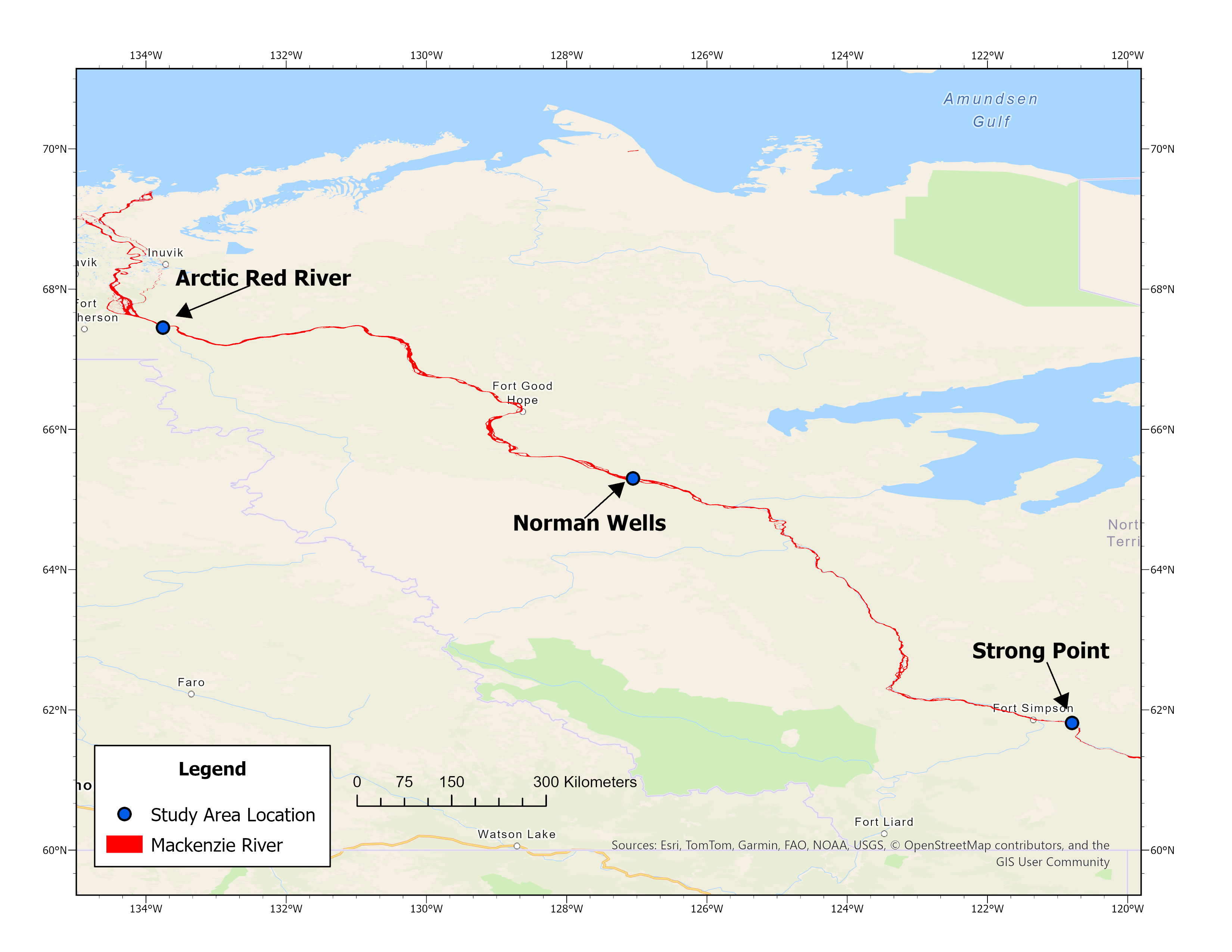
GEM Undergrad Thesis
The ice break-up season is considered to be the most critical hydrologic event of the year in water studies. Ice break up can lead to ice jamming along rivers which can cause flooding, and affect both the natural environment, communities along the river, and human made infrastructure such as bridges. This study will look at using remote sensing techniques to determine the velocity of river ice floes during the ice break up season. Specifically, the research will investigate if CubeSat imagery can be reliably utilized to retrieve river flow velocity and river discharge during ice-break up along sections of the Mackenzie River in the Northwest Territories. PlanetScopes 3m resolution imagery will be used to identify, classify, and match ice floes to determine the average velocity of different sections along the Mackenzie River. The analysis is performed in ArcGIS Pro and is semi-automated to improve efficiency. The final velocity results will be used to calculate river discharge to compare with the Water Survey of Canada hydrometric data. The results are expected to show the speed of the ice floes relative to the centerline and size of each floe. The approach will determine if the discharge measurements calculated match with in-situ observations and if GIS applications can be reliably used to determine ice floe velocities.

Violet McCloskey
Understory and tree methane emissions from burned and unburned bogs and swamps in the Canadian Shield
Peatlands are major natural emitters of the greenhouse gas methane (CH₄), yet gaps remain in our understanding of emission magnitudes and how pathways may shift after natural disturbances such as wildfires. Recent studies indicate that tree stems are an important CH₄ emission pathway in tropical wetlands, while other studies suggest that tree bark can act as a barrier to CH₄ diffusion, such that bark disturbance may increase emission rates. However, research linking these processes in boreal conifer-dominated peatlands remains scarce.
To address these knowledge gaps, we conducted two sampling campaigns measuring understory and tree CH₄ fluxes from burned and unburned bogs and swamps at the headwaters of the Hudson Bay Lowlands. The objectives were to i) assess how burn severity, wetland type, and environmental conditions affect CH₄ fluxes from black spruce trees and ii) assess how environmental controls influence understory CH₄ emissions from burned and unburned bogs and swamps.
Methane fluxes were measured using close chambers. Six collars were installed across four locations along the transect that intersected the burned and unburned bog, and burned and unburned swamp. Tree stem CH4 flux measurements from black spruce were measured at each collar location, where fluxes were completed at the base and 1.5 m above the peat surface. Tree CH₄ fluxes decreased with height across all sites. Burned and unburned bogs showed the highest tree and soil CH₄ fluxes, whereas swamps exhibited little variability in both tree and soil fluxes across sites. This presentation will explore the importance of tree stem and soil CH₄ emissions and their responses to wildfire and local environmental conditions.

Jack Robertson
Tourist Perceptions and Community Benefits of Mountain Gorilla Ecotourism in Bwindi Impenetrable National Park, Uganda
Mountain gorilla tourism in Bwindi Impenetrable National Park is widely promoted as a mechanism for supporting both wildlife conservation and local livelihoods. This study analyzes survey responses from 30 international tourists and 22 community members in the Rushaga sector to examine tourist motivations, satisfaction with the trekking experience, and community perceptions of tourism-related benefits. Results indicate high tourist satisfaction and widespread belief that tourism benefits surrounding communities, while community responses describe a range of ways in which tourism-related benefits are experienced locally, including employment, craft sales, and community development projects.
GEOG 471: Remote Sensing Project

Yexing Mao, Aurora An, Catherine Huo
Spatial Distribution of Snowfall Associated with Lake-Effect Snow Processes Around Lakes Erie and Ontario
Seasonal snowfall is important for the Great Lakes region because it affects climate, water supply, and ecosystems. In the Lake Erie and Lake Ontario areas, lake-effect snowfall (LES) is a major winter weather process. LES happens when cold air moves over warmer lake water. Heat and moisture transfer from the lake to the atmosphere, which creates unstable conditions and forms narrow snow bands. These bands often produce heavy snow in downwind shoreline areas. However, it is still difficult to describe the overall spatial pattern of LES snowfall across multiple winters because ground snow stations are limited.
The objective of this study is to compare snowfall patterns during the strongest and weakest LES events in the winters from 2020 to 2025 around Lake Erie and Lake Ontario. Instead of examining all winter days, this study focuses on representative LES cases to better show how snowfall changes under different LES conditions.
Using our current code workflow, we identified two key events: one strongest LES case and one weakest LES case. For each case, we analyzed snowfall distribution and snowfall amount at four time points: the day before the LES event and the day after the LES event for both the strongest and weakest cases. This event-based comparison allows us to observe how snowfall patterns change before and after LES under contrasting conditions.
The current results show that snowfall distribution and snowfall amount are different between strong and weak LES cases. Strong LES events produce more concentrated and more obvious snowfall patterns, while weak LES events show less intense and more limited snowfall signals. These findings help illustrate how LES intensity can shape snowfall distribution in the Great Lakes region and provide useful insight for winter weather interpretation and regional environmental understanding.
Predicting Wildfire Burn Extent in California, USA

Abtin Abbaspour, Agnes Barkho, Benjamin Marsh, Cindy Wang
Predicting Wildfire Burn Extent in California, USA
Wildfires are uncontrolled natural disasters that burn grasslands, forests, and other landscapes, causing severe ecological and societal impacts in California, USA. Accurate next-day predictions of wildfire spread are crucial for emergency response and resource allocation; however, existing methods can often lack high-resolution spatial prediction that account for various landscape conditions. The combination of remote sensing with machine learning offers a progressive approach in addressing this gap. This study examines whether landscape, environmental, and active-fire variables can be used to predict next-day wildfire burn extent in California using a convolutional neural network (CNN). Specifically, we (1) characterize current landscapes and fire conditions by deriving environmental variables from remote sensing datasets, (2) implement and train a CNN that integrates multi-layer raster data and outputs pixel-level next-day burn prediction imagery, and (3) evaluate performance using three wildfire events (Santa Clara Unit, Dixie, and Fairview Fire), comparing predicted day-after burn extent with observed satellite imagery. We will demonstrate how the integration of environmental and active-fire information improves next-day burn predictions, evaluated using pixel-level spatial accuracy metrics. Model performance is expected to be strongest in regions with consistent vegetation and terrain patterns in comparison to heterogeneous landscapes. The results will generate reliable day-ahead burn imagery that can support wildfire management, including containment planning and rapid decision-making during active fire events. More broadly, this study contributes to the advancement of data-driven early warning systems and long-term mitigation strategies. By demonstrating the effectiveness of remote sensing and machine learning methods, this framework offers a scalable approach for predicting wildfires in other regions globally.

Nouran Hassan, Russell Crouch, Michaella Neidermyer
Assessing Marine Ecosystem Stressors in Ambon Bay
Ambon Bay, Indonesia, is a coastal waterbody central to the Coral Triangle, which is a sprawling habitat for aquatic life that supports 76% of the world’s coral reef species. This region has a vast reservoir of marine resources, essential to the surrounding settlements and marine ecosystems. Its positioning within the Indonesian throughflow not only leaves it immensely vulnerable to pollutants from some of the most polluted waterbodies on the planet, but also exposes important nearby ecosystems to a combination of highly toxic outputs.
Water quality in Ambon Bay has steadily declined due to the accumulation of pollutants, resulting in significant impacts on marine biodiversity, ecosystem stability, and coastal livelihoods. These growing environmental pressures, alongside the objectives outlined by the 6th and 14th SDGs calls for a systematic, remote-sensing based approach towards identifying these changes in marine health over time.
The objective of the research emphasizes the detection of three main marine stressors most commonly associated with ecosystem degradation: plastic pollution, algal blooms, and coral bleaching/mortality. This will be achieved through the use of Sentinel-2 imagery, machine learning classification, and dimension reduction algorithms to predict, visualize and model the presence of these stressors. Its impact will be quantified by highlighting susceptible regions within the bay through analyzing spatial overlaps between the three catalysts.
Through this methodology, we expect to identify clear temporal patterns in how coral reefs, algal growth, and plastic pollution have changed within Ambon Bay between 2016 and 2026. Due to the escalating nature of the issue, we anticipate an increase in algal and plastic detection over time, and a significant decrease in coral extent due to continued bleaching events and degraded conditions caused by the aforementioned rise in pollutant concentration.We also expect stressors to compound mainly in nearshore areas due to the prominence of human activity, pollution inputs, and natural environmental stressors.

Gabriel Chang, Aidan Green, Jackie Lin, Thomas Nickerson
Sea Level Rise Analysis in the Netherlands
Sea level rise presents a critical challenge for the Netherlands, where large portions of the country lie at or below mean sea level and rely on extensive flood protection and land reclamation systems. As global sea levels continue to increase due to climate change, accurately monitoring sea level trends is essential for long-term coastal planning and infrastructure resilience. In addition to ocean rise, land reclamation and subsidence further complicate relative sea level measurements. The objective of this project is to evaluate the performance and accuracy of multiple satellite-based remote sensing instruments in measuring sea level rise in the Netherlands while accounting for land deformation in reclaimed regions.
This study primarily uses laser altimetry data from ICESat, radar altimetry from Jason-1, wide-swath altimetry from SWOT, and Synthetic Aperture Radar (From Sentinel-1) imagery for land motion analysis. ICESat provides high-precision elevation measurements using laser pulses, Jason-1 offers long-term radar-based sea surface height records, and SWOT improves spatial resolution through wide-swath observations. SAR data will be used to detect land subsidence or uplift in reclaimed coastal areas. All satellite-derived measurements will be compared against long-term Dutch tide gauge records, which will serve as the reference dataset for validation. Statistical analyses, including trend comparison, bias assessment, and error evaluation, will be conducted to determine accuracy and consistency across instruments.
The expected outcome is continued detection of rising sea levels in the Netherlands, with measurable differences in precision and spatial coverage among instruments. By identifying the strengths and limitations of each system, this project aims to improve confidence in satellite-based sea level monitoring and support more informed coastal management and land reclamation strategies.
Campbell Bowser, Lucia Lee, Jack Shiry
Characterizing Snow Properties using Synthetic Aperture Radar over Trail Valley Creek, NWT
The characterization of snow cover is a fundamental component of climatological and hydrological research, primarily due to its significant influence on Canada’s climate, water resources, and ecosystems. Synthetic aperture radar (SAR) has been utilized in the past to characterize snow properties, including with legacy sensors such as Sentinel-1. Our aim is to demonstrate how observations from the Surface Water and Ocean Topography (SWOT) over the Trail Valley Creek area (Northwest Territories) can be used in a novel approach to characterizing snow cover over land. This includes demonstrating the presence of snow cover with Sentinel-2 data, testing the potential for SWOT data to be used in snow applications, and comparing those results with data from legacy sensors (Sentinel-1). We expect that we will be able to test the correlation and sensitivity between snow depth and backscatter from the SWOT satellite and verify the results with data from Sentinel-1. These findings will help highlight the sensitivity of SWOT observations to real snow properties, including snow depth measurements obtained for the Trail Valley Creek research station. Furthermore, it will demonstrate the capability of SWOT for purposes outside of the mission’s original objectives (water- and ocean-focused) by exploring applications over land.
Samuel McAllister, Jasmine Klassen, Yesha Masani
Assessing the Capabilities of OBIA in a recovery context
Speed is a critical factor in disaster recovery, affecting both lives saved and medium-and-long-term recovery success. Remote sensing can play a critical role in this recovery process by identifying highly impacted areas and optimizing the flow of aid. However, a lot of this work currently relies on Very-High Resolution (VHR) imagery to accomplish, which is simply unavailable for many organizations outside of predetermined recovery windows. Our work aims to test the capabilities of Object-Based Image Analysis (OBIA) on the freely available medium-resolution Sentinel-2 data over our chosen study area Caguas in Puerto Rico. The city was impacted by two hurricanes, Irma and Maria in 2017 within the span of two weeks. We hope to leverage the noticeable change in land-cover across the study area caused by the hurricanes to test the analysis algorithm’s abilities for identifying damaged and undamaged urban areas as well as changes to various vegetated areas of varying densities. Additionally, we will conduct a high-level assessment of physical changes brought about to our study area over the course of two years. While we expect the OBIA and accompanying analyses to provide precise results for mainly vegetated areas, we expect significant challenges when dealing with the urban spaces due to a high variability of surface reflectance and the difficulty in identifying individual features with medium-resolution satellite data. We also expect to observe significant physical change over the Caguas area, but we do not expect these to be permanent, with a high likelihood of return to pre-hurricane levels. Should the OBIA and accompanying analyses provide satisfactory results, we believe this could be a significant opportunity for many organizations and entities globally which do not benefit from regular access to VHR imagery to improve their long-term recovery monitoring and planning capabilities.
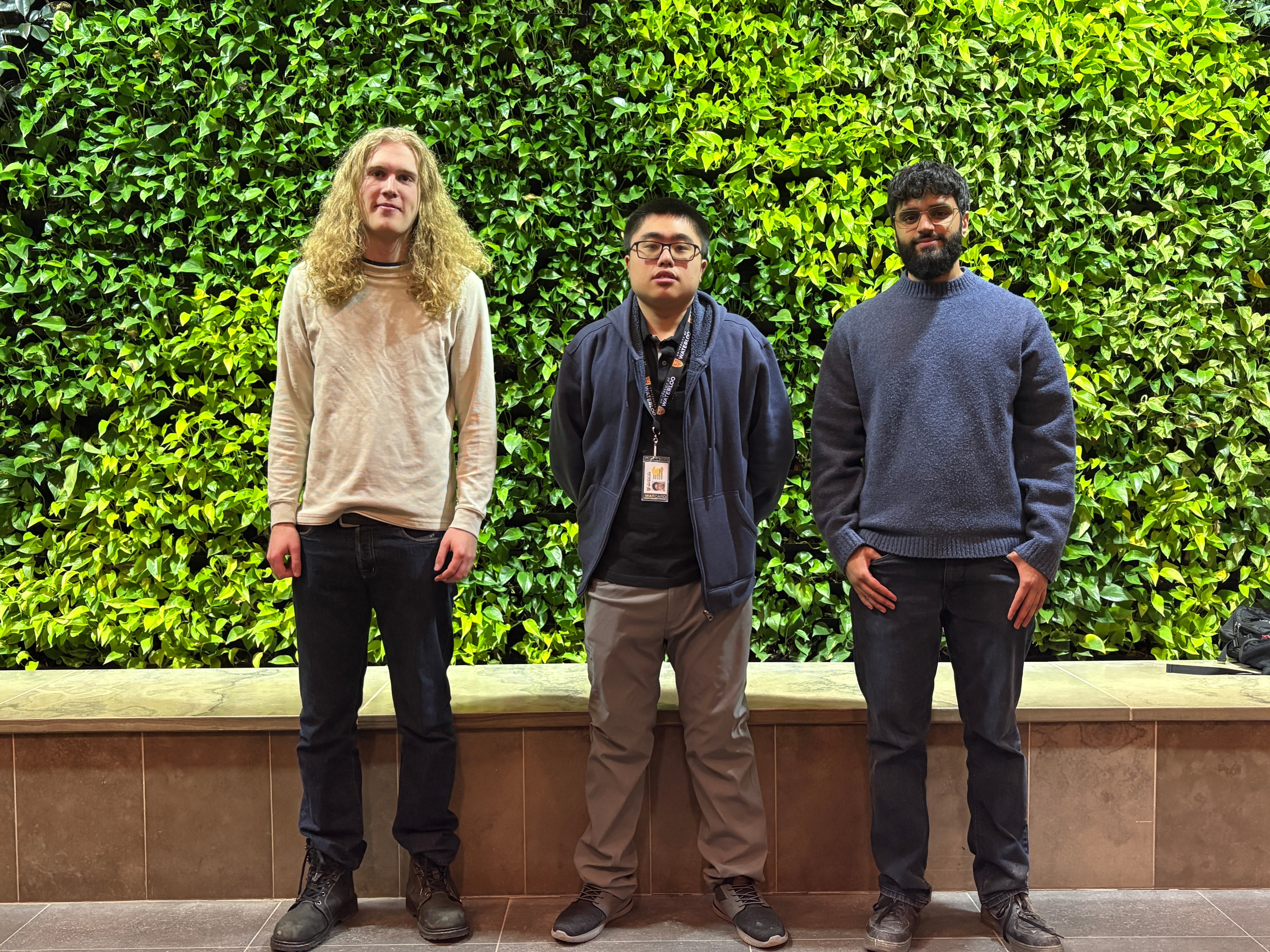
Gurkirat Panesar, Matthew Finlay, Noah Deng
Comparing Snow Cover Persistence Between Urban Thunder Bay and Surrounding Rural Areas Using Remote Sensing Data
Urban snow persistence often differs between cities and rural areas because of impervious surfaces, urban layouts, vegetation, snow management, and topography, altering how snow accumulates, redistributes, and melts. This can impact winter maintenance because the same snowfall can produce different snowpack lifetimes and uneven snow distribution across an urban-rural gradient. This project examines post snow day snow persistence in Thunder Bay, Ontario and surrounding rural areas by combining weather-station observations with Sentinel-2 optical remote sensing and street-level camera/video captures.
Weather-station records are used to identify comparable snowfall events and no-snowfall windows. For each event, we compute persistence metrics such as time-to-melt, melt/settling rate, and the probability of snow remaining through standardized post-snowfall windows, while using station meteorological variables (e.g., temperature and wind) to contextualize differences. Sentinel-2 imagery provides spatial context: we derive the Normalized Difference Snow Index (NDSI; a spectral index for snow detection) using an adaptive threshold where needed to account for varying surface conditions across the scene and summarize snow presence/snow-cover fraction patterns for urban and rural zones, including contrasts between built-up areas and urban greenspaces (e.g., parks). Because station records vary in length and continuity across the region, the station set is defined based on data availability and overlap with the study period.
As complementary qualitative evidence, we will review camera and street-level video sources for select dates to verify snow presence and melt timing. Instead of using seasonal totals or one station at a time, this event-by-event urban-rural comparison focuses on how long snow stays after each snowfall and connects those differences to mapped patterns from Sentinel-2, with confirmation from camera/video checks. We will report urban–rural differences in persistence curves, time-to-melt, and melt rates across multiple events, and summarize where snow lasts versus melts the fastest. We expect snow to disappear sooner and melt faster in more built-up, actively managed areas than in nearby rural and vegetated locations.

Brian Han, Fatima Eden, Sean Lai
Multi-sensor Analysis on Mangrove Patterns in the Ca Mau Peninsula, Vietnam
Mangroves occupy less than 1% of the global forest areas and yet are extremely crucial in biological systems. They support 25% of the marine species and serve as a strong “blue carbon” sink, which can store up to four times as much carbon as tropical forests. Vietnam, though previously known for its dense mangrove cover along its 3,260 km of coastlines, is currently experiencing rapid infrastructure development and land-use change. These factors, among others, have catalysed a 35% decrease in Vietnam mangrove cover, mirroring the global trend of mangrove decline since the 1950s. Northern Vietnam has shown progress in restoration, but the Southern Cà Mau region remains a critical zone, as land continues to be converted for aquaculture, and the consequences of dike installation and dam construction are starting to surface. This study utilises Sentinel-1, Sentinel-2, and PlanetScope imagery to observe changes in mangrove distribution in the Cà Mau Peninsula of Southern Vietnam, specifically looking at geographical, physical, and biophysical fluctuations between 2016 to 2026. Each satellite source will be uniquely classified to produce 10-year summaries of structural and health changes from radar indices of Sentinel-1, growth and degradation patterns from multispectral vegetation indices of Sentinel-2, and a more detailed focus on hotspot regions from high-resolution PlanetScope mosaics. These classifications, combined with further indices calculations and pixel-based analysis, can be used to hypothesise possible correlations of mangrove forest dynamics with human-induced changes. Ultimately, this analysis will provide a framework for future research relating to mangrove monitoring in regions balancing infrastructure growth and ecological resilience.
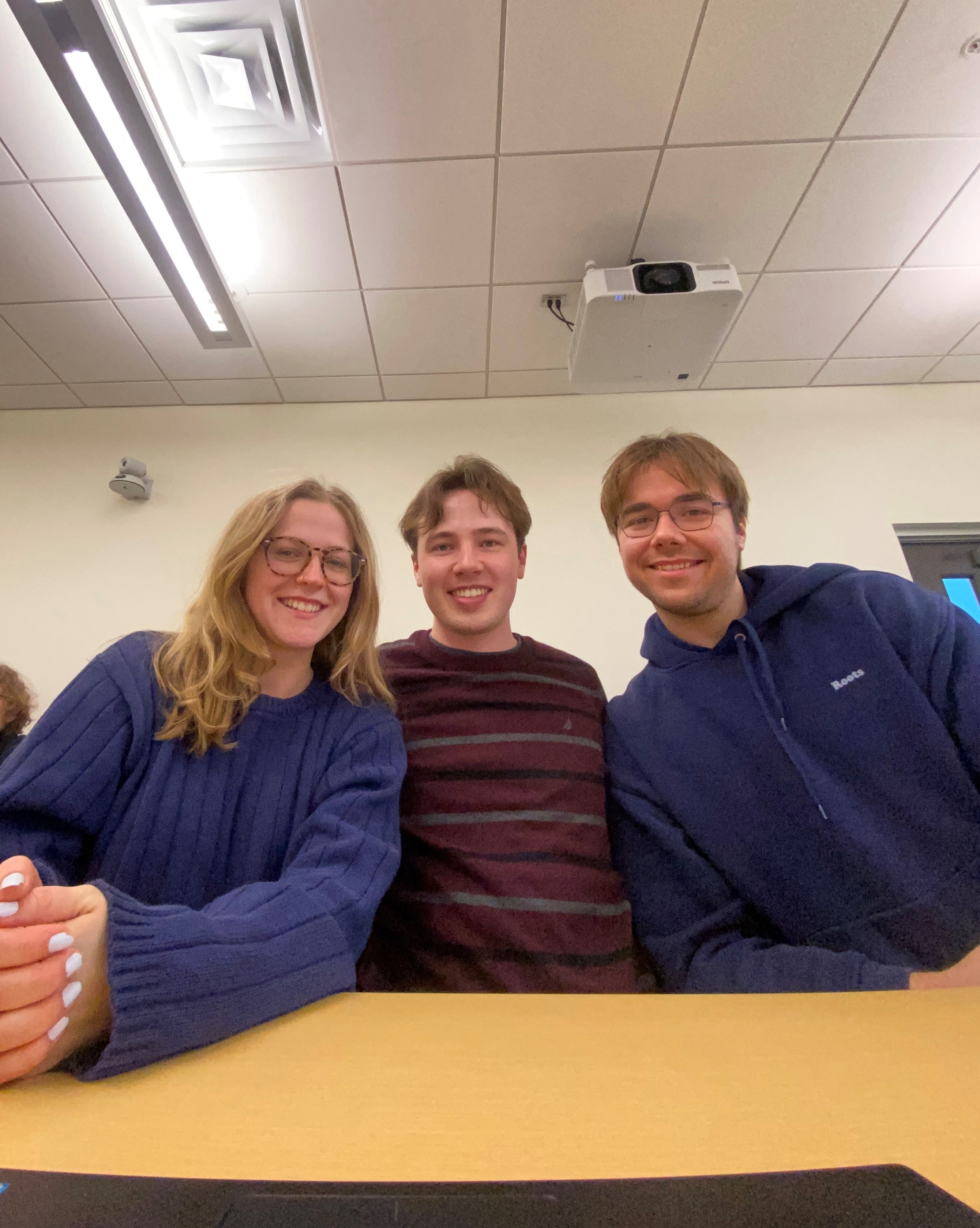
Adrian Tralman, Elsa Patterson, Jordan Aaron Keszler
Encroachment on Indigenous Communities in the Brazilian Amazon: Comparing Mining‑Driven and Forestry‑Driven Biomass Loss Using Remote Sensing
Indigenous Territories (ITs) in the Brazilian Amazon hold over one million square kilometers of rainforest that is critical to biodiversity conservation, climate regulation, and carbon sequestration. Despite their protective role, deforestation within these territories has increased drastically since 2013, driven primarily by illegal mining and forestry-related agricultural expansion. These two encroachment types produce unique spatial and temporal disturbance patterns, yet scholarship comparing them remains limited. This study compares spatial patterns and rates of forest loss across three ITs: Sararé (mining-driven disturbance), Tierra Wajãpi (forestry-driven disturbance), and Menkragnoti (control site). We will use a multi-sensor approach combining Sentinel-1 SAR, Sentinel-2, GEDI, and ICESat-2 imagery over dry-season composites. Optical sensor satellite data will be compared to synthetic aperture radar (SAR) data to determine differences in how efficiently deforestation can be detected. Furthermore, utilizing LiDAR sensors (GEDI and ICESat-2), changes in above-ground biomass (AGB) will be assessed to provide further data on the effects of deforestation on forest ecology. A supervised Random Forest classification will be applied to our imagery using shared training samples. For mining-driven disturbances, we expect to see spatially concentrated, high-intensity biomass loss, while forestry-driven encroachment is anticipated to produce more diffuse deforestation. Our research addresses UN Sustainable Development Goals 10 (Reduced Inequalities), 13 (Climate Action), and 15 (Life on Land), by quantifying deforestation and ecosystem degradation to inform climate action strategies and documents how Indigenous communities are impacted.
GEOG 415: Economic Geography Project

Sam Watson
BC Local Government Climate Action Project
Working with LGCAP to model the emissions of each municipality participating in the project. There are three diferent projects that municipalities can participate in; Low emission vehicles, solarthermal retrofits and building retrofits. We model the municipalites baseline compared to the post project upgrades to evaluate the success of the project in each municipality and across BC as a whole.
INTEG 420: Senior Honours Project

Melissa Valad
The Unseen Ecology: Redefining Ecological Belonging in the Urban University
Today’s world faces a climate crisis, and if we are going to address it adequately we need to develop pro-environmental behaviour at all levels of society. Although many people claim to hold environmental values, such as sustainability, their actions don’t always reflect them — this is known as the value-action gap. I propose bridging this gap by strengthening people’s environmental value from a personal, place-based context through acknowledgement of the socio-ecological relationships that often go unnoticed within daily life. The extinction of everyday experience with nature, compounded by a narrow conceptualization of what nature is, diminishes people's affinity for the natural world and undermines the development of environmental values. Drawing on phenomenological inquiry and Bloom’s Affective Taxonomy, this project centers ecological belonging as a foundation for environmental value. To this end, I am developing a workshop that invites participants to observe and respond to the nature around them, expand their conceptualization of nature to include urban and designed ecosystems, and engage with local community ecosystem services.
In the workshop, participants can foster grounded environmental values through place-based ecological connections. The workshop is inclusive of all students, staff and faculty within the University of Waterloo. The learning objectives are twofold: first, participants will identify their attitudes towards nature through concept analysis, and second, they will recognize nature and reflect on the socio-ecological relationship that exists within their lived environment. The primary outcome is for participants to develop environmental value from a sense of place and a motivation to embark on a variety of social experiences in nature. In addition to the workshop, I am developing a set of materials for key stakeholders to give an opportunity for these activities to be shared with a wider audience. My hope is that people will reconnect and reflect on their relationship with nature to ensure strong environmental values and meaningful action.

Alia Nanji
Legal Standing for the Silenced: Reimagining Legal Status for Captive Entertainment Animals in Canada
Legal standing, the right to bring an action in court, is a growing topic of discussion in the field of animal rights law. With the present federal legislation defining animals as property, institutions such as zoos, aquariums, and circuses cannot effectively be held accountable for the treatment of animals in their care. In numerous cases, entertainment animals suffer from prolonged confinement, isolation, and inadequate living conditions. When cases of neglect arise, advocates such as animal rights organizations lack an efficient legal pathway to challenge those responsible for the animals’ suffering. Despite the consensus among experts that the current animal protection systems must be reformed, extending legal standing to captive entertainment animals has been insufficiently explored within the Canadian legal system.
By engaging in a literature review of existing case law, parliamentary debates, and scholarly commentary on the legal status of animals, this project concludes that legal standing is a necessary structural reform, but that granting it alone would be ineffective without foundational reforms. Accordingly, this project proposes a three-tiered model for implementation. The model begins with groundwork to build public support, progresses through the alignment of provincial inspection and enforcement systems, and concludes with federal Criminal Code amendments that formally recognize animals’ legally protected interests and grant them legal standing. Ultimately, by situating legal standing within a tiered proposal, this project contributes to evolving debates on the future direction of animal welfare law in Canada.
Creating Collaborative Success Through the Lens of Group Entrepreneurship
Nathan Groenewald
Creating Collaborative Success Through the Lens of Group Entrepreneurship
Collaboration lies at the heart of modern entrepreneurship, social innovation, and academic work, yet teams often struggle with conflict, ill-defined roles, misaligned expectations, and poor communication. Despite extensive research on group entrepreneurship, there remains a gap in translating these insights into accessible, practical tools that teams can use in real-world settings. This project aims to understand how collaborative teams enhance their effectiveness by translating insights from group entrepreneurship research into practical, design-based tools. The study of group entrepreneurship highlights both the creative potential of teams and the common pitfalls that impact collective success, making it essential to develop strategies that support more effective collaboration.
Drawing on literature from group entrepreneurship, organizational psychology, communication studies, and human-centred design, this project addresses the following question: How are insights from group entrepreneurship translated into practical resources that help collaborative teams work more effectively and avoid common pitfalls? Through this design project, the work provides people with a toolkit that can be implemented in pre-established or newly formed groups to support clearer roles, stronger communication, and more effective collaboration.

Tesni Greig-Clarke
Teaching Students About Neurodiversity: A Toolkit for Grades 4-6 Teachers in Ontario Public School Classrooms
Neurodiversity is a term originating from disability advocacy communities, as a way to communicate the lived experiences of those with neurological differences and advocate for a more inclusive society. The curriculum of Ontario public school classrooms doesn’t include education on neurodiversity, despite its potential impacts on addressing broader societal stigma, unlocking learning potential in diverse classroom communities, and empowering neurodivergent students. This project aims to address this gap through the design of a toolkit of resources that can be easily implemented in classrooms in Ontario in connection with curriculum strands across Grades 4-6.
To achieve this outcome a research phase was completed, including the review of Ontario curriculum documents, historical and contemporary neurodiversity research, and existing solutions external to Ontario. The design phase of the project was guided by IDEO’s 2012 Design Thinking for Educators framework, including discovery, interpretation, ideation, experimentation and evolution phases.
The toolkit empowers teachers to feel comfortable teaching about neurodiversity by providing background learning, coaching on how to facilitate conversations about neurodiversity, and connections to existing curriculum requirements. The toolkit contains three engaging classroom activities built around the goals of having students be able to understand the concept of neurodiversity, apply it to themselves and others, and work toward creating a society that is more inclusive for neurodivergent individuals.

Madeline McDonnell
Teaching Identity Development Through Play: A Game Theory Workshop for Grade 10 Students
Interest-based identity development is the process of understanding your values, articulating them, and integrating them into society. It is a critical skill that is formed throughout your life but especially during adolescence as it strengthens problem solving, decision making and resilience. However, despite the undeniable benefits, the Ontario Curriculum does not address it head-on. Therefore, my workshop was created to address this gap in pedagogy. The learning goal for this workshop, designed for grade 10 students in civics and careers, is teaching students how to integrate both an individual's interests and societal interests when they don't fully align. This includes analyzing how interests are represented in their communities and proposing courses of action to address any differences.
Research shows that by teaching students these skills, students will feel more prepared for life after they graduate and decrease their stress levels. This is significant because it will strengthen their understanding of themselves and how they fit in society, making them feel ready for life after high school. The workshop includes play-based pedagogy as the main form of learning through mini games, structured around a game theory concept called Prisoner’s Dilemma – a type of social action problem. I followed a three-part lesson plan and connected it to the current course curriculum, so this lesson has a higher chance of being implemented in classes. Finally, the students will create a plan for ordering a pizza with 4-5 constraints to see how these concepts apply to real life.

Mikaela Moyer
Designing a Digital Engagement Framework: Strengthening Community Engagement and Retention in Small Organizations
Small membership-based organizations depend on strong relationships to remain financially stable, yet many rely on fragmented and informal communication systems that weaken engagement over time. This challenge is especially pronounced in seasonal clubs, where off-season communication gaps often lead to reduced participation and long-term member loss.
This project examines The Oxford Hills, a publicly owned golf and country club in southwestern Ontario with over 200 members, as a single in-depth case study. It identifies the root causes of off-season disengagement and designs a structured digital engagement framework that strengthens belonging, personalization, and two-way communication. Using a design thinking approach, the work maps current communication gaps, gathers member insights, and defines system requirements for a low-resource digital solution.
The final deliverable is an implementation blueprint that outlines the structure of a digital engagement tool. The blueprint includes user needs, feature priorities, communication workflows, and evaluation metrics, presented as a clear framework that guides how the system would function and support member interaction throughout the year. This framework can guide future tool development by The Oxford Hills or be adapted by other small, community-based organizations seeking stronger year-round member retention.

Kavya Srinivasan
Designing for Dignity: Montessori-Inspired Arts Engagement for Individuals Living with Dementia
Traditional dementia care settings often prioritize safety and routine. While essential, these structures can limit opportunities for autonomy, creativity, and self-directed engagement. Research shows that Montessori-based programming emphasizes choice, independence, and meaningful activity. When combined with structured arts activities, this approach can improve mood, social interaction, and cognitive stimulation for people living with dementia. Despite this evidence, there is little practical design work that intentionally integrates these approaches for everyday care practice.
This project evaluates dementia care models to identify gaps in autonomy-driven and creative engagement. Observation and feedback from a local Montessori school and memory care facility highlight the benefits of arts-based activities for supporting cognitive function, fine motor skills, and meaningful participation. Insights from this research informs a human-centered approach to creating an engaging set of activities for individuals living with dementia.
For the final deliverable, a customizable, Montessori and dignity-focused arts activity set is designed and prototyped to adapt to varying cognitive and physical abilities. For example, reusable watercolour pages appear blank when dry but reveal vibrant images with just a brush of water. This is a mess-free, simple to use, and engaging activity for individuals with minimal fine motor skills. An accompanying implementation booklet provides activity examples and descriptions. Together, these materials demonstrate how intentional, Montessori-informed arts design can enhance dignity, independence, creativity, and meaningful engagement in a variety of dementia care settings.
Building Confidence in Teens and Young Adults Through Home Maintenance Education Workshops

Melissa Osinga
Building Confidence in Teens and Young Adults Through Home Maintenance Education Workshops
Household maintenance is an integral part of independent adult living that is often omitted from school curriculums. These skills are expected to be learned outside of the classroom within the family or community, however, not all youth have access to the mentorship to learn and practice these essential skills. While there are many existing educational resources available for free online like YouTube, they lack the meaningful hands-on experience needed for teens and young adults to gain confidence in their abilities. This hands-on experience has the greatest effect on low-income earners as outsourcing these tasks is often an insurmountable barrier leading to housing quality disparities.
To address this problem, I designed a workshop for high school and first and second year university students that allows them to practise simple maintenance and repair skills in a low-stakes environment. This will assist them in building the confidence necessary to try these tasks in their own lives. The workshop is targeted to prepare students who are entering, or are just about to be entering independent living. It is designed to be accessible for all high school and first and second year university students in the Waterloo region, but specifically tailored for low-income underprivileged teenagers and young adults. My final design consists of a workshop and an information booklet. The workshop begins with an introduction that includes building a basic toolkit paired with an opportunity to practise using the basic hand tools. The second section will focus on sewing on a button or changing lightbulbs in various light fixtures.

Ray Kool
Mapping the Gap: Assessing Visitor Engagement and Information Accessibility at the Peter Russell Rock Garden
The Peter Russell Rock Garden is a geological exhibit at the University of Waterloo's Earth Sciences Museum, and the largest rock garden in Ontario. Despite its prominence, the garden has information access gaps. It lacks clear signage linking to online resources, contributing to low visitor awareness of digital materials. Website users must piece together information from a static garden map, a technical rocks page, and a separate tour script, which are not optimized for self-guided exploration. Finally, no data has been collected on visitor engagement or satisfaction, representing a gap in understanding how the garden is used and valued.
This project evaluates visitor engagement and identifies design interventions to improve access to digital resources using a visitor satisfaction questionnaire administered to the campus community. Following IDEO's design thinking framework, it adapts scales from the Dimensions of Visitor Experience and The Collaboration for Ongoing Visitor Experience Studies. Items were iteratively refined with museum staff to align with institutional goals and piloted with students.
Findings are analyzed using descriptive statistics, cross-tabulation, and thematic analysis to identify patterns in visitor engagement and interventions for improving the garden's information accessibility. Preliminary results reveal high visitor satisfaction with the physical space but limited awareness of digital resources. The results support the recommendation to develop an interactive wayfinding map and install signage with QR codes linking to the garden's web page. These would bridge the gap between the garden’s physical presence and its digital resources, offering more flexible, self-guided access than the current static map and dispersed web pages and equipping visitors with the tools to engage more fully and independently with the space.

Liam MacArthur
From Guided Journaling to Psychoeducation: Designing MindMate to Improve Help-Seeking Intentions Across Athletes
Athletes often face sport-specific stressors, such as an elevated risk of anxiety and depressive symptoms, yet help-seeking intentions remain low due to stigma and limited mental health literacy. This paper reports on the process of low-fidelity prototyping MindMate, an athlete-oriented large language model system that is not intended to replace therapy or clinical care. MindMate uses guided journaling to support psychoeducation and resource navigation by eliciting athletes’ experiences in their own words. It provides structured follow-up prompts to encourage reflection and elaboration. A large language model-based system supports adaptive prompts and interpretation of journal responses, enabling the identification of symptom consistent language (e.g. repeating performance anxiety in practice contexts) strictly without making diagnostic claims. When a symptom pattern is flagged, MindMate uses a retrieval-augmented generation framework to provide psychoeducational content from a curated vector database. The symptoms and examples of mental health concerns in which they commonly appear are described. An emphasis is placed on wording messages to help reduce perceived isolation (e.g. highlighting that similar experiences are commonly reported by athletes) alongside outlining pathways to appropriate professional resources; strict system prompt design ensures early crisis detection and guidance. This paper outlines design suggestions for the journaling-to-psychoeducation pipeline MindMate follows and proposes an evaluation agenda focused on user experience, perceived safety, mental health literacy outcomes, and potential changes in help-seeking intentions among athlete users.
PLAN/GEOG 481: Geographic Information Systems Project
Sarah Cloughley, Micah Colman, Charlotte Arruda, Catherine Huo, Aurora An
Time Series Analysis of Water Pollution and Invertebrate Diversity in Laurel Creek
Water pollution is a significant driver of change in freshwater ecosystems, often influencing ecological processes by affecting water quality and ecological communities. These changes can lead to shifts in freshwater biodiversity, especially invertebrate communities. This study uses time series analysis to examine the long-term relationship between water pollution and invertebrate diversity in Laurel Creek. By integrating hydrological indicators and biological monitoring records, this research analyzes how changes in pollutant levels affect temporal trends in invertebrate diversity. The results will help identify key periods of ecological change and provide scientific data support for watershed management, biodiversity conservation, and freshwater ecosystem protection.
Andy Jabbo, Yasseen Mobada, Neel Amin, Gurkirat Panesar, Ali Al Humidi
University of Waterloo Campus Map Re-design
This project tackles a key challenge in campus navigation at the University of Waterloo: existing digital maps often lack the campus-specific detail, accessibility features, and up-to-date information users need. As the university expands, students, staff, and visitors increasingly require a reliable, inclusive, and easy-to-use wayfinding system.
Our team is developing an enhanced interactive campus map using Geographic Information Systems (GIS) technology to improve navigation, accessibility, and user experience. The tool aims to provide an intuitive, visually clear interface by compiling and updating campus spatial datasets, including buildings, pathways, amenities, and transportation connections.
The project’s goal is to create a sustainable, user-centered mapping solution that prioritizes accessibility and long-term data management. The outcome will be a functional prototype and implementation strategy that demonstrate how a GIS-based digital map can effectively support everyday navigation across the University of Waterloo campus.

Alyssa Dinopoulos, Gabriel Joakim, Iman Khan, Gabriel Andrew Lo, Xavier James Nicholas Hammond-McGarry
Transit Accessibility Index: Understanding the Accessibility of the GTA’s Transit Systems
TRAINS recognizes the importance of the Greater Toronto Area (GTA) and its relationship to its transit systems. While the GTA has made considerable effort to make their transit lines more accessible, there are still gaps in its accessibility that researchers have noticed. We at TRAINS aim to build a tool that could help with understanding these gaps in accessibility. By looking at transit accessibility from five different lenses (Transit Coverage, Ability, Income, Walkability, and Quality of Service) we aim to generate a web-mapping tool that can be used by both government and public agents in order to assess various aspects of transit accessibility. These tasks will be taken under by a series of experts with background in transit and planning. The intent of this tool is to serve as a Transit Accessibility Index (TAI) and will allow users to generate a multi-criteria analysis using the different lenses as a basis.
Samuel Galloway, Jackie Lin, Emily Bolton, Samuel Mcallister, Ethan Huynh
Leveraging Indoor Wayfinding Technology to Modernize Navigation and Accessibility at the University of Waterloo
Interior navigation has become an increasingly popular topic in recent years, offering assistance for many students and staff attempting to navigate through unfamiliar buildings and campuses. The University of Waterloo, having seen rapid expansion since its establishment, has been unable to keep its navigational aids at a satisfactory level and poses a significant navigational challenge for those navigating its buildings. We aim to remedy this challenge by leveraging the technologies available on campus to create a modern and accessible wayfinding tool for staff, students, and visitors.
Michael-David Terlecki, Adrian Li, Carson Burke, Leo Li, Nashita Rahim
Housing Development Interactive Tool - Adatum Corp.
Despite only accounting for 3% of Ontario’s total land area, the Greater Golden Horseshoe contains 10.2 million people, nearly 70% of Ontario’s population. Housing and land development for these people is critical, prompting a case study into developments in the region. Accessible analysis of how housing development has evolved over time is underdeveloped within GIS. This project addresses this gap by developing an interactive GIS tool visualizing housing typology, temporal change, and relationships with planning related variables through multi-criteria analysis. With the tool, the Adatum team seeks to study the current development patterns within the Greater Golden Horseshoe starting with two case studies Waterloo-Kitchener and Newmarket-Aurora. The tool supports evidence-based insight for policymakers, developers, community members, and researchers. It is twofold. Firstly, the tool provides a tool for users to draw their own conclusions. Secondly, the Adatum team provides professional analysis, as provided in Storymap format, on housing typology and overall development trends through the policies that created them in multi-criteria analysis, to assess their effectiveness in providing ‘good’ development outcomes as related to demographics, and other land-use characteristics. Adatum expects development patterns to be more less clustered in Waterloo-Kitchener as opposed to Newmarket-Aurora, with regards to urban fabric, and related data. This is due to Waterloo-Kitchener's historic and recent development patterns which different from Newmarket-Aurora contextually.

Yesha Masani, Madelyn Kuo, Melanie Falik, Jeeshita Yeluri
The Impact of Tourism on Housing Affordability across Barcelona, Spain
In 2024, anti-tourism protests spread across Spain with Barcelona on the frontlines. With more than 15 million tourists visiting in 2024, many property owners have switched from long-term to short-term tourist rentals, which many claim has driven up rent and reduced affordable housing for residents. This study looks at how housing affordability has changed across Barcelona due to the increase in tourism and the expansion of Airbnb rentals. In order to do this, a housing affordability index was created to normalize affordability across Barcelona. Through the use of various GIS tools, including hot spot analysis and regression analysis, this research spatially compares Airbnb hotspots across the city against rent change and housing affordability change over recent years to detect correlation between rate of change of both variables and the associated amount of Airbnbs. The study also investigates tourism stress in different districts of the city and relationships between high tourism stress and rent and housing affordability across multiple indicative years. The results of this research will help to identify where pressures from tourism are strongest and the degree to which affordability is impacted. This can provide a basis for understanding the future of short term rentals and tourism and what this could mean for Barcelona residents.
PLAN 405: Integrated Planning Project
Charlotte Arruda, Smriti Lata Ghosh, Yasseen Mobada, Ananya Patel, Rosemin Lalva
Heat Vulnerability Index and Dashboard
Extreme heat events are increasing in frequency and severity across Canada, creating significant health, housing, and infrastructure risks for municipalities. This project, in partnership with HelpSeeker Technologies, aims to develop a heat vulnerability index and interactive dashboard to support equitable, data-informed decision-making for housing and major infrastructure investments in Ontario. The index is built using population, housing, and climate data at the census subdivision and dissemination area levels, primarily sourced from the 2021 Statistics Canada Census and the Ontario Open Data Catalogue, with supplementary datasets as needed. The project analyzes these datasets using Principal Component Analysis to generate a spatially explicit vulnerability index and visualize results in a user-friendly dashboard for municipal and government users. Key constraints include inconsistent data availability in smaller municipalities, the lack of up-to-date census data, and the exclusion of provinces and territories outside Ontario. Despite these limitations, the tool is expected to help municipalities identify highly vulnerable areas, assess the feasibility of targeted investments, and design more effective strategies to mitigate the impacts of extreme heat events on at-risk communities.

Graham Hall, Josh Till, James Tom-Vargas, Suktae Son
REAL-03 Development Charges and Housing Costs Group A
Ontario's municipalities rely largely on Development Charges (DCs) for financing growth-related infrastructure such as roads, water systems, and community facilities. Over the last decade, these fees have grown significantly and now represent a significant percentage of the initial cost of new homes. While the notion of "growth should pay for growth" has shaped municipal finance strategy, the growing reliance on DCs has prompted questions about whether focusing infrastructure expenses on new development is the most efficient and sustainable funding mechanism. Simultaneously, municipalities face growing financial responsibilities caused by aging infrastructure, population growth, and increasing service demands, all within a restricted set of revenue tools.
The goal of this capstone project is to assess how municipal infrastructure might be funded more effectively while ensuring fiscal sustainability for municipalities and avoiding disproportionate expenses on the next generation. The research, conducted in partnership with the Real Property Association of Canada (REALPAC), focuses on Ontario's development fee framework while also exploring alternate municipal income methods and funding models.
The initiative uses a comparative policy and financial analysis approach, including Ontario's development charge laws and local budgets, analyzing DC rates across major municipalities, and investigating alternate funding mechanisms utilized in other countries, such as the United Kingdom and the United States. Negotiated planning obligations, infrastructure levies, municipal financing procedures, and increased municipal revenue instruments are all discussed in detail.
This research project intends to contribute to ongoing policy discussions around municipal finance and housing affordability by identifying potential funding opportunities and evaluating their advantages and constraints. The desired outcome is a set of evidence-based insights and recommendations that can be used to inform more balanced infrastructure funding models that benefit both municipal financial health and the sustainable future of housing.
Simplifying Additional Residential Unit Approvals Through Web Planning Tools
Andy Jabbo, Chongyi (Chris) Sun, Adrian Li, George Gianniotis, Navdar Dary
This project addresses a critical challenge within Canada’s housing system, focusing on the urgent need to increase housing supply in established neighbourhoods. Currently, federal and provincial legislation encourages the construction of Additional Residential Units (ARUs). However, there is a barrier to adoption for homeowners due a lack of accessible resources that help to determine whether their property can accommodate an ARU, coupled with a frequent perception that the approval process is slow, expensive, and complicated.
Our team has partnered with Siteability Inc. to advance a web-based planning feasibility tool which seeks to help the average homeowner by simplifying the initial planning processes and steps required for an ARU permit application. The tool aims to provide instant insights into what can be built or renovated on a property by translating zoning bylaws and municipal legislation into an all-in-one user experience.
Our objective is to further develop the existing functionality of the Siteability tool by improving user access to educational resources and technical guidance around the planning and permitting process for ARUs, while also expanding current platform capabilities to support a more streamlined user experience.
Our solution focuses on user testing of key end-user groups to determine overall user perception and satisfaction of the current iteration of the Siteability tool. User testing has been carried out anonymously through a moderated task-based usability trial to identify user behaviour, points of confusion, and feedback for improvement. Results of the user testing will inform recommendations for user interface improvements for future iterations. Additionally, we are also focusing on the development an educational training module to guide users through the Siteability tool in conjunction with the ARU planning and permitting process.
Andra Popp, Lulit Meraf, Sydney Robb, Sam Ma, Victor Constantinescu, Khalil Heron
PIF-01: Flowing Futures: Avon River Design Challenge
The Avon River is a defining ecological and cultural asset in Stratford, with immense potential to serve as an inclusive, climate-resilient public realm that strengthens both community connection and ecological function. Increasing environmental pressures, including fluctuating water levels, declining habitat quality, and water degradation, alongside accessibility gaps and social fragmentation, highlight the need to reconceptualize the river as an active, regenerative corridor rather than a passive scenic backdrop. Community consultations facilitated through local civic initiatives identified a strong interest in strengthening ecological function while enhancing public engagement and cultural expression.
The objective of this capstone project is to develop a comprehensive, systems-based design framework that positions the Avon River as a resilient ecological and social spine for Stratford. Our approach combines site analyses of hydrological patterns, ecological conditions, cultural history, and current public-use dynamics with precedent studies in regenerative waterfront design.
The proposed design integrates three primary components: (1) ecological restoration through naturalized wetlands, riparian habitat enhancement, and water-quality interventions; (2) a universally accessible, multi-modal river loop promoting year-round connectivity beyond a traditional recreational trail; and (3) participatory cultural infrastructure, including adaptable installations and storytelling nodes co-developed with local artists, youth, and Indigenous communities. Design outputs include annotated site plans, digital renderings, and a feasibility assessment evaluating environmental performance and social impact.
Compared with conventional waterfront beautification projects that prioritize aesthetics, this proposal centers on ecological function, accessibility, and long-term resilience. Expected benefits include measurable habitat improvements, expanded equitable access, strengthened civic identity, and a phased implementation strategy supporting regenerative tourism and sustainable community development. Preliminary modelling and feasibility analysis indicate that phased ecological restoration and accessibility upgrades are both technically viable and socially supported, demonstrating the Avon River’s potential as a model for inclusive, regenerative waterfront design.
Aaron Bell Joel Sothern, Michela Testani, Joel Sothern
REALPAC-02 Affordable Housing Policy Analysis - Build Canada Homes
Canada is currently facing a shortage of affordable housing, particularly within the Greater Toronto Area, driven by decades of historical underinvestment in community and social housing. In response, the federal government launched Build Canada Homes in September 2025, a federal agency designed to drive long-term affordable housing solutions at scale. The AMJ Team analyzes the policy framework of Build Canada Homes and its potential to increase the supply of affordable housing for low- and middle-income households. While Build Canada Homes aims to accelerate construction through innovative methods like pre-fabricated housing, it faces significant wicked problems. Challenges include navigating jurisdictional friction between federal mandates and municipal zoning, ensuring affordability amidst rising construction costs, and maintaining transparency within private-sector partnerships. The AMJ Team, in partnership with REALPAC, evaluates these risks by examining census data, academic research, and stakeholder input. By applying a planning-focused lens to the economic and social feasibility of the program, we identify gaps where current policy lacks, offering actionable recommendations to ensure that this federal intervention effectively translates into a more equitable and accessible housing landscape for all Canadians.
Bob Allen, Matt Reiner, Victoria Dickson, Nathaniel Heron
REAL-03 Group B - Development Charges: Who Should Bear the Burden?
Development Charges are a significant source of funding for growth-related capital projects in municipalities across Ontario. Development Charges were created with a ‘growth pays for growth’ philosophy, where the burden of funding lies with new construction. In recent years, a growing share of these costs has fallen on new home purchasers. This transition raises questions regarding fairness, consistency, and equity.
To address this problem, our team is preparing a report that proposes policy reforms to Ontario’s Development Charges Act. The objective of the report is to shift the burdens imposed by the Act away from first-time homebuyers by identifying alternative municipal funding sources for capital projects.
We have reviewed the Ontario Development Charges Act and highlighted key areas for change. By examining Development Charge policies, provincial amendments to those policies, and by-laws, we conducted a comparative analysis of individual municipalities’ processes to understand the discrepancies in Development Charges throughout the province. Lastly, we have compiled a list of broad solutions proposed by experts in the field and considered their applicability in solving the problem.
Notable stakeholders in the field have proposed modifications, including exemptions for missing middle housing, altering payment timelines, shifting who is responsible for paying, and standardizing rates across municipalities within the same region. These changes are practical and can make a real change when implemented. However, the existing solutions are short-term answers to a broader problem. Our proposed changes focus on long-term solutions for growth-related capital projects by mandating disclosure, clarity and fairness of development charges. This will be accomplished by breaking down charges, noting where the money is going, what it funds, and who should ultimately be responsible for paying the fee, because more often than not, the new home buyer is not benefiting from the astronomical fees they are paying.
Kenya Miller, Sameer Fettes, Anna Chung, Paige Thompson, Linda Evans
Measuring Emergency Homelessness Response Policy in Canadian Cities: A Hybrid Human–Machine Learning Approach
Homelessness continues to present a significant policy challenge across Canadian cities. While federal initiatives such as Reaching Home: Canada’s Homelessness Strategy provide national funding and guidance, municipal governments design and implement many emergency response policies independently. As a result, emergency homelessness strategies are often developed within jurisdictional silos, and there is limited systematic evidence comparing how cities structure and prioritize their responses. This research addresses that gap by examining patterns in emergency homelessness policy across major Canadian urban centres.
The objective of this study is to analyze how cities structure emergency homelessness responses and identify patterns of similarity and divergence across three dimensions of policy design: targeted populations, funding mechanisms, and intervention types. The analysis focuses on three cities with significant homelessness challenges and accessible policy documentation: Vancouver, British Columbia; Toronto, Ontario; and Montreal, Quebec. Emergency homelessness responses are defined as crisis-oriented interventions intended to support individuals or families experiencing or at risk of homelessness.
The project uses a hybrid human–machine learning approach. A human-curated dataset of municipal homelessness policy documents was compiled using the CivicInquire database and related policy sources. Machine learning techniques are then applied to analyze the dataset. Natural language processing methods, including TF-IDF vectorization and Latent Dirichlet Allocation, are used to group documents by policy topics, while policy intensity scores are calculated using regular expressions and classifier models to evaluate document titles, document types, and the specificity of policy measures.
Preliminary findings suggest that while all three cities rely on multi-sector emergency responses, differences exist in how policy priorities are structured. Toronto emphasizes shelter system management and eviction prevention programs, Vancouver shows strong emphasis on encampment responses and temporary housing initiatives, and Montreal places significant emphasis on extreme weather responses and provincial funding programs.
Miranda Reyes, Lisa Acatrinei, Treesa Varghese
From Compliance to Inclusion: Advancing Housing Accessibility
Many Ontarians with disabilities encounter housing that does not adequately support their day-to-day needs, despite the existence of accessibility codes and standards. Current design standards and funding criteria in Ontario often treat accessibility as a uniform requirement, which can overlook the distinct needs of people with mobility, sensory, cognitive, and age-related disabilities. This mismatch can lead to inaccessible housing, inefficient funding allocation, and unclear guidance for designers, policymakers, and housing providers.
This project aims to develop a clearer, user-informed understanding of accessibility needs in housing and to organize these needs into practical groupings that can better guide design standards, funding criteria, and building guidelines in Ontario. Specifically, we will (1) determine the current and projected prevalence of different disability types in Ontario, (2) identify the range of housing design needs associated with these disabilities, and (3) explore potential groupings of accessibility needs by user group.
Our approach combines analysis of existing demographic and disability-prevalence data with a structured review of the housing-accessibility literature and guidelines. The expected outcome is an annotated database of disability-related housing needs linked to user groups, along with a set of proposed accessibility groupings tailored to the Ontario context. These groupings are intended to provide more nuanced and actionable guidance than current one-size-fits-all standards, supporting more targeted design decisions and funding programs that better reflect the diversity of accessibility needs in Ontario housing.
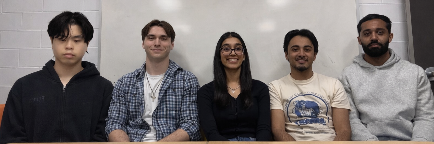
Aleksandar Duric, Aryana Deol, Azeem Mirza, Rabinder Bains, Sho Nguyen
Rethinking Retail Safety - REALPAC-06
Retail environments increasingly face complex and interconnected challenges including organized retail theft, public demonstrations, homelessness, drug use, and medical emergencies within commercial spaces. These issues do not stem from a single cause and cannot be addressed through a single policy or intervention. In many ways, the situation can be understood as a “wicked problem,” where systems such as public safety, social services, private property management, and public health interact in ways that complicate solutions. Addressing these challenges requires approaches that move beyond traditional security responses and instead consider preventative, operational, and systemic strategies.
First, physical environmental design can act as a preventative tool by shaping behaviour within retail spaces before intervention becomes necessary. Design features such as defensive architecture and strategic lighting can influence how spaces are used and discourage certain activities. These measures allow property owners to address safety concerns while maintaining welcoming environments.
Second, improving incident classification and response protocols is also important. Many situations treated as security incidents are actually medical or social service related emergencies. Clear response procedures and appropriate staff training can help ensure that these events are handled more effectively and consistently across retail environments.
Third, long term effectiveness depends on integrating social services within a broader rights based approach. Many behaviours associated with vulnerability are more effectively addressed through coordinated housing, health, and social support systems rather than enforcement alone. Stronger partnerships between property owners, municipalities, and service providers can help support these coordinated responses.
In conclusion, these approaches aim to address retail safety challenges in a more comprehensive and sustainable way. Preventative design, improved response protocols, and stronger coordination with social services can reduce reactive enforcement and encourage more consistent management of complex situations within retail environments.
Sofia Melo, Myah Sachedina, Tim Ross, Dylan Schnurr
Designing and Implementing Nature-Based Solutions in Ontario's Land Use Planning Framework
Canada is experiencing accelerating biodiversity loss driven by land-use change, urban expansion, and fragmented governance across jurisdictions. While the federal government has adopted the Kunming–Montreal Global Biodiversity Framework and Canada’s 2030 Nature Strategy, translating these national commitments into actionable planning tools remains challenging within Ontario’s land-use planning system, particularly on privately owned and non-Crown lands where development pressures are greatest. This gap presents a significant opportunity to integrate biodiversity objectives more effectively into provincial and municipal planning frameworks.
This project examines how nature-based solutions can be implemented across private, public, and Indigenous and unceded lands in Ontario to support Canada’s 2030 Nature Strategy biodiversity targets. The objective is to develop actionable policy and design guidance that embeds biodiversity considerations into planning policy, development review processes, and private land development practices.
Led by fourth year planning students, under the guidance of Dr. Jeremy Pittman, the project employs a policy and design research approach. The team analyzes Ontario’s planning and development legislation in relation to the 2030 Nature Strategy, synthesizes academic and professional literature, and evaluates regulatory and financial feasibility to identify mechanisms for integrating nature-based solutions across diverse land-use contexts.
Preliminary findings suggest that existing planning tools in Ontario provide fragmented and inconsistent guidance for implementing nature-based solutions in private development, limiting their effectiveness in achieving biodiversity outcomes. By consolidating policy options, implementation strategies, and best practices, this project offers a more coordinated framework for integrating biodiversity considerations into land development.
Key outputs include a policy report mapping Ontario’s planning legislation to the 2030 Nature Strategy, an internal presentation outlining implementation pathways for municipal decision-makers, and a Best Management Practices Catalogue for municipalities and private developers. Together, these deliverables aim to support more consistent biodiversity gains, improved climate resilience, and clearer expectations across Ontario’s land-development system.
Hayden Milne, Chloe McNabb, Andrew Wong, Tharun Abraham Aju, Grace Keren Wang, Micheal Glazyrin
KIT-01: Developing an Energy Cost Calculator and Guide for Energy Transition for Customers
The City of Kitchener’s Strategic Plan mandates a transition to a low-carbon future. However, residents lack context-specific data to understand the financial impact of switching to alternative energy. This project addresses this information gap by developing a tool to better quantify cost savings and emission reductions.
The main objective of this project is to develop an Excel-based calculator that provides locals data on the costs and emissions associated with transitioning to a new home energy system. This tool will provide decision support to residents to help them make more informed decisions and raise awareness of the emissions associated with different home energy systems.
The calculator’s design adopts a comprehensive approach by integrating localized variables such as Kitchener’s specific climatic conditions and land-use patterns. Beyond basic utility rates, the model will evaluate personal preferences alongside the broader energy efficiency of the home to provide a tailored assessment of potential savings. This ensures that residents receive a realistic estimate of the financial and environmental impacts associated with transitioning to high-efficiency energy systems.
Kitchener Utilities currently offers a basic rate calculator. Our tool will benefit customers exploring different home and water heating options by allowing them to compare the monetary and carbon emissions costs of different systems. Existing comparison calculators do not exist for the City of Kitchener in particular, and instead capture a broader or different geographic region.
Final results of this project will include the development of a user-friendly calculator tool that combines region-specific rate information with data from external sources. The Excel-based calculator will have inputs of building type, existing energy system, and new heat pump efficiency level. Outputs of user costs and savings, as well as greenhouse gas emission reduction rates.
Ariana Morin, Courtney Ross, Arnav Kapoor, Jamie Hearder
Socioecological Analysis of Build Now 2026
The Build Now development at 2025 University Avenue East in Waterloo aims to align with and exceed national biodiversity and sustainability standards. The project received a Ministry Zoning Order (O. Reg. 12/25), which permits mixed-use development with 1,010 residential units and commercial uses on the site. By receiving an MZO, the project is no longer required to complete an environmental impact assessment; however, they are still developing one as part of their consultation with Six Nations.
Through a social-ecological perspective, we plan to evaluate the “costs versus benefits” of the Build Now project. In this, we will review the mix of social, environmental, and economic tradeoffs and bring to light the overall benefits of the Build Now 2025 project. Our analysis will draw on different social-ecological frameworks and will look at how the social and environmental pieces interact with each other.
To conduct this analysis, we will review policy documents and literature/readings at the federal, provincial, and municipal levels. We will also compare the Build Now project to supplemental MZO-approved projects in Ontario. This would give us a better understanding of how different MZOs interact and alter how projects are approached in-order to preserve biodiversity and integrate more Nature-Based Solutions. We will also apply socio-ecological and economic components to assess how these components interact with each other.
Our results include impact on ecological connectivity such as the crayfish in the area, the role of green infrastructure was executed efficiently, as well as the “Urban village” concept, which has a positive impact on social interaction. We have analyzed how the social and environmental pieces interact with each other to create an organically social solution that involves environmental sustainability.
Shively Holland, Timurul Hoque Kazi, Kiel Harris, Lilly Brown, Catherine Mennill, Charlotte Petkovic
IAQ-11 Queen Elizabeth Way Pedestrianization and Street Redesign
Terre 11 Solutions from the University of Waterloo is working with the City of Iqaluit, Nunavut, to create a new pedestrianization strategy and street re-design for Queen Elizabeth II Way. As Iqaluit’s main commercial corridor, the street features commercial storefronts, housing, and employment uses, but lacks formal pedestrian infrastructure. The 2003 Pedestrian Master Plan was created to incorporate pedestrian facilities and enhance the corridor through landscaping, but was only partially realized due to environmental constraints, including permafrost and active layer changes, as well as competing municipal priorities.
Building off the 2003 plan and best practices from other Arctic communities, Terre 11 Solutions intends to develop a contemporary street redesign for a community-oriented space with design features that consider Iqaluit's unique climatic and low-density conditions and prioritizes pedestrian safety and accessibility.
Terre 11 Solutions will review municipal documents and conduct information-gathering sessions with City staff to understand the 2003 plan’s barriers to implementation, then complete a current analysis of the topography, easements, traffic flows, and common commuter patterns. Based on these findings, we will develop alternative street cross-sections that vary parking supply in the main corridor, provide spaces for bus stops, explore public art opportunities, and provide accessible pedestrian facilities that accommodate snow-plowing operations.
Terre 11 Solutions has reimagined the corridor based on the 2003 vision, identified key barriers to implementation, and compiled current context data to support design decisions. A review of best practices and guidelines has also been undertaken to inform preliminary layouts and design visions that are tailored to meet the needs of Iqaluit’s climatic, cultural, and operational conditions.
The proposed design will shift Queen Elizabeth II Way from a primarily vehicular thoroughfare to a multi-modal corridor that accommodates Arctic climate conditions, snow-clearance patterns, and fixed infrastructure, such as access vaults, while improving pedestrian accessibility and safety.
Maddie Berman, Joshua Ponte, Nicholas Kerr, Brandon Fowler
NEDA-02 - Building Independent Grant Writing Capacity in Nunavut: A Structured AI-Assisted Proposal Tool
Municipalities across Nunavut face persistent capacity challenges when preparing grant applications. Economic development offices often operate with limited staff and time, while funding programs are complex. As a result, communities frequently rely on external consultants to prepare grant proposals, which can increase financial costs, reduce community authorship, and limit the integration of Inuit values and local priorities in funding applications.
The objective of this project is to design and prototype a structured AI-assisted grant writing tool that enables Nunavut communities to independently develop funding proposals. The tool guides users through a structured drafting process, aligning proposal content with funding evaluation criteria, and improving the clarity and competitiveness of grant submissions while reducing reliance on third-party consultants.
To achieve this objective, the project follows a multi-phase design approach. We review federal and territorial grant structures to identify common evaluation criteria and recurring narratives, evaluate large language models (LLMs) for reliability, cost feasibility, and adaptability, and develop a browser-based prototype with three layers: a user input layer for priorities and criteria, an AI draft generation layer using structured prompts, and a refinement layer to edit. A needs assessment will be conducted, and training materials will be developed to support knowledge transfer.
Preliminary internal testing suggests that structured prompting significantly improves the alignment of AI-generated content with grant evaluation language compared to open-ended drafting. The results also highlight the importance of human oversight and simple interface design to ensure usability for end users with varying technical experience. Compared to consultant-prepared proposals, the tool is expected to reduce preparation costs, increase integration of community-defined priorities, and standardize the use of evaluation-aligned language. The proposed system demonstrates the potential to strengthen independent grant-writing capacity, reduce reliance on external consultants, and support more community-driven economic development initiatives across Nunavut municipalities.
Reka Somogyi, Ingrid Lu, Brianna Tsoi, Ealy Fong, Sudiksha Desai
IQA-09: Tundra Transplantation for Urban Vegetation
Currently, the urban environment in Iqaluit lacks greenery. As development increases in the City, there is a desire to integrate and preserve natural features within the urban landscape. During greenfield development, tundra, the predominant vegetation in Iqaluit, is often removed and discarded as waste. As it takes decades to establish, it is imperative to preserve or transplant existing tundra to ensure the City continues to benefit from its ecological functions and aesthetic qualities.
This project addresses the loss of tundra and other native vegetation during development. Using existing literature and case studies of urban greening initiatives and tundra transplantation attempts, the project aims to draft policy recommendations for the City of Iqaluit’s General Plan and Zoning By-Law. These documents are intended to provide the municipality with a clear foundation for the preservation of existing vegetation and will be complemented by implementation and design guidelines for practice. The latter will outline tundra preservation and transplantation, and urban greening methods for the City and developers. By implementing clear policies for urban greening, expectations will be standardized, reducing discrepancies in the development process related to vegetation.
In collaboration with municipal staff, the General Plan will include new guiding policies that focus on the following sections: Protection and Restoration of the Natural System, Development Requirements, Sustainability, and Plan Implementation. The project will also include actionable requirements in the Zoning By-Law that mandate adequate retention of existing on-site vegetation. The implementation and design guidelines will provide instructions on how to transplant tundra, describe what considerations to make when doing so, and outline who is responsible for what step in the process. Feedback from municipal staff on policies and guides will be incorporated throughout the process to ensure applicability and alignment.
Christopher Schnurr, Jazlyn Kooger, Mariella Kaczmarczyk, Valentina Casas, Yanmeng Cai
TBM-01 The Blue Mountains Green Drainage Initiative
The Town of The Blue Mountains is experiencing concerns related to stormwater runoff carrying sediments, nutrients, and anthropogenic litter into Georgian Bay through the Thornbury Harbour Outfall. As urban development continues to expand and climate change intensifies precipitation events, the capacity and effectiveness of the existing stormwater infrastructure are under growing pressure. In response, the municipality has engaged our team to conduct preliminary research into potential Low Impact Development (LID) and nature-based stormwater management solutions that could be implemented near the Thornbury Harbour Outfall to improve water quality and manage water quantity.
The objective of this project is to identify strategies that enhance the efficiency of the existing stormwater management system through a treatment-train approach that can be replicated in other similarly impacted areas within the municipality. Through preliminary research, policy review, and site analysis, several potential interventions were evaluated based on treatment efficiency, costs, feasibility, and ecological impact.
The chosen interventions focus on conveyance and end-of-pipe LID solutions rather than relying solely on traditional grey infrastructure. Implementing bioswales along surrounding municipal rights-of-way will be used to intercept and filter runoff during conveyance. A detention basin will then be situated at the end-of-pipe to capture, treat, and infiltrate runoff. These LID strategies are designed to manage water quantity as well as capture sediments and urban debris, such as cigarette butts, to improve overall quality and reduce pollutant discharge into Georgian Bay.
The recommended approach focuses on solutions that fit within the policy landscape, compliment the surrounding environment, and work with existing infrastructure. By implementing nature-based stormwater strategies, the Town of The Blue Mountains can better manage runoff, improve water quality, and create approaches that could be applied to other areas of the municipality facing similar stormwater challenges.

Kavishka Gomes, Urooj Khan, Iraj Tanveer, Shajive Jeyakumar, Rose Pirzada
Breaking the Boiler Barrier: Hybrid Pathways for Low Carbon Commercial Buildings
With increasing pressure to reduce greenhouse gas emissions, decarbonizing space heating in Canada’s commercial real estate sector has become a significant challenge. Many office and multi-residential buildings continue to rely heavily on natural gas heating systems, particularly in colder climates where reliability during peak winter conditions is essential. While full electrification is often proposed as a long-term solution, practical barriers such as high capital costs, electrical infrastructure limitations, and operational risk make immediate adoption difficult. As a result, hybrid heating systems that combine electric heat pumps with existing natural gas infrastructure are gaining attention as a practical transitional pathway for building decarbonization.
This capstone project evaluates the technical and financial feasibility of hybrid heat pump systems in office and multi-residential buildings across Canada. The analysis focuses on Ontario, British Columbia, Quebec, and Alberta as representative case study regions. The project develops a financial modelling framework that integrates provincial building stock data, heating system usage patterns, and technology performance assumptions to estimate the potential impacts of hybrid heating systems across different building types and climates.
The model compares hybrid heating configurations with conventional natural gas systems and fully electrified alternatives, assessing impacts on natural gas consumption, greenhouse gas emissions, capital investment requirements, and key financial indicators such as payback period and return potential. By identifying conditions where hybrid systems can reduce emissions while maintaining operational reliability and financial feasibility, the project provides a practical decision support framework for commercial real estate owners and industry stakeholders evaluating building decarbonization strategies.
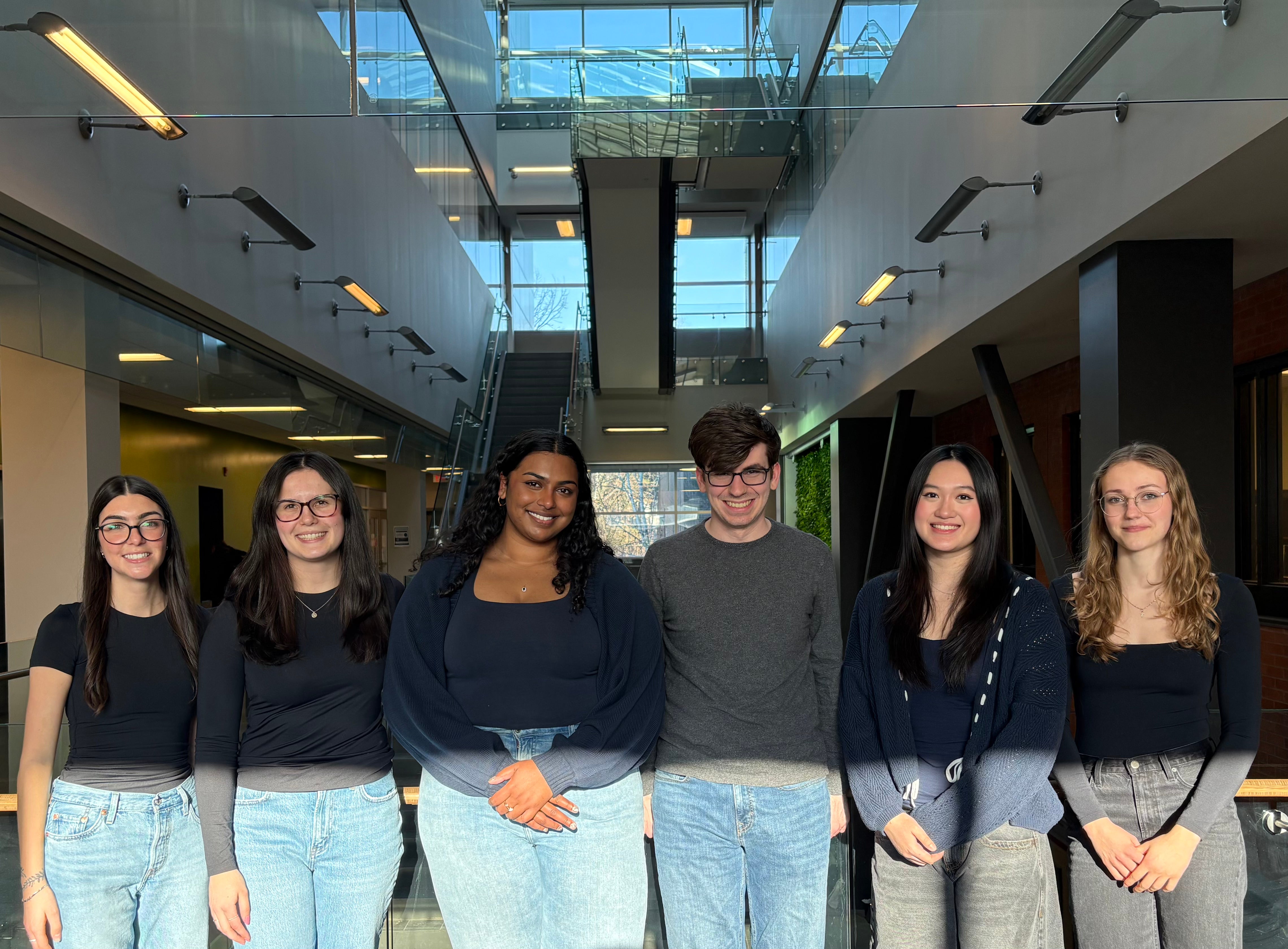
Erika Bourdeau-Halverson, Rachel Baker, Ashvika Mathivannan, Evan Mathis, Alley Poon, Maja Ruszkowska
Union Co-op Project
This project stemmed from Union Cooperative’s proposition to develop affordable housing in the City of Kitchener, Ontario, using land owned by non-profit organizations. The task was to determine which of the provided 240 sites were most suitable for an affordable housing development. The objective was a portfolio of the best ten sites with a description of methodology, standardized site statistics sheets, financial feasibility and pro forma analyses, and required planning approval pathways including associated risks and mitigation strategies.
The first step in our approach was to develop a framework of criteria related to redevelopment requirements and preferences to determine site feasibility. Using a hierarchical method, the criteria were sorted into essential prerequisites and preferred site characteristics; if the site does not fulfill or satisfy an essential checkpoint, it does not proceed with the evaluation. This framework was coupled with a simplified scoring system of -1 (unfulfilled/unsatisfactory), 0 (potential for conformity/neutral benefit), and 1 (fulfilled/satisfactory), allowing to sort site strength in redevelopment feasibility by a total score out of 14.
As opposed to conventional site evaluation methods, which tend to be slow and vary by individual, this framework allows for standardized and efficient elimination of unsuitable sites, and thus more allocation of time and resources towards further research of suitable sites. The connected scoring system indicates level of suitability (the higher the score, the stronger the site) and establishes a straightforward method of site-to-site comparison – both of which are more difficult and time-consuming using more subjective methods.
Thus, the outcome of this project is not only a detailed portfolio of the best ten sites for redevelopment by Union Co-op, but also an objective and standardized site criteria evaluation framework – the premise of which can be used in any site selection process for development.
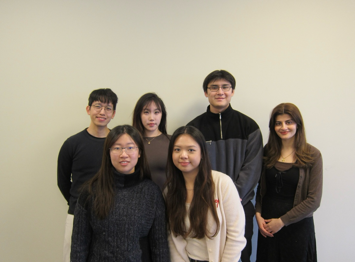
Hok Lam Geoffrey Yu, Maisie Liu, Ali Noori, Maryam Hamdan, Anna Liu, Cherilynne Chau
Assemble Your ARU | Accelerating the Approval Process for ARU Applications Across Canada
Canada is in the midst of an acute housing crisis, and in efforts to address this challenge, a key policy response has been to promote the construction of "as-of-right" Additional Residential Units (ARUs) within existing residential neighbourhoods. Despite current "as-of-right" provisions, there exists no simple way for homeowners to determine if they can truly build an ARU on their property. The pre-application process requires homeowners to interpret zoning by-laws and building code specifications scattered across documents that are often fragmented and inaccessible. While municipalities offer general ARU guidelines, they do not provide a clear roadmap for homeowners to follow. The current process expects homeowners to independently assess and implement all requirements, which discourages most from pursuing development.
A present disconnect lies in the absence of a digitized tool that provides users with property-specific answers. As such, the objective of our capstone project is to develop a prototype ARU tool that simplifies property planning and streamlines the ARU approval process for homeowners, city planners and real estate professionals. To achieve this, our team conducted a comparative analysis of ARU permitting workflows across large, mid-sized, and small municipalities in Ontario, Alberta, and British Columbia. These findings informed the development of a prototype expansion to the Siteability (project partner) platform, enabling homeowners to check their ARU eligibility, understand applicable zoning and building code requirements, select from a pre-approved ARU design catalogue, and visualize real-time overlays of floodplain and zoning data. Compared to the current fragmented process, the platform answers the where, what, and how of building ARUs in one place through the implementation of new functions and features geared towards reducing application approval time, fewer incomplete applications, and improved user understanding of ARU development feasibility.
If successful, this platform could make building an ARU a realistic option for far more Canadian homeowners than the current process allows.
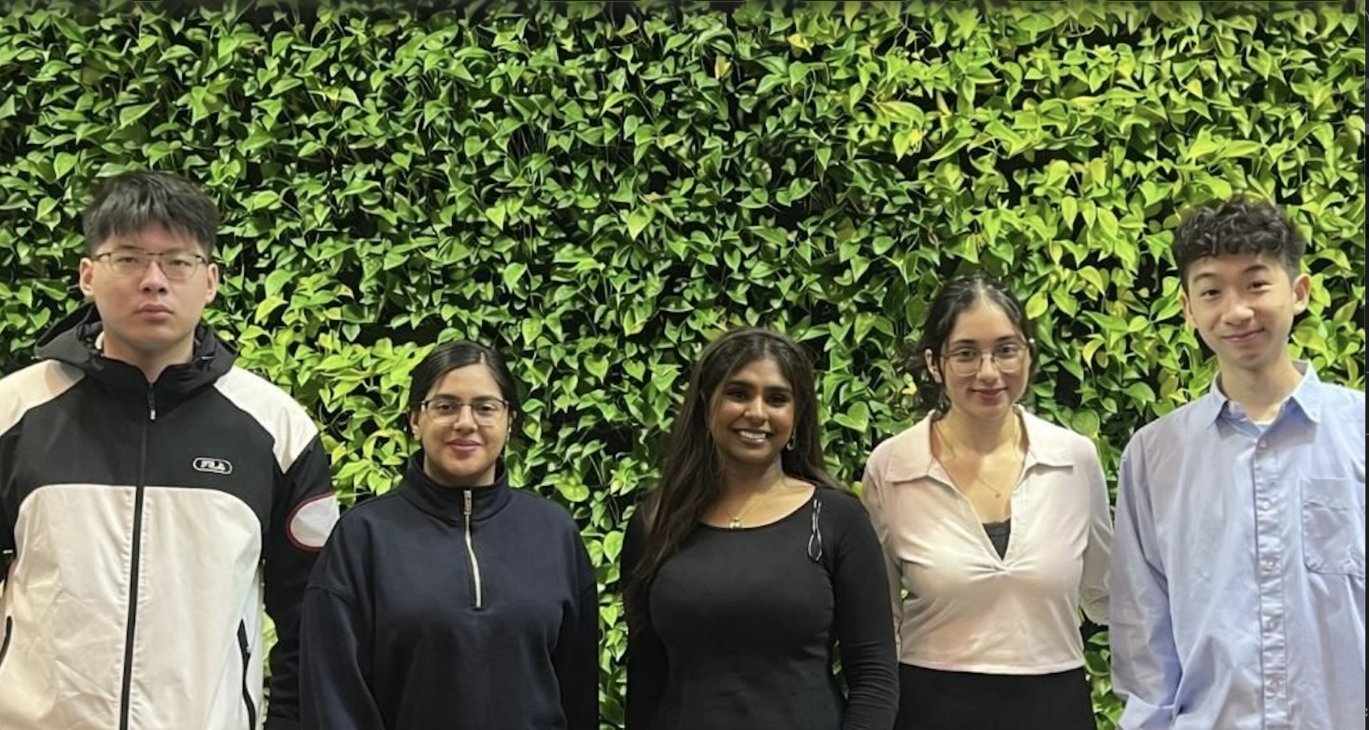
Mehak Anand, Anna Ul-Ain. Charles Leung, Shirika Hariram, Joe Lin
Stormwater in The Blue Mountains: Beaver River Bridge Outfall Proposal
The proposed stormwater management design for Beaver River Bridge Outfall the Town of The Blue Mountains addresses critical water quality issues at the in Thornbury. Currently, a large portion of downtown stormwater discharges into the river with limited treatment, introducing pollutants such as sediment, litter, oils, and winter road salts into a sensitive cold-water ecosystem vital for fish migration and spawning. The primary objective is to identify practical, low impact development, and modular green infrastructure that improve water quality while remaining realistic for municipal maintenance. Following an evaluation of various alternatives, the recommended design strategy is the implementation of Dry Grass Swales with Perforated Pipe Underdrains at a tiered system. This approach utilizes vegetation to slow runoff and a bed of engineered soil to filter contaminants before treated water enters a perforated subsurface pipe for safe conveyance to the river. Unlike larger treatment facilities or under-bridge vaults, this solution specifically accommodates the site’s steep slope and limited spatial constraints. The design further incorporates rock check dams to reduce runoff velocity and prevent slope instability.The project includes a detailed four-phase maintenance plan which includes potential CCTV inspections for baseline mapping, vacuum-based cleaning of inlets, and the installation of monitoring wells to track drainage performance over time. By transitioning toward sustainable infrastructure, this proposal supports the Town's goals of climate adaptation and natural system protection and offers a feasible framework to enhance the health of the Beaver River while serving as a sustainable urban stormwater design.
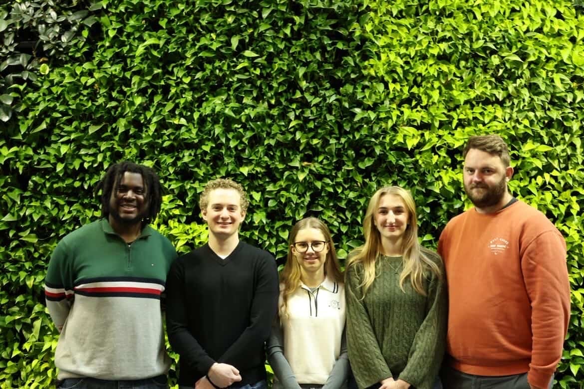
Oluwadamilare Faith Awoleye, Marita Kuruyan, Eric Devos, Jade McGowan, Matthew Rogers
Union Co-op Development Project
This PLAN 405 capstone project for Union Co-op 02 focuses on evaluating potential development opportunities that support non-profit housing initiatives. The student planning team will work with a project partner to produce several key deliverables: a feasibility analysis of potential sites, a hypothetical development concept created in collaboration with University of Waterloo architecture students, a financial proforma for selected sites, and a report outlining required building permits and development considerations. The project aims to produce well-researched, professional-quality work that meets the course requirements and academic standards, while advancing learning objectives related to non-profit development, including project management, stakeholder communication, and collaborative problem-solving. The project team consists of five members, each assigned specific responsibilities based on their strengths. The team consists of Oluwadamilare (Dami), Matthew, Marita, Jade and Eric. Each member brings a range of skills from, real estate development, research and report writing and housing policy.
Balancing Surface Water Drainage and Pedestrian Mobility in Iqaluit
Martin Yin Chung Tang, Charles Chan, Fatima Majeed, Susan Chau
Balancing Surface Water Drainage and Pedestrian Mobility in Iqaluit
The City of Iqaluit is located in a zone classified as continuous permafrost, where ice that forms in void spaces in any soil type, bedrock, and organics remains frozen over at least two years in 90 to 100% of the ground surface. This environmental condition poses unique challenges for building and maintaining underground stormwater infrastructure as any infiltration of warm water could melt the permafrost and damage nearby infrastructure. In addition, the current street design emphasizes surface water conveyance over pedestrian infrastructure. The Capstone project team is retained by the City of Iqaluit and Future Cities Institute to document and categorize current conditions throughout Iqaluit, investigate approaches used in cold-climate regions facing similar challenges, and recommendations that can inform future street design and reconstruction projects in Iqaluit. The research team identifies three typical street-type scenarios in Iqaluit and conduct research on drainage and pedestrian solutions in Nuuk, Greenland, and Scandinavian countries. Evaluation criteria are created to develop an option analysis matrix to identify strengths, weaknesses, and appropriate application scenarios for each possible solution. The final deliverable incorporates approaches from Arctic communities that are well‑suited to the three identified scenarios.
Renee Leake, Tomas Stevenson Hoyos, Shayna Morphy, Arvin Heidarzadeh, Alexander Lino Ammaturo
REAL-07: Future of Office Spaces in Hybrid Work Environments
This project examines the future of office spaces in hybrid work environments, with a primary focus on stabilizing commercial real estate assets while positioning organizations for long-term structural change. As hybrid work has evolved from a temporary response to a strategic organizational model, it has fundamentally altered expectations around time, space, and workplace flexibility. Offices are increasingly redefined as spaces for collaboration, social connection, and creative exchange rather than routine desk-based work, while home environments support focused individual productivity. However, research demonstrates that although working from home is enhancing concentration yet increasing social isolation and potentially weakening engagement if not intentionally managed.
The project seeks to identify how office environments can balance employee autonomy with employer performance objectives, ensuring productivity, inclusion, and asset resilience. Particular attention is given to measuring in-office versus remote productivity, leveraging digital engagement strategies, and equipping leadership with new management competencies required for hybrid oversight. Recognizing that employee experience differs between new hires and seasoned staff, the project also considers how onboarding and belonging strategies can mitigate disengagement risks.
From an urban planning perspective, hybrid work is reshaping central business districts (CBDs) and accelerating adaptive reuse opportunities. Evidence of decentralized live/work patterns and office-to-housing conversions signal both market instability and opportunity. This project centers on CBD recovery strategies, exploring how flexible, activity-based offices, mixed-use integration, and strategic asset repositioning can sustain downtown vitality. Ultimately, the research provides decision-relevant insights for building owners and employers seeking to reconcile real estate performance goals with evolving workforce expectations in hybrid urban spaces.
Environment Capstone Symposium Directory
The following directory can be used to find the poster locations of students:
Faculty of Environment Capstone partners

Capstone Awards
Thanks to the generosity of our donors; Libro Credit Union and the Rosen Foundation for Environmental Innovation, the Environment Capstone Symposium Awards recognize outstanding student projects that demonstrate creativity, collaboration, and leadership in addressing environmental challenges. These awards celebrate the dedication of our students and the important role experiential learning plays in preparing the next generation of environmental leaders.
1. Jack Rosen Award for Excellence in Sustainability Innovation
Recognizes posters that:
- Present a novel and high‑impact solution to a sustainability challenge
- Demonstrate innovation or creative thinking in advancing sustainable practices or systems
- Clearly communicate feasibility and long‑term environmental benefit
2. Jack Rosen Award for Leadership in Environmental Stewardship
Recognizes posters that:
- Highlight responsible care for ecosystems, natural resources, or communities
- Introduce innovative or creative stewardship practices that strengthen environmental responsibility
- Demonstrate leadership through meaningful, place‑based environmental action
3. Jack Rosen Award for Advancements in Conservation & Waste Reduction
Recognizes posters that:
- Present an innovative conservation or waste‑reduction strategy, including recycling or circularity
- Offer practical pathways to protect or restore natural systems or reduce material impacts
- Demonstrate clear environmental benefits supported by strong reasoning or data
4. Jack Rosen Award for Interdisciplinary Environmental Integration
Recognizes posters that:
- Combine insights from multiple disciplines to address an environmental challenge
- Show innovative integration across fields, demonstrating how collaboration strengthens the solution
- Explain complex ideas in a unified and coherent manner