Contact the Geospatial Centre
Dana Porter Library, Room 328
University of Waterloo Library
Waterloo, Ontario N2L 3G1
Email: librarygeo@uwaterloo.ca
Air photos for the City of Guelph for the years 1930, 1955, and 1966 have been scanned, digitized and georeferenced and are available for public viewing and downloading. Image formats include jpg, tiff, pdf, and KMZ files (for Google Earth). All image formats can be viewed in a GIS program.
For access to the original scanned images or paper air photos, please visit the Geospatial Centre.
Grid Index
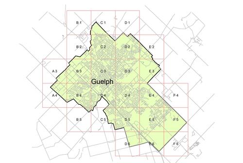
For grid images, select the following links.
| A3 | A4 | B1 | B2 | B3 | B4 | B5 | C1 | C2 | C3 | C4 | C5 | D1 |
| D2 | D3 | D4 | D5 | D6 | E2 | E3 | E4 | E5 | E6 | F4 | F5 | F6 |


