
Dr. Colby Steelman is interested in what’s happening underground, but he doesn’t have to dig deep to get there. As an environmental geophysicist, he uses geophysical tools to measure physical properties of the Earth from the surface. His current research studies groundwater and how we can better manage and protect it.
Traditionally, researchers drilled wells or boreholes as far as 100 metres down to collect samples for analysis. But Steelman takes a different approach.
“Geophysical instruments allow us to work from the surface and non-invasively detect responses from below ground,” Steelman explains. “It’s similar to medical imaging – like an X-ray or MRI – but for the Earth.” He uses these images to build models that show how water moves in and around soil and rock.
Take road salt, for example, which significantly impacts groundwater in this region. High sodium chloride levels in wells that pump up groundwater create issues for drinking water and treatment.
“Geophysical tools allow us to image conditions around a well and assess the extent of a contaminant plume or impact zone,” says Steelman. “This information helps with decision-making, such as where to drill a new well, or determining whether conditions are improving or worsening by monitoring over time.”
Steelman first discovered his enthusiasm for this work as an undergraduate here at Waterloo. During a co-op term, he worked with geophysicists using large sensors to measure conditions below the Earth’s surface. He was fascinated by the equipment and what could be learned from their measurements, leading him to complete a PhD, also at Waterloo.
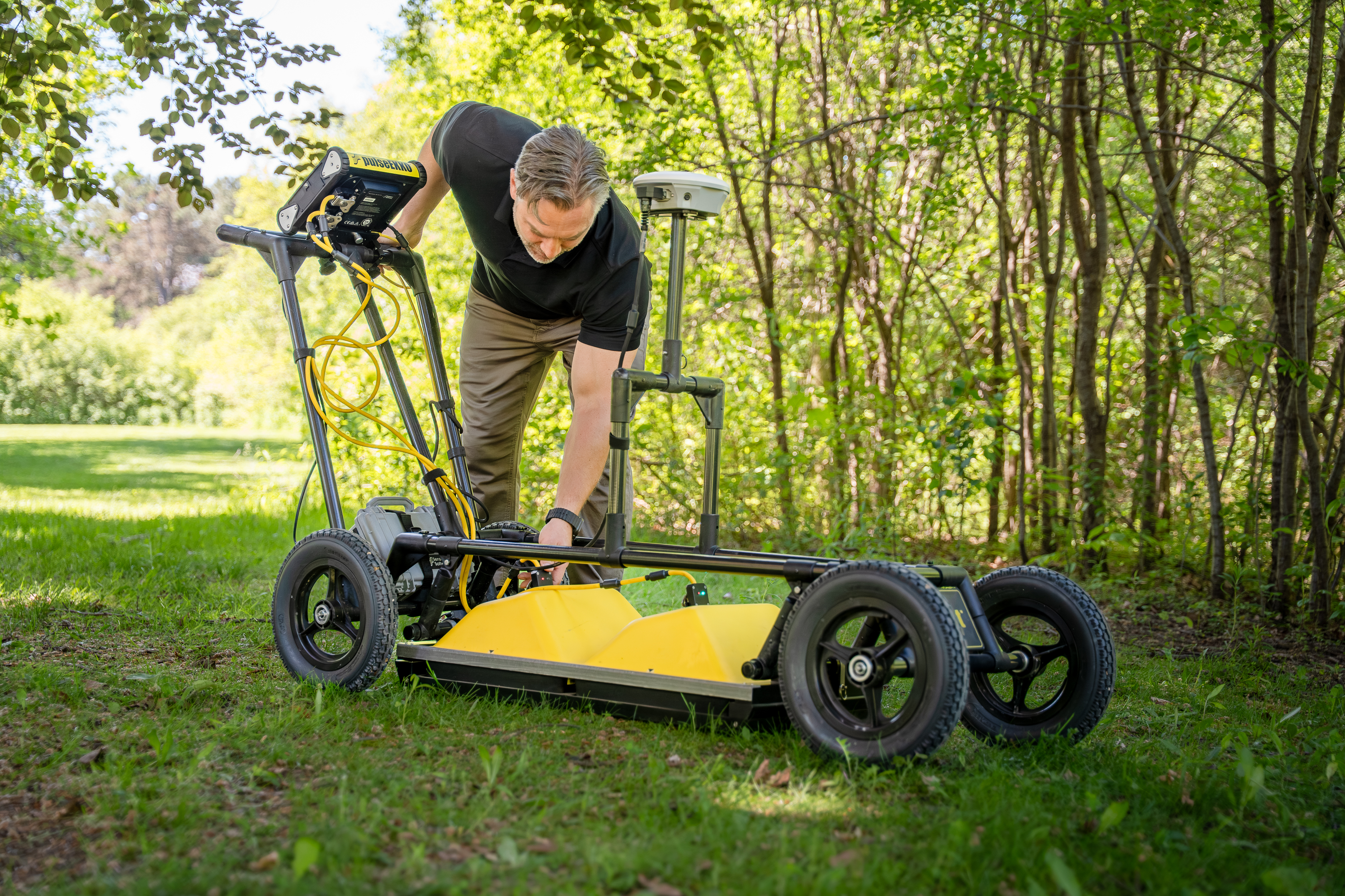
Now he’s the faculty member inspiring the next generation of environmental scientists with innovative new equipment, like the ground-penetrating radar (GPR) pictured here. GPR sends radio waves into the ground where they bounce off boundaries or objects several meters below the surface. The waves that come back are recorded and used to build geological models or monitor physical property variations.
But this is just one of the tools Steelman uses to get a glimpse of what’s going on beneath the surface. Environmental issues involving groundwater, soil, and rock often create unique physical property variations that can be tracked over time using a variety of geophysical tools. These tools generate and measure how the Earth responds to electrical current, electromagnetic fields, or mechanical waves, allowing Steelman to study how water moves underground without ever lifting a shovel or core sampler.
“I enjoy taking instruments into the field and uncovering something we wouldn’t otherwise see,” Steelman reflects. “It’s a bit like archaeology—not finding artifacts but detecting signatures that imply the presence or absence of something. The challenge in learning from non-invasive measurements is what excites me about what I do.”
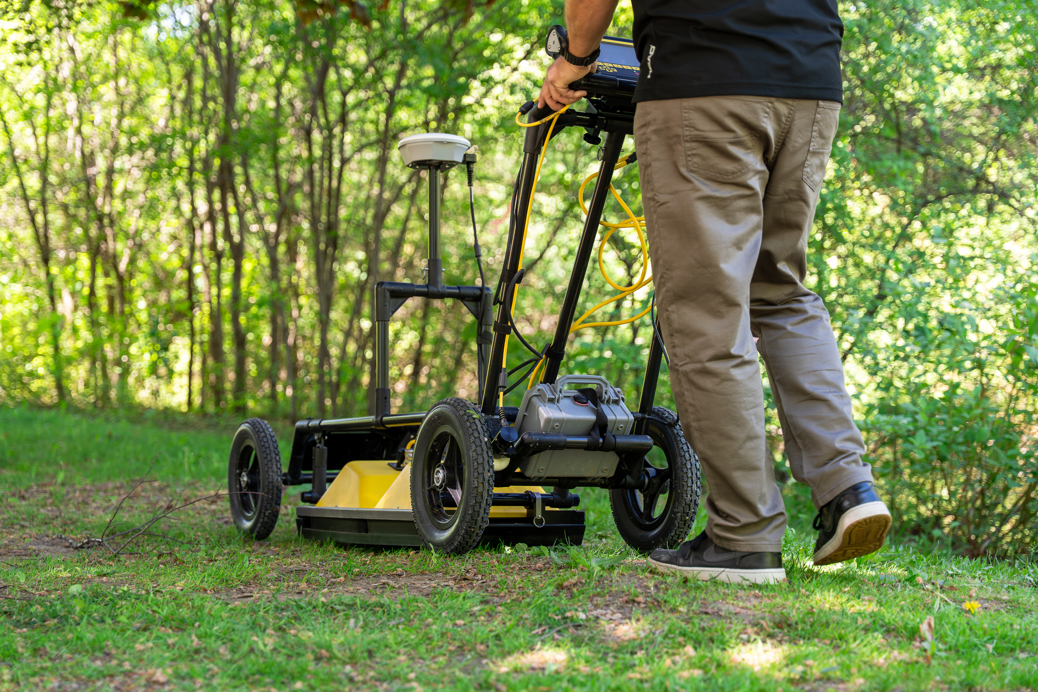
Ground-penetrating radar (GPR) sends radio waves into the ground where they bounce off boundaries or objects several meters below the surface.
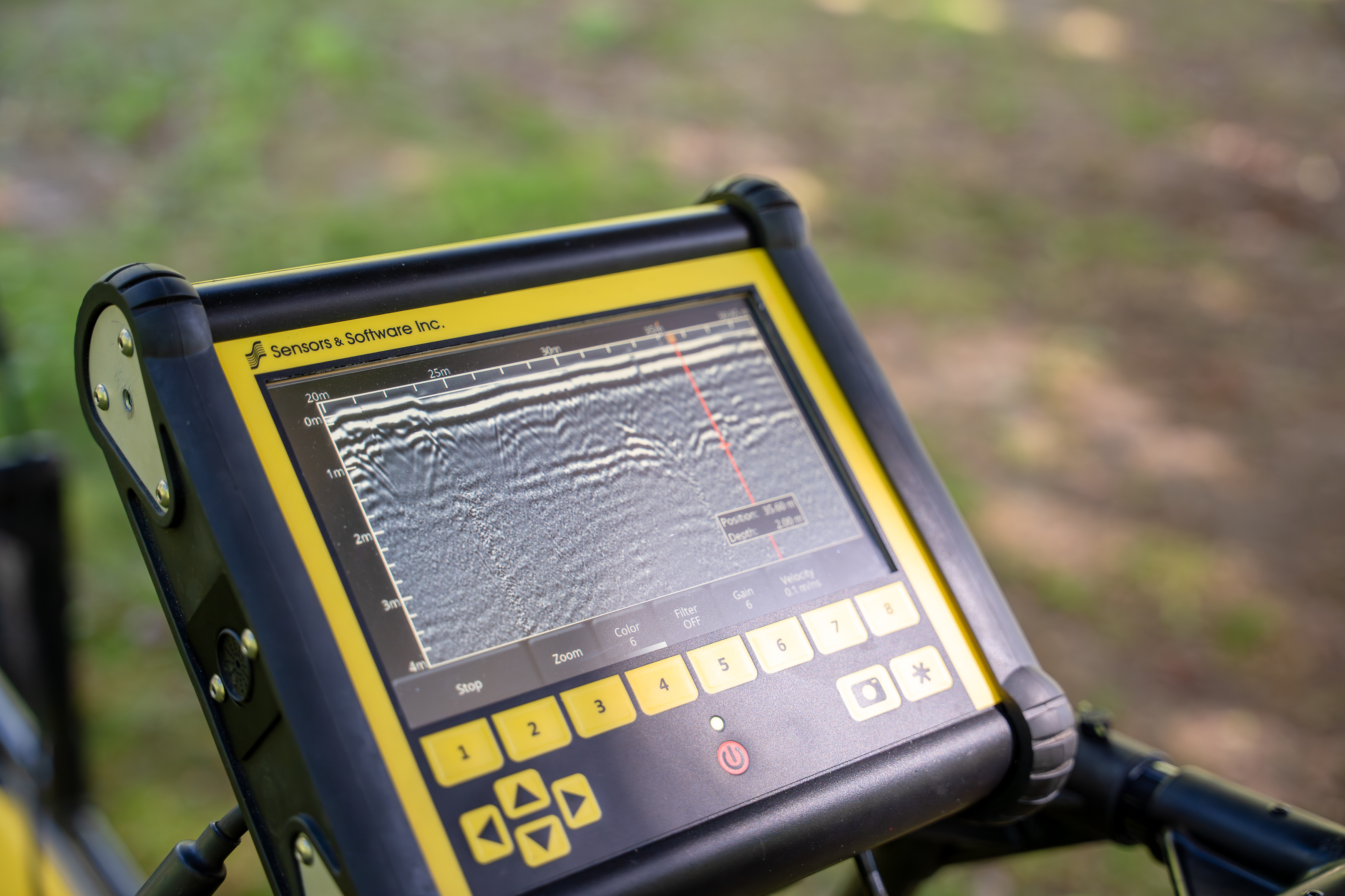
The waves that come back are recorded and used to build geological models or monitor physical property variations.
This information allows Steelman to study how water moves underground without ever lifting a shovel or core sampler.