Contact the Geospatial Centre
Dana Porter Library, Room 328
University of Waterloo Library
Waterloo, Ontario N2L 3G1
Email: librarygeo@uwaterloo.ca
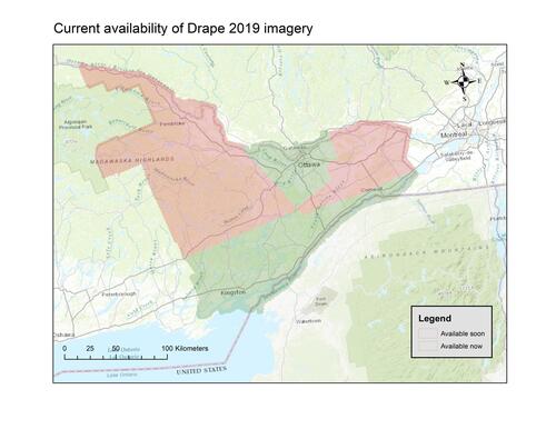
Received from Land Information Ontario (LIO), 2019 imagery for the Digital Raster Acquisition Project for the East (DRAPE). These orthorectified images have been captured from aircraft because of the ability to obtain high resolution products over a large area. Orthophotos are captured during spring under the best conditions possible to achieve cloud free, snow free, ice free, smoke free, and leaf off conditions. Using the ADS80 Leica digital camera, these true colour orthophotos have a pixel resolution of 16cm and are accurate to 45 cm at 95% confidence level.
This dataset is not yet complete, and additional tiles will be received over the coming months. As this data becomes available from LIO, the Geospatial Centre will make it available to faculty, staff and students at the University of Waterloo. The map below shows what is currently available through the Geospatial Centre (click on the map to open the index).