The Geospatial Centre has purchased and acquired a number of new datasets recently:
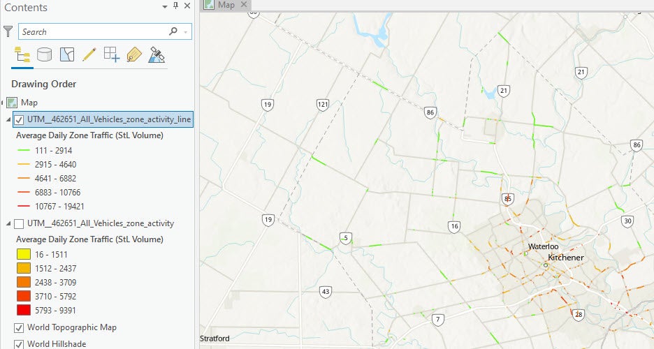
StreetLight Data - This dataset is based on mobile device location tracking and covers specific streets within the Region of Waterloo. The main purpose of using this data is to analyze the traffic volume or relative trip activity in the Region of Waterloo. This traffic data can be used to analyze vehicle traffic volume and activity for specific weekdays and times (i.e. Monday-Friday during rush hour). Data are available for vehicles, bicycles, and pedestrians, and are calculated based on traffic zones or street segments.
Public Transit Ridership Data for GTA - For the purpose of studying public bus usage, the Geospatial Centre has obtained ridership data for the cities of Brampton, Mississauga, and the region of York. The data includes average daily ridership based on bus routes for the years 2019-2021.
Chile 2017 Census Data - Purchased from EastView, this census database for Chile is divided into 4 variables: Demographic, Housing, Migration, and Social, encompassing the many districts of cities and municipalities.